


Advanced surveying technologies, including 3D laser scanning and high definition photogrammetry captured by drones, are transforming Scan-to-BIM processes and the way construction projects worldwide are designed and delivered.
The ability to digitally capture a physical space or site, from the ground and from the air, using scan data to create an intelligent 3D model, is often referred to as Scan-to-BIM.
The Scan-to-BIM process provides a vital starting point for design teams who use 3D BIM models to iterate their designs and subsequently manage, coordinate and share all project information.
Scan-to-BIM is being reshaped by technology
Scan-to-BIM is typically applied on projects where an existing building needs to be captured, such as a refurbishment, a conservation project, or an extension to an existing building. However, it has also proved useful on new build projects, used to create a record of the existing context and adjacent buildings and structures, or when a building needs to be captured before demolition.
Surveying firms are often able to deploy a combination of three principal technologies to capture the 3D data. Terrestrial tripod-based laser scanners are able to record interior spaces and exterior facades, or hard to reach mechanical and electrical installations or plumbing, concealed in walls or behind ceiling tiles.
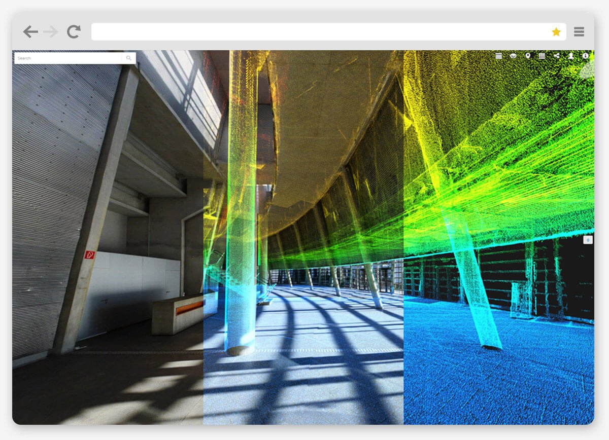
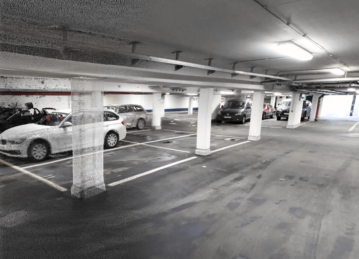
On projects with large floor areas, or where scanning process speed is of essence, surveyors are increasingly turning to the NavVis M6 Indoor Mobile Mapping System (IMMS). It captures detailed point cloud data, also referred to as Point Cloud Scan-to-BIM. As a reality capture, it also provides image data to create fully-immersive indoor visualizations with navigation.
Scan-to-BIM process speed decimates scanning time
I recently spoke to Mark Hanna, founder and CEO of US surveying firm PrecisionPoint, a trusted partner of NavVis. Marc was enthusiastic about the firm’s use of the NavVis M6 on large architectural projects. His surveyors are able to capture 100,000 to 150,000 square feet in a day using a single trolley, compared to about 25,000 square feet a day using a regular tripod scanner.
“Speed is important because many of the buildings we scan are in use. It is less disruptive if we can get in and map the space with the IMMS and it doesn't require us to set up any targets inside the space to establish dimensional control,” he said.
In addition to terrestrial and mobile scanners, high resolution photos taken by drones fitted with high resolution cameras can be stitched together to comprehensive information models using software running complex algorithms in a process called photogrammetry.
Photogrammetry is used to create orthophotos, a geometrically corrected photo with a uniform scale that can be used in the same manner as a map to measure true distances. In addition, it can generate a second point cloud covering all hard-to-reach areas of the building, such as the roof. When combined with the interior point cloud data, this provides a master dataset for the project and the foundation for a highly detailed building information modelling.
Highly detailed BIM models require new technologies
The “to-BIM” aspect of Scan-to-BIM is arguably the trickiest task for surveyors as they work to transform this detailed, but “dumb”, point cloud data into an intelligent 3D model.
A unified point cloud file is typically data heavy and must be broken down into manageable chunks. For example, the exterior, first floor, second floor, third floor etc. to enable efficient modeling in BIM authoring tools such as Autodesk Revit.
Algorithm-based modeling tools that operate within BIM authoring software help simplify the process by carrying out automated feature extraction, identifying items such as pipework or structural steel and transforming them into 3D objects.
3D components in BIM effectively “know” what they are and where they are in the model and have survey data and attributes tagged to them. They provide designers with much more detailed information to work with than static 2D floor plans, sections and elevations.
How Scan-to-BIM is being used
Scan-to-BIM can kick off at any time during the design stage. Sometimes the client will specify it at the inception of a project, before an architect has been appointed. It creates a single digital “source of truth” on a project, rather than have to issue a pack of thousands of drawings from different, sometimes unreliable, sources.
Existing buildings, particularly older ones, tend to suffer from a lack of as-built documentation, or outdated and misleading plans, and Scan-to-BIM can significantly enhance the precision and transparency of information.
A good visual model can help clients explore the building without having to physically visit the site, and immediately understand any adjacencies or planning challenges, giving a significant head start for design. From a health and safety perspective, it can help identify any hazards, such as materials containing asbestos, or challenges in terms of access to site.
However, given that many building owners are not tech savvy, Scan-to-BIM is currently most often requested by the architect, on behalf of the client, before detailed design, when preparing documentation ready to go out to tender. This is where newer technology, such as the NavVis system, offers an advantage. The data captured by the NavVis M6 can be uploaded to BIM software but it is also made available as an interactive browser-based 3D “walkthrough” that the client can easily use.
Mark Hanna made this point when I spoke to him, telling me that publishing building data in the browser-based NavVis IndoorViewer is a popular deliverable when there are many stakeholders involved who may not have BIM expertise.
The benefits of 3D building information models
The construction industry tends to operate at low margins. Greater accuracy and transparency at an early stage helps contractors reduce their risk and therefore put forward more realistic bids. For example, a detailed BIM model can help them precisely calculate material volumes and areas, and plan how much material they can store on site and the human hours needed to complete work. A BIM model also potentially increases the time available for tendering contractors to ask questions and understand the project risks.
Of course, getting 3D scanning and modeling work done upfront comes at a cost, especially compared to a traditional 2D surveys. But it can result in major savings.
According to Hanna, a BIM model PrecisionPoint created for one client saved hundreds of thousands of dollars in change orders by revealing that structural steel in the existing as-built drawings was out by several feet in some locations.
And the case for Scan-to-BIM becomes even more compelling when you consider the potential long term savings that transparent data sharing and early engagement in intelligent 3D design can bring to projects.