


Never standing still, the NavVis team measured the accuracy and speed of NavVis VLX against a terrestrial laser scanner at the Munich HQ.
One of our guiding principles here at NavVis is that we love spatial technologies. With passion and dedication, everyone in the company strives to push mobile mapping to new heights, and the benefits are felt throughout the surveying and reality capture industry.
But it’s one thing to say it; it’s entirely another thing to prove it. We’re presenting the results of a special test our technicians conducted to demonstrate how the accuracy and speed of NavVis VLX measures up against conventional terrestrial laser scanning (TLS). We used two different TLS devices, referred to here as TLS Device A and TLS Device B for the sake of anonymity.
And the results are not merely good. They’re outstanding. In the video below, you can see how we mapped an area roughly 500 sqm of our Munich HQ in just 25 minutes with NavVis VLX, compared to two hours mapping the same space using the TLS Device A. Furthermore, TLS Device B in combination with a total station took even longer to complete, around five and half hours.
Putting aside the key statistic of being on average 10 times faster than a TLS even on a relatively small project – benefits which accrue even further when scanning larger environments – what about the accuracy? Our findings show that 68% (one sigma) of the measurements captured with NavVis VLX lay in a range of between 0-3 mm difference compared to a TLS scan. Certainly more than satisfactory for the majority of typical scanning jobs.
The differences between mobile and static scanning systems
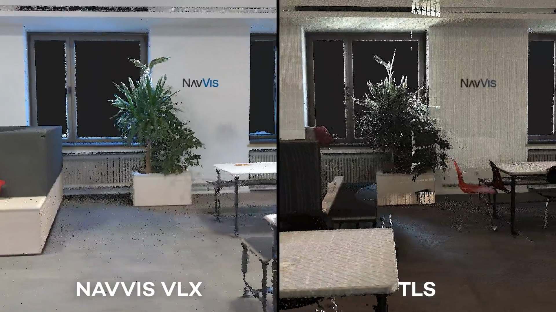
What’s immediately apparent in the video are the differences in how data is acquired. A TLS will capture data by scanning at a single position, while mobile devices continuously capture data at multiple positions while being moved through an environment.
(Another point of difference from static scanning systems: NavVis continually improves the data quality of our mobile mapping devices through software updates. You can read more about that process here.)
What this means is that when we refer to the accuracy of a TLS, we’re talking about the accuracy of discrete measurements at a single position. Meanwhile, the accuracy of a scan using a mobile mapping system is based on many discrete measurements taken continuously. This path of very dense scanning positions is otherwise known as the mapping trajectory.
For a single TLS position (or set-up), the specification sheet usually refers to certain confidence levels associated with standard deviation, often 1-sigma, which equals 68% confidence, and sometimes 2-sigma, which equals 95%. A standard deviation of 5 mm with a confidence level of 1-sigma, or 68%, means that 68% percent of all measurements must be within a range of 5 mm accuracy.
NavVis VLX versus TLS: Test conditions and results
The test conditions were to capture a reference scan of one floor of our offices in Munich, a space measuring approximately 500 sqm, using TLS Device B. In total this required 21 scan positions, and the task was completed in five hours and 30 minutes.
To assure a ground truth reference for the evaluation, we used control points surveyed with a total station. This exact same methodology is documented in our accuracy white paper; Evaluating the accuracy of a wearable mapping system.
Scanning the same area with NavVis VLX, the effort required here was one dataset captured in 25 minutes. The data from NavVis VLX is much more comprehensive because of the many scan positions in its mapping trajectory. Another benefit to being fully mobile is that there are no shadows in the point cloud when compared to a TLS.
While the video shows the comparison between a NavVis VLX and TLS Device A (scanned without using spherical targets), we found that the global cloud-to-cloud registration did not work out correctly. But to be fully transparent, we present the results from all three datasets so you can see their comparable accuracy.
Also note that because of the separate occasions on which some scans were taken, furniture and other objects may have been moved around a little, leading to minor discrepancies when comparing point clouds.
| NavVis VLX | TLS Device A | TLS Device B | |
| Capture time | 0h25m | 2h01m | 5h30 |
| Panorama images | 152 | 21 | 21 |
| Raw data (GB) | 9.8 | 2.2 | - |
| Processed data (GB) | 38.0 | 35.2 | - |
| Full point cloud (e57) | 7.8 | 7.1 | 26.4 |
| e57 (GB) (5 mm point density) | 1.9 | 1.3 | 0.9 |
| Number of points | 74,147,621 | 44,987,455* | 48,056,505* |
*= (filtered by 5 mm point density)
Wrapping up
So there you have it. We’ve put our most versatile wearable mobile mapper to the test against two other devices and tabulated the results.
The key findings are that not only is NavVis VLX on average 10 times faster than a terrestrial laser scanner for capturing the same space, but that it also satisfies the standard criteria for accuracy. These speed advantages scale up even further when when scanning larger environments.
If you need further evidence to satisfy your curiosity, you’re invited to download the point clouds and study the results for yourself. For those laser scanning professionals and surveyors considering their next choice of equipment, we strongly recommend you take a closer look at NavVis VLX.