Infrastructure development is the backbone of modern society, driving economic growth and connectivity. Infrastructure is roads and bridges, but also airport terminals and runways. In all these cases, the success of infrastructure projects relies heavily on accurate and up-to-date survey data. With much of today's extensive, aging civil infrastructure built before the introduction of sophisticated CAD tools, many projects begin with little to no digital documentation.
The ability to capture detailed 3D data in real-time makes advanced surveying and reality capture techniques indispensable in the modern infrastructure and transportation sectors, which are essential for the mobility of people and goods. Even more so, minimal disruption of operations and reduced time spent in hazardous or high-traffic environments are required.
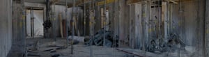
An in-depth conversation with Dallas Airport and Qk4, this webinar is your opportunity to gain valuable insights into how state-of-the-art SLAM laser scanning can tackle the complex world of surveying in demanding infrastructure projects.
Key takeaways:
- Explore some of the most pressing challenges facing civil engineering firms and airport commissions/operators in infrastructure development. Understand how SLAM laser scanning, combined with rapid 2D and 3D model generation, effectively overcomes them, and learn how these technologies streamline data collection and visualization, providing accurate and actionable insights.
- Discover strategies and best practices for seamlessly integrating SLAM laser scanning data with existing infrastructure information to optimize project efficiency and ensure decision-makers from multiple areas have a complete view of the development status, enabling informed and data-driven choices.
- Delve into compelling cases showing the successful implementation of advanced surveying tools and innovative workflows in special infrastructure development projects. Explore how NavVis technology has significantly improved project efficiency and accuracy for Dallas Airport and Qk4.
Get ready to solve the unique surveying challenges inherent in infrastructure development, ensuring the success of these projects for the continued growth of our communities. Join us to bridge the gap between surveying and infrastructure and pave the way for a more connected and resilient future.