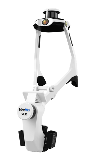
All-in-one, highly-detailed reality capture
Comprehensively capture 3D measurements with two 32-layer lidar sensors in combination with groundbreaking SLAM software to deliver industryleading point cloud quality for a wearable device. Four cameras positioned on top of the device take high-resolution, sharp images in every direction for a complete 360º image — all without the operator appearing in the field of view.
Live scanning feedback
Monitor your scanning progress in real time with a built-in touchscreen interface to ensure complete coverage as you move.
Geo-registration
NavVis VLX 3 takes your laser scanning and survey workflows to the next level. It’s fully compatible with standard tools in the field, and can capture control points in a local site coordinate system measured by both Total Stations and GNSS rovers. It also supports national and global coordinates for precise georegistration and alignment of datasets.
Innovative folding design
The unique hinged design folds up and fits into a protective case or backpack, so that a single operator can easily transport and set up.
Precision meets ergonomics
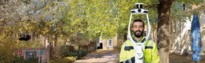
A first-of-its-kind wearable device which enables operators to comfortably scan at the speed of walking. The forward-facing design allows for targeted scanning, together with a built-in screen for optimal viewing. Comes fully equipped with:
- Grip pads
- Shoulder pads
- Built-in screen
- Forward-facing design
- Stabilizing belt
Seamless transportation
With multiple methods of transporting NavVis VLX 3, moving around and between sites has never been simpler. A protective, hard-shelled case on wheels enables air and rail travel, while a compact, sturdy backpack allows you to move to and from your site with ease.