
NavVis VLX 2
Product brochure
September 2024
Ready for anything
NavVis VLX 2 is the industry-trusted, wearable dynamic scanning system for laser scanning professionals and
surveyors that require fast, accurate and affordable reality capture of the built environment both indoor and outdoor.

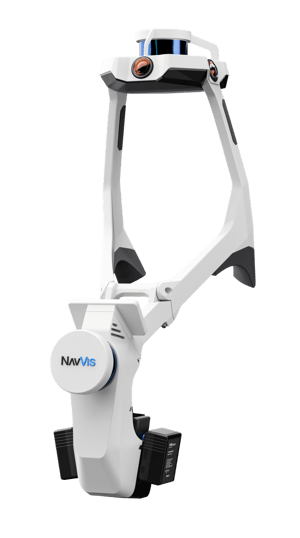
Grip pads
Shoulder pads
Built-in screen
Forward-facing design
Hot-swappable batteries
4 x high-resolution cameras
2 x 16 - layer lidar sensors