In partnership with


Get the latest news as it happens
You'll get the latest updates, news, and industry insights – plus the occasional newsflash – direct from the team at NavVis.

State of Mobile Mapping 2021
NavVis in partnership with Geo Week News, BIMplus, Lidar News, and GIM International conducted one of the biggest and most ambitious surveys in the geospatial industry.


NavVis Reality Capture Solution
NavVis has the most accurate mobile mapping systems on the market. Used together with NavVis IVION, professionals in the laser scanning, surveying and AEC industries have an end-to-end reality capture solution. Discover the benefits for yourself with these hand picked resources.

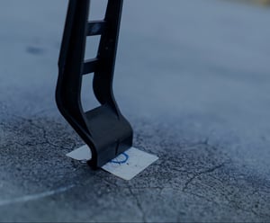
.jpg?width=300&name=211122_Resources_Thumbnails_1200x675%20(1).jpg)


Join the global movement
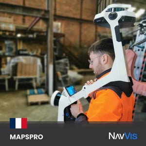
Teams like MAPSPRO are always looking for the best solutions to deliver top-notch results to their clients. However, some environments are more challenging to work in than others. With NavVis VLX, the team efficiently captures and processes every single detail, delivering high-quality point clouds without much interruption to operations or other setbacks.
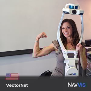
The VectorNet3D team in the USA pushes the boundaries of laser scanning, and leading the charge is the one and only Angela Somerville, a true expert in harnessing the full potential of our NavVis VLX, particularly in the construction industry. Her team got to Innovate with NavVis, and the results transformed their workflows.
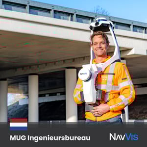
The crew at MUG Ingenieursbureau is happy to be a part of our global movement. Easy, fast, and efficient data capture is now possible with our tech, and their team couldn't be more satisfied by the results. Roads, rail, cables, pipes, and more are now digitally deliverable in various formats - the possibilities are endless when you Innovate with NavVis.
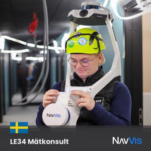
Surveyors from all around the globe, just like LE34 MÄTKONSULT, take initiative to provide next-level results to their clients - by using NavVis VLX. With our laser scanning tool, your data can be more accurate, and even in challenging environments, it enables the capture of data at unprecedented speed thanks to its wearability and technology.
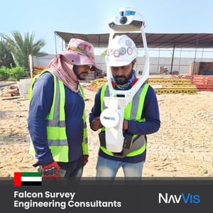
The Falcon Survey Engineering Consultants team wanted to use NavVis VLX to improve their workflows. They quickly realized that, by using our mobile mapping tool, they can now achieve more accurate results, reduce project errors, lessen their time on site, and even save money!
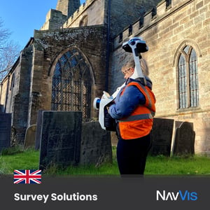
SURVEY SOLUTIONS quickly learned how valuable mobile mapping is for their workflows for survey and inspection purposes. NavVis VLX can tackle anything from complex indoor spaces with challenging lighting conditions to outdoor environments and construction sites.
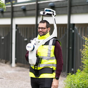
.jpg?width=300&name=221010_innovate-with-navvis-Position-Partners%20(1).jpg)
Matthew Jones from Position Partners as he puts our NavVis VLX to the test in some underground, low-light conditions. Our #LaserScanning device can help you deliver results with survey-grade accuracy even in these challenging environments.
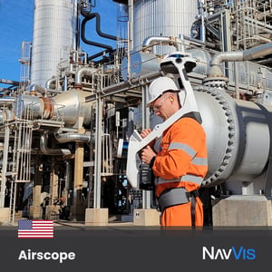
To tackle complex buildings, construction sites & more, the Airscope team chose to Innovate with NavVis. Our unique SLAM algorithms have been specifically developed to overcome the challenges of capturing high-quality point clouds with a mobile system - helping this team (and more all around the world) deliver accurate results!
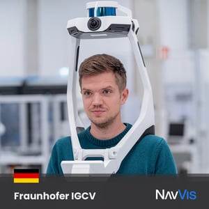
The Fraunhofer IGCV crew has cracked the code - work smarter, not harder! Our mobile mapping tool provides reliability, accuracy, and agility, making things easier when and where it's needed. Reduce costs and enhance your workflows, using the right tool for the job.
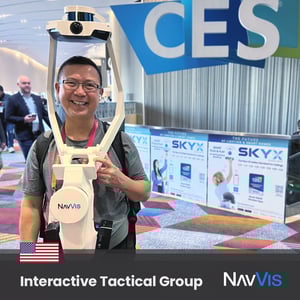
Michael Quan, founder of Interactive Tactical Group, was spotted cheerfully using his NavVis VLX while sharing the benefits of our laser scanning technology. Our wearable mobile mapping device offers accuracy, efficiency, and speed to those who want to positively transform their workflows!
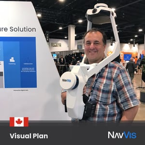
Our friend Kelly Watt from Visual Plan Reality Capture & Digital Twins Solutions knows it! His team was delighted to add NavVis VLX to their toolbox, and they can now tackle anything from complex indoor spaces with challenging light conditions to outdoor environments and construction sites - with time to spare!
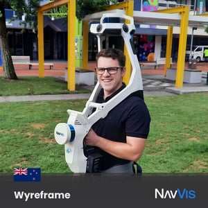
Check out Tiaan Hattingh from Wyreframe wearing NavVis VLX - his smile says it all! Our mobile mapping tool is accurate and convenient, allowing you to capture high-quality point clouds in less time on the field.
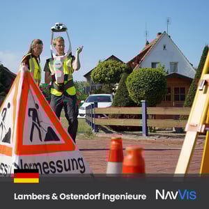
Surveying professionals André Frerichs and Miriam Krusch decided the way to offer their best services to clients is with NavVis VLX. Our mobile mapping tool helped them achieve precise, cost-effective, and time-efficient results in their projects. What a team!
.jpg?width=300&name=220718_innovate-with-navvis_AxisAdvanced2%20(1).jpg)
The laser scanning market in Israel is changing rapidly, and the expert engineers at Axis GPS & Advanced mapping solutions decided to Innovate with NavVis
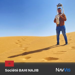
We love to see all the places our technology goes to Innovate with NavVis! Thanks to our friends from Société BAHI NAJIB for sharing this amazing photo from the Morrocan desert with NavVis VLX.
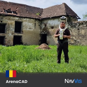
Our friend Andrei Oros from ArenaCAD in Romania chose to Innovate with NavVis and use NavVis VLX. It provides accurate data and high-quality point clouds and fits perfectly into scanning workflows.
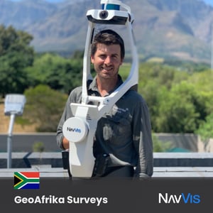
Terrence Elliott from GeoAfrika Surveys captures the true essence of what it means to Innovate with NavVis. As the first adopter of NavVis VLX in South Africa, we couldn't be more excited to see what you can accomplish with our next-generation mobile mapping technology!
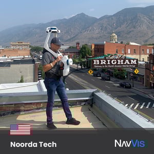
This is what Ty Phifer, COO of Noorda Tech, recommended. They often use NavVis VLX to create architectural existing condition models because of its accuracy level, wearability, and velocity - making their job easier!