Build on Truth
Access it Anywhere
Every successful construction project needs data you can trust and use. NavVis delivers both. Where survey-grade accuracy meets instantly accessible site data to catch issues early, stay on schedule and on budget.

1
Capture

NavVis LX-Series
2
Process
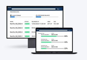
NavVis IVION Processing
3
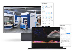
Collaborate
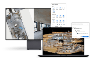
NavVis IVION
4
Integrate
Partners
Turn your site data into decisions
- Cloud access from desktop or mobile-no installs
- Compare to BIM, track progress, resolve RFIs fast
- Share a link, align the whole team instantly