Streamline your architecture, engineering and construction projects with advanced reality capture technology
Rapid, precise data handling and as-built documentation made easy
What is NavVis MLX?
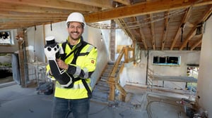
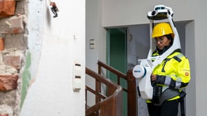
NavVis MLX, part of the NavVis LX-Series, is a compact, handheld dynamic scanning system designed to enhance AEC and surveying workflows. Its portable design makes it ideal for use in confined spaces, smaller areas, and shorter, more frequent scanning sessions on-site.
Key benefits
- Professional simplicity: NavVis MLX combines professional-grade accuracy with ease of use, delivering the data quality you and your clients require throughout all project phases.
- Groundbreaking innovation: Equipped with state-of-the-art 3D laser scanning technology and visual odometry, NavVis MLX ensures comprehensive coverage of spaces through two complementary capture modes.
- Versatile applications: Perfect for scan-to-CAD or BIM workflows, it supports both 2D and 3D modeling, leveraging superior LiDAR and visual SLAM capabilities.

NavVis reality capture workflow
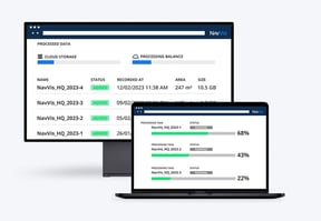
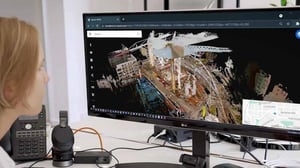
NavVis MLX wearable mapping device and NavVis IVION provide an end-to-end reality capture solution for laser scanning professionals, surveyors and engineers empowering them to seamlessly capture, process and access reliable as-is and as-built data.
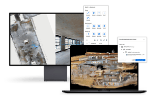
Manage your point clouds with intuitive tools for creation, collaboration, and publication.

NavVis Reality Capture Solution Workflow
NavVis technology helps you build a fast yet accurate workflow and deliver high-quality results. See how it works—from capturing reality with NavVis VLX and NavVis MLX to uploading and processing data in NavVis IVION, to drawing or modeling in third-party software, and more.
NavVis seamlessly fits into existing workflows of third party solutions
NavVis IVION provides seamless integration and effortless workflow compatibility right at your fingertips. A wide array of downloadable data formats is available to fit into your existing workflows and third-party solutions. Moreover, we simplify the export and import of Points of Interest (POIs) using universally compatible file formats, guaranteeing a smooth and efficient data transfer process. Experience the simplicity of integrating our point cloud data formats into your projects to enhance productivity.


FAQ
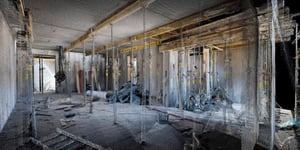
Unlike costly, time-consuming traditional methods for reality capture, NavVis technology delivers comprehensive spatial data at scale. The exceptional point cloud quality provided by NavVis MLX and the high-resolution panoramic images offered by NavVis IVION turn modeling into a less complex and more precise job, enabling stakeholders to identify discrepancies and make informed adjustments early. This technology allows for rapid iterations and verifications, reducing the overall time and expense associated with design changes.
Find out more in NavVis MLX and NavVis IVION brochures here.
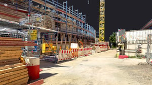
NavVis technology transforms point clouds and images of construction sites, buildings, and assets into web-based, intelligent spaces. NavVis IVION grants every stakeholder instant access to the latest data, simplifying decision-making processes and substantially reducing the likelihood of miscommunication. Smart remote collaboration functionalities within NavVis IVION enable improved efficiency in planning, engineering, and operations. Additionally, the use of standardized data formats ensures compatibility with various tools and systems, promoting effective teamwork across different project phases.
NavVis MLX is the most accurate handheld dynamic mapping system on the market, producing high-quality point clouds and high-resolution images at scale. Thanks to its groundbreaking LiDAR and visual SLAM technology, along with its unique form factor, it speeds up the capture of as-is/as-built conditions and delivers more comprehensive surveys faster. This efficiency allows for more frequent updates to project data in NavVis IVION than any traditional method, ensuring stakeholders can access the most accurate and recent information tailored to their project's timeline.
Yes, NavVis technology significantly simplifies the production of as-is/as-built documentation. By making the data capture and processing more efficient and less labor-intensive and facilitating the documentation process, it offers a fast, reliable method for generating detailed records of the site conditions. This not only saves time but also reduces the likelihood of human error, ensuring that the final documents accurately reflect the project's status. So, where as-built documentation is used to maintain the BIM model that all stakeholders are referring to as a single source of truth, costly planning mistakes are avoided early and often.
Reality capture technology has never been more accessible and straightforward to learn, set up, and operate. By integrating these capabilities into your operations, you can perform your own surveys rapidly and with greater flexibility. This self-sufficiency saves time and expenses and allows for more agile project management, as data can be collected and analyzed as needed. Reality capture technology broadens your service offerings, enabling you to provide expanded value to internal departments and clients. This approach fosters a more responsive and cost-effective strategy for managing and delivering projects.
When coupled with advanced solutions for spatial data management like NavVis IVION, reality capture technology can offer a virtual window into the construction site, enabling stakeholders to share updates and review progress without needing physical site visits. This virtual access is particularly beneficial for projects with tight budgets that can only accommodate travel for some. It ensures timely updates and efficient data management, as all information is digitally captured and stored for easy access and sharing. This way, even remote stakeholders can stay informed and involved in the project's progress.
Resources
-1-1-1-1.png?width=300&name=16072024-Webinar-on-demand-pionering-progress-construction-gilbane-events%20(1)-1-1-1-1.png)
.jpg?width=300&name=Construction-Site-742577%20(2).jpg)

Ready to dive in?
Consult our experts
Our experts speak your language
Simply fill out the form, and one of our colleagues will be in touch shortly.
Talk to us to discover customized solutions, unique applications, and significant ROI opportunities.
Our experts will clarify pricing details and assist you in optimizing your toolkit and services.
And if you would like a demo, don't hesitate to request one!

