

Like other built-world industries, commercial real estate relies heavily on high-quality documentation.
Leasing agents need imagery and walkthroughs to show properties, and 2D floor plans to calculate square footage. Architects use 3D Revit models for buildouts when a lessee moves into a new space. Owners want 2D CAD drawings for space management and 3D Revit models for managing their facility.
This creates a problem. To produce all these deliverables, building owners have historically needed to hire two providers. One for panoramic capture (to produce walkthroughs) and one for terrestrial laser scanning (to produce 2D and 3D models). The result is high costs, bloated timelines, difficulty scaling and a variety of other problems that distract from more important work.
But an experienced laser scanning professional with a mobile mapping system can change that.
The way they’ve always done it
Let’s start by exploring the root of the problem, and the reason building owners have always hired two service providers. It’s fairly simple: Before mobile mapping systems matured, there weren’t any capture tools that could produce accurate 2D and 3D models and walkthroughs.
Terrestrial lidar scanners
These devices are designed to capture extremely accurate point clouds. This data makes it easy to produce an accurate 2D CAD model, and a clean 3D Revit model for leasing agents, architects, and owners.
Unfortunately, point clouds make poor walkthroughs. The data sets are extremely large, notoriously difficult for novices to understand, and require significant training to use. An agent would never hand one over to a prospective lessee to explore a property (if that’s even possible to do).
Panoramic cameras
Panoramic cameras are the opposite. They are made to capture imagery and generate walkthroughs that are very pleasant for potential lessees to explore.
But the data sets make for poor 2D floor plans and 3D Revit models. Though some of these cameras can produce 3D data, their accuracy is limited and, in most cases, not sufficient for applications such as space and area calculations. Even the most accurate cameras can claim only "99% accuracy," which means a measurement for a room 100 feet long would be off by a whole foot. The global accuracy of a multi-million square foot office space would be off by even more.
A new approach
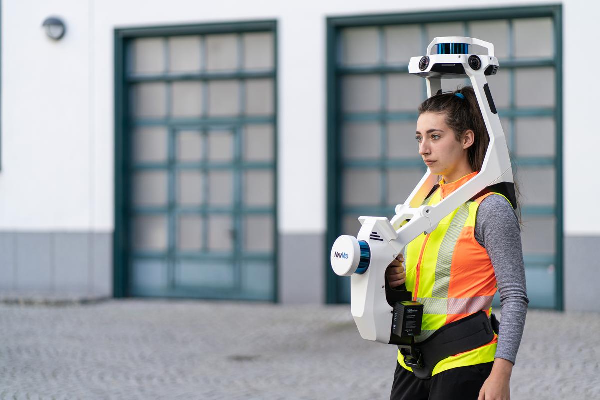
With the arrival of top-quality mobile mapping devices like NavVis VLX, the market has changed. These devices include survey-grade lidar and multiple HD cameras, so they can perform 3D and panoramic capture at the same time.
A provider like you can use a mobile mapping system to capture a property for a building owner and produce all the 2D CAD models, 3D Revit models, and walkthroughs they need. And you can save the owner from the trouble and expense of hiring a second provider.
And there’s a bonus: You and your mobile mapping system can capture much faster than commercial real estate clients are used to. In NavVis’ testing, an operator with a terrestrial laser scanner needed between two hours and five and a half hours to scan a 5,300 sq ft office space. An operator with NavVis VLX needed only 25 minutes for the same space.
This speed translates directly into ROI for building owners.
Using the old methods — two providers, two separate data sets — a fit-out construction project can be delayed by a week or two as it waits on as-built data. Mobile mapping can get it done in a day or two, and expedite the construction cycle significantly. That means your clients can start renting out their space weeks earlier, and generate more profit from their investment.
In that way, mobile mapping can pay for itself many times over.
Is the data good enough for commercial real estate?
Of course, none of that matters if the data isn’t up to the clients’ standards. The good news is that the best mobile mapping systems can produce point clouds at cm-level accuracy levels, which is more than enough for space analysis and fit-out applications. (See this white paper detailing the rigorous accuracy testing of the NavVis VLX, if you’re interested).
Can these mobile mapping systems compete with a panoramic camera for producing walkthroughs? The truth is that a walkthrough produced by a mobile mapping system won’t be quite as beautiful as one produced by a specialized tool.
But commercial real estate clients aren’t looking for the most beautiful data — they’re looking for data to perform a job. If a walkthrough is clean, clear, and features are easy to discern, it is more than enough for them to explore a layout, take accurate square footage, and grab measurements in a space. Mobile mapping systems also represent a faster and more economical option than panoramic cameras, with the ability to scale quickly and cover the large properties common to commercial real estate.

In other words: The walkthrough is more than good enough for this application, and given all the added benefits of mobile mapping, the difference in quality is unlikely to be a dealbreaker.
Wrapping up
Historically, building owners have relied on two or more service providers to produce the documentation they need. This means commercial real estate represents a huge opportunity for a laser scanning professional with a mobile mapping system.
Use a top-tier mobile mapping system like NavVis VLX to capture a property, and you produce all the quality 2D and 3D models and walkthroughs that a client needs. You can get in and out quickly. You can reduce costs, shorten timelines, and scale in a way neither terrestrial scanning nor panoramic cameras can do.
In short, you and your mobile mapping system can offer a very compelling value proposition to even the most demanding commercial real estate clients. And that makes this market worthy of exploration.
If you'd like to learn more about how NavVis technology can fit into your commercial real estate projects, feel free to chat with one of our experts.
Sean Higgins is an independent technology writer, former trade publication editor, and outdoors enthusiast. He believes that clear, buzzword-free writing about 3D technologies is a public service.