From laser scanning systems
to site intelligence
NavVis provides industry-leading mobile 3D laser scanners and a browser-based SaaS platform that transforms high-accuracy reality capture into actionable digital spaces.
Powered by advanced SLAM technology and precision software, our solution helps professionals in surveying, AEC, and manufacturing remotely access, verify, and collaborate on real-world site data—faster, easier, and with confidence.
3D laser scanners
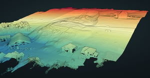
Our cutting-edge 3D laser scanning technology offers a comprehensive solution for capturing detailed, survey-grade 3D point cloud data in a variety of environments both indoors and outdoors. Whether you’re a professional surveyor seeking accurate, reliable results or a reality capture specialist looking to efficiently capture high-quality data, the NavVis LX-Series wearable and handheld laser scanning systems are designed to meet your needs and exceed your expectations.
Leverage the power of SLAM with industry-leading equipment and transform the way you capture reality.

Redefining handheld reality capture
Handheld dynamic scanning system, ideal for confined, smaller spaces or shorter, more frequent scanning on site.
Learn more
Ready for anything
Industry-trusted, wearable dynamic scanning system for fast, accurate, and affordable reality capture.
Learn more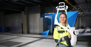
The cornerstone of reality capture
Industry-leading, wearable dynamic scanning system for comprehensive, highly detailed reality capture of large, complex indoor or outdoor sites.
Learn moreSoftware
With its user-friendly design, NavVis IVION transforms point clouds into web-based intelligent spaces using intuitive tools for creation, collaboration, and publication. NavVis IVION streamlines workflows, reduces the effort to generate reliable reality capture data, and speeds up model creation and verification. Stakeholders can visualize site information and make informed decisions based on updated site conditions. Remote collaboration tools enhance planning, engineering, and operations.
Quick, seamless processing of real-world conditions for trusted results.
Learn more
One tool to accurately align, refine, and manage point clouds and panoramas.
Learn more
Capture and convert real-world site conditions into accurate, BIM-ready documentation – streamlining planning, modeling, and collaboration.
Learn more
Visually compare 3D models, point clouds, and panoramic images within NavVis IVION.
Learn more
Plan projects with confidence using up-to-date site information. Provide teams with digital views of sites – accessible anytime, from anywhere.
Learn more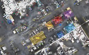
A shared source of truth for smarter conceptual planning – built on real-world data.
Learn more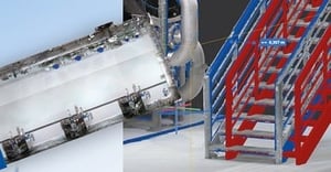
Accelerate documentation, reduce rework, and streamline construction verification with NavVis reality capture technology and virtual site access.
Learn more
Turn facilities into a data-rich environment where assets, issues, and insights are visible, actionable, and always up to date.
Learn more


Learn more about laser scanning
and a Reality Capture management platform