
The definitive guide to scan-to-BIM
The term scan-to-BIM refers to a workflow that uses 3D scanning to document an existing asset and turn it into a Building Information Model (BIM). This process aligns older buildings with contemporary construction documents and planning methodologies, leveraging the advancements in BIM tools available on the market.
For more detail, let’s break it down term by term:
- Scan: 3D scanning technologies, e.g. mobile or terrestrial lidar. These tools are used because they capture an accurate, comprehensive, and detailed point cloud data set for the real-world building, which is foundational for scan-to-BIM projects. This data is essential for creating a precise model that integrates seamlessly with BIM tools.
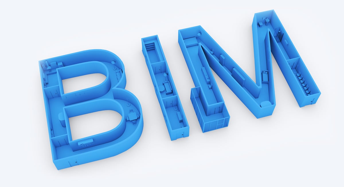
- BIM: Building information modeling, a powerful AEC collaboration methodology. In a scan-to-BIM workflow, the final deliverable is a BIM-compliant 3D model, enhancing the effectiveness of construction documents and construction drawings throughout the project lifecycle.

Stage 1: Project planning
Like any project, a scan-to-BIM project will require careful planning. Make time before work begins to talk with your client about their BIM requirments. Discuss questions like their intended applications for the BIM and their accuracy requirements. Compile all this information into a scope of work (SoW).
This will help prevent nasty surprises later in the project, and ensure that you and your client are on the same page.
Our guide to project planning can help you learn how to:
- Talk to your client about their needs
- Get important project details
- Use standards documents for absolute clarity
- Define a scope of work (SoW)

Stage 2: scan planning and field execution
Once you’ve locked down the project parameters with your client, you’ll need to plan the actual scanning work. No matter your level of experience, this is a good opportunity to make a solid plan for how best to approach the scan-to-BIM process and produce the best results for your client.
If you’re new to scan-to-BIM, be sure to think about this stage before you take on your first client. It will help you think about what kinds of scanners you’ll need for different kinds of projects.
Our guide to scan planning can help you learn how to:
- Pick the right scanner
- Develop a hybrid workflow
- Use survey control
- Make a scan plan
- Take notes
.jpg?width=1200&height=800&name=G11CustomerValidation-2257%20(1).jpg)
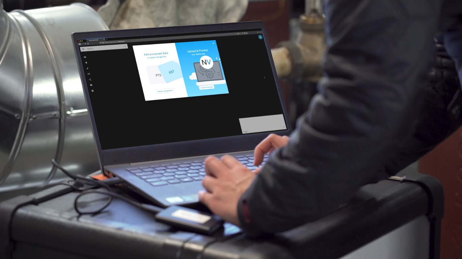
Stage 3: Data processing
After capturing the data, you’ll need to prepare it for the BIM modeling process. To do this, you’ll finalize the data in your processing software, clean up unwanted or erroneous data, register your scans together, and perform various checks to ensure that you’ve met coverage and quality requirements as agreed on in the scope of work.
If this is your first time processing data for a scan-to-BIM workflow, you’ll also want to ensure that your computing hardware can handle the huge data sets you’ll be working with.
Our processing guide can help you learn how to:
- Keep talking to your client
- Check your processing hardware
- Consider cloud processing
- Clean your data
- QA
- Register—and then QA again
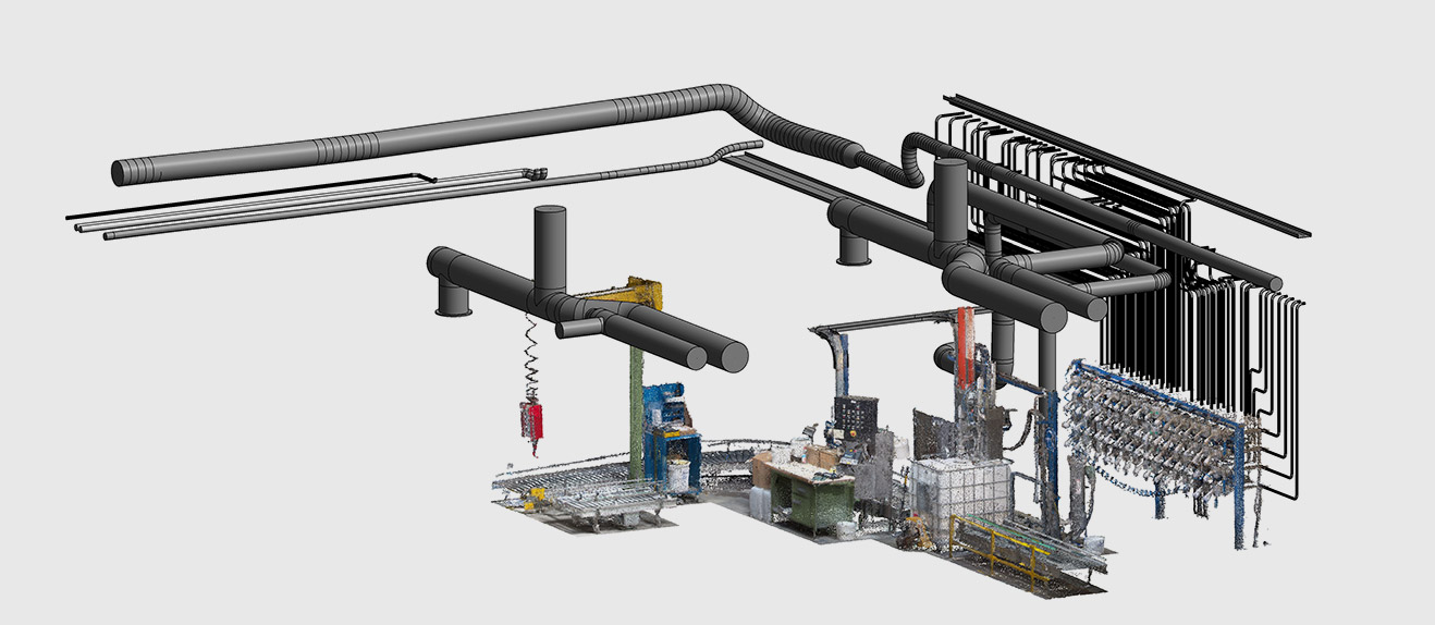
Stage 4: Modeling
Once the data is prepared and you have double- and triple-checked it to be sure that it meets requirements, you’ll turn that 3D data into a geometric BIM model.
If this is your first scan-to-BIM workflow, you’ll need to select your BIM modeling software from a range of options, determine your modeling personnel, and plan out your workflow to make the most of your employees’ time. At the end of this process, you’ll likely hand the work off to your client for their BIM work, so it’s your last chance to make sure everything is right.
Our modeling guide can help you learn how to do the following:
- Pick the right modeling tools
- Think about your modeler
- Time management is key
- Send your client a test model
Resources


Try it yourself
Take the next step in the mobile mapping revolution
The speed and scalability of mobile mapping devices are the best they've ever been, bringing survey-grade accuracy to the most challenging projects. Get hands on with NavVis VLX and see for yourself what's possible. This tool embodies the latest in mobile mapping and simultaneous localization and mapping, offering unparalleled accuracy and efficiency for even the most challenging projects.