

Data management & synchronization
One tool to accurately align, refine, and manage point clouds and panoramas.

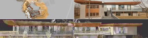
Visually inspect point clouds to select and remove unwanted objects, reflections and noise. Easily examine and clean your point clouds inside NavVis IVION without disrupting the panoramic context or exporting to another software. Deliver high-quality visuals that your team and clients can trust.
Update and refine your site without disrupting live access for other users. Site admins can make changes and manage data in a draft version, review all edits in a draft changelog before publishing - ensuring clean transitions, no downtime, and full visibility into revisions before sharing updates with all users.
Maintain the connection between point clouds and panoramic imagery, to enhance contextual accuracy and ensure everything lines up thanks to intuitive geo-registration and control point validation. Keep your data accurate and audit-ready.
Data import from various sources
Create comprehensive digital sites in one place and enhance your NavVis scans by combining them with bundles, datasets, point clouds, or 360° panoramic images from third-party devices, such as drones, 360° cameras, TLS, and total stations.

Site-referenced coordinate system
When creating a new site*, you can choose from various spatial reference systems, such as latitude & longitude (WGS 84), projected spatial reference or a local reference system – allowing for survey-grade geo-registration of data. Selecting your own site coordinate system ensures that your data is aligned with your site's exact location, making it easier and faster to upload and download data.
*A site in NavVis IVION is a container that bundles data, metadata, and access rights. A site can represent a single building, a campus, or an entire plant. Sites can also be used to separate different projects at the same location.

Seamless integration of 360° panoramas
Add 360° pano images from third-party 360° cameras to your NavVis IVION site with an easy, fast, and intuitive browser-based upload. Ideal for regular full-site documentation, the 360° images are automatically placed within your scanned spaces – no extra tools needed. This streamlined workflow keeps point clouds, BIM models and all 360° panoramas centralized, helping you enhance your digital twin without disrupting your existing data management processes.
Only available in: PRO ENT
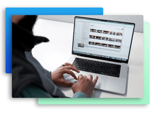
Draft-to-publish workflow for data management
Edit your data using a draft version to make changes without affecting the live site. Once you have finished editing, aligning, and managing the data, publish the draft. This will update the published version of the site and document the changes in a change log. Users can work on the same site simultaneously, enabling streamlined operations. Data admins can manage and update new data while end users work with the latest version. This workflow simplifies data management without disrupting end users.


