Calculate Your Savings: NavVis vs. Terrestrial Laser Scanners
Not every project requires a terrestrial laser scanner. Use our calculator to see when NavVis VLX makes more sense — and how much time and money you can save.
Calculate Your Time & Cost Savings
See how much you can save with NavVis VLX 3 compared to terrestrial laser scanners.

The results shown represent estimated labor time savings only. They do not account for processing costs, hardware investments, NavVis IVION subscription fees, or additional cost savings associated with travel, accommodation, mobilization, and per diem expenses for multi-day projects. Our sales team will walk you through the full cost model.

- 2.5x faster data acquisition
- 2.1x faster office time
- 35% total labor time reduction (includes site prep, control points, and project closure)
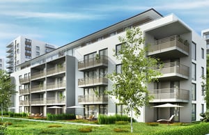
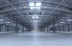
Site characteristics: 5,000 sqm + 1h of control point collection, 120 sqm per Terrestrial Laser Scanner setup with few obstacles, a low amount of occlusions, consistent lighting, a long line of sight, and a large field of view (FoV).
- 5.0x faster data acquisition
- 5.0x faster office work
- 48% total labor time reduction (includes site prep, control points, and project closure)
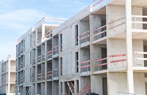
Site characteristics: 2,000 sqm + 3h of control point collection, 20 sqm per Terrestrial Laser Scanner setup, varied geometries with occasional occlusions, multiple varying-sized rooms, changing lighting, medium line of sight and field of view (FoV).
- 7.5x faster data acquisition
- 3.8x faster office work
- 61% total labor time reduction (includes site prep, control points, and project closure)
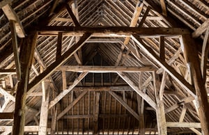
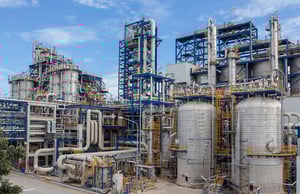
Site characteristics: 750 sqm + 1h of control point collection, 10 sqm per Terrestrial Laser Scanner setup, complex geometries with frequent occlusions, occupied tight spaces, challenging lighting conditions, minimal line of sight and field of view (FoV).

- 2.5x faster data acquisition
- 4.2x faster office work
- 57% total labor time reduction (includes site prep, control points, and project closure)
Site characteristics: 45,000 sqm + 3h of control point collection, 120 sqm per Terrestrial Laser Scanner setup, few obstacles, a low amount of occlusions, consistent lighting, a long line of sight, and a large field of view (FoV).
- 5.0x faster data acquisition
- 9.1x faster office work
- 76% total labor time reduction (includes site prep, control points, and project closure)
Site characteristics: 20,000 sqm + 5h of control point collection, 20 sqm per Terrestrial Laser Scanner setup, varied geometries with occasional occlusions, multiple varying-sized rooms, changing lighting, medium line of sight and field of view (FoV).
- 7.5x faster data acquisition
- 6.7x faster office work
- 72% total labor time reduction (includes site prep, control points, and project closure)
Site characteristics: 2,000 sqm + 2h of control point collection, 10 sqm per Terrestrial Laser Scanner setup, complex geometries with frequent occlusions, occupied tight spaces, challenging lighting conditions, minimal line of sight and field of view (FoV).
- 2.5x faster data acquisition
- 4.6x faster office work
- 60% total labor time reduction (includes site prep, control points, and project closure)
Site characteristics: 100,000 sqm + 5h of control point collection, 120 sqm per Terrestrial Laser Scanner setup with few obstacles, a low amount of occlusions, consistent lighting, a long line of sight and a large field of view (FoV).

- 5.0x faster data acquisition
- 9.9x faster office work
- 82% total labor time reduction (includes site prep, control points, and project closure)
Site characteristics: 200,000 sqm + 10h of control point collection, 20 sqm per Terrestrial Laser Scanner setup, varied geometries with occasional occlusions, multiple varying-sized rooms, changing lighting, medium line of sight and field of view (FoV).
- 7.5x faster data acquisition
- 10.0x faster office time
- 81% total labor time reduction (includes site prep, control points, and project closure)
Site characteristics: 5,000 sqm + 3h of control point collection, 10 sqm per Terrestrial Laser Scanner setup, complex geometries with frequent occlusions, occupied tight spaces, challenging lighting conditions, minimal line of sight and field of view (FoV).
Let us help you grow
By turning to one of our experts, you will be able to:
- Collaborate with them on an in-depth, customized calculation of your potential ROI
- Gain insights into new applications and services to help you expand your offerings and business
- Discuss best practices for improving your quoting process with mobile mapping systems as a valuable addition to your toolkit
“We now have four NavVis VLX in operation, every day, 5 hours a day producing around one to one and a half million sqft of as-built capture per week.”