

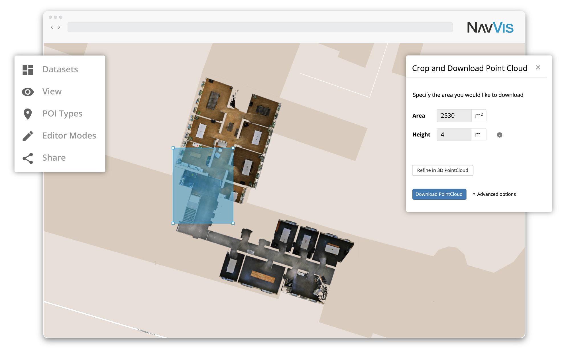
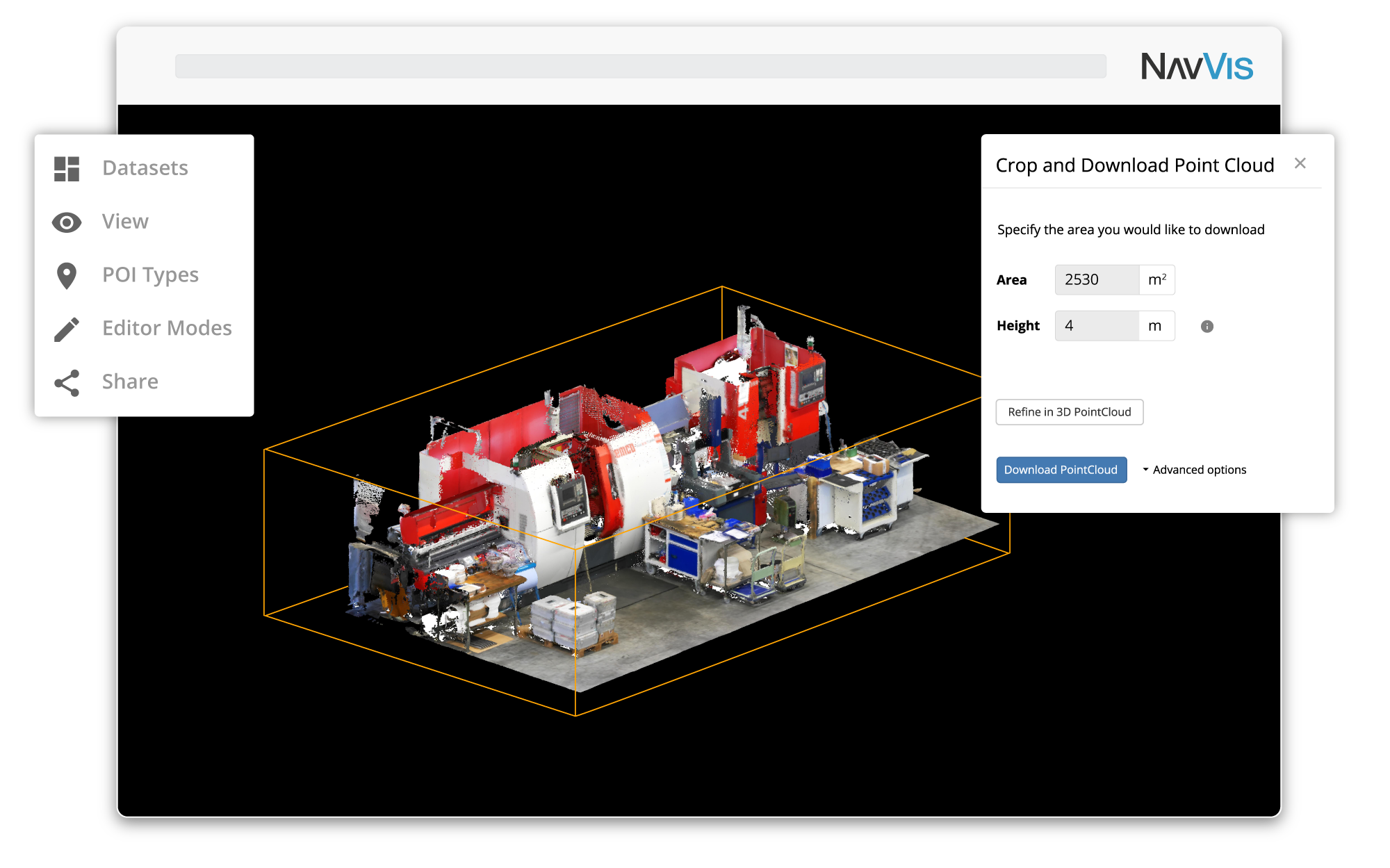
The upcoming release of NavVis IndoorViewer 3D building visualization software will include a new feature to select, crop and download point cloud sections in browser.
NavVis, the leading global provider of indoor spatial intelligence technology and enterprise solutions, announces the beta release of NavVis IndoorViewer 2.5. This major software release will significantly extend the point cloud functionality through a new download feature that lets users select and crop sections of large point cloud files in browser, and then download and use the file in third party modeling software.
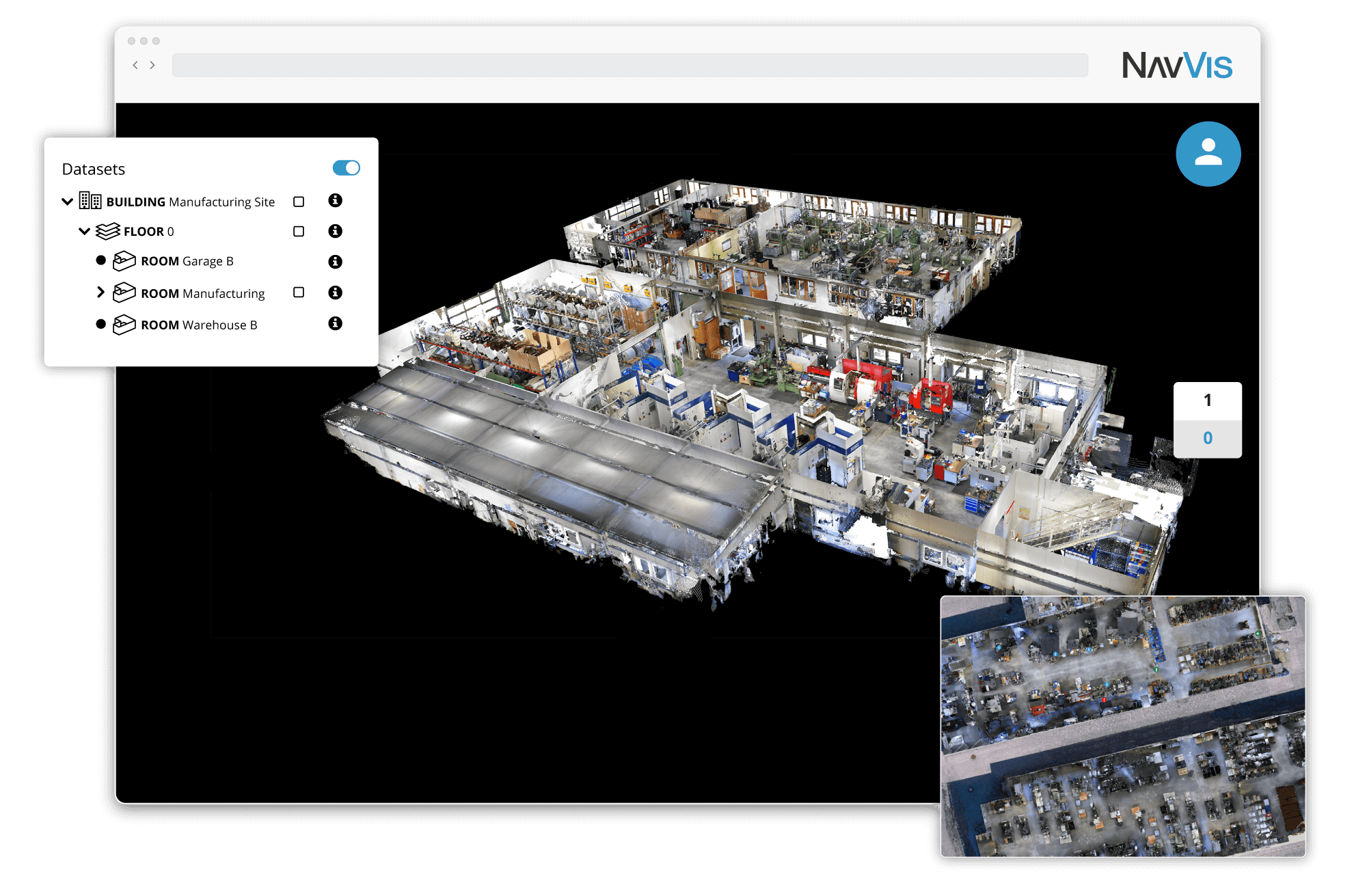
NavVis IndoorViewer is a web-based 3D building visualization software that displays point clouds, 360° panoramic images and floorplans as realistic, fully immersive digital buildings. The intuitive interface and realistic 3D view have made NavVis IndoorViewer especially popular among building stakeholders who want to access and enrich laser scan data but lack the technical expertise to work with point clouds and advanced modeling software.
For more advanced users working with point clouds to create 3D building models, NavVis IndoorViewer serves as an online hub for accessing, streaming and managing point cloud files in browser. The online access and streaming addresses the challenges of storing and sharing point cloud files, which often contain massive volumes of data.
Another challenge in working with large point cloud datasets is that it can be difficult to find the exact section of the scan needed. Modelers often need to use point cloud software to inspect and locate the section of the dataset that needs to be extracted. With NavVis IndoorViewer, users can upload scans from different devices and merge the datasets into a basic building model in just a few clicks. The merged files are uniformly displayed as a building point cloud and can be viewed as if users are on site, or from a top down perspective. The 2D map and floorplan view in NavVis IndoorViewer can be used to access point cloud files based on location, while the realistic 360° panorama view can be used to verify real-world details. For users that need to access specific scans, the dataset menu lists every uploaded file separately and lets users jump to and display the relevant dataset.
The upcoming release of version 2.5 further extends the point cloud functionality in NavVis IndoorViewer with a new feature that will let users select and crop sections of the intuitively displayed point clouds and floorplans, and then download and use this file in third party modeling software.
“The emergence of online file storage and sharing applications has already transformed many modern workplaces through significant gains in collaboration and efficiency that result from being able to access and share files on any device. With this in mind, the point cloud functionality in NavVis IndoorViewer has been extended to harness similar benefits for professionals working with reality capture data,” said Georg Schroth, NavVis CTO.
“As part of this ongoing effort, the next major release of NavVis IndoorViewer will include a feature that was highly requested by professionals working with point clouds: being able to download and save sections of the point clouds being streamed in browser. With this new feature, the tedious search for the right scan files is a thing of the past. Only those parts of the point cloud that are really required to get the job done can be downloaded as you browse through them in browser.”
For an overview of the point cloud functionality in NavVis IndoorViewer, watch the feature highlight video below:
Version 2.5 of NavVis IndoorViewer will be released in Fall of 2019. The beta release of the point cloud download feature will be available to preview at the NavVis booth F3.056 in Hall 3 at INTERGEO 2019.