

Global design firm Unispace made huge savings from 3D reality capture scanning solutions provided by PrecisionPoint, a certified NavVis Mapping Partner.

In our ongoing series spotlighting NavVis Mapping Partners all over the world, we pay a visit to Carmel, Indiana, in the United States. This where you’ll find the headquarters of PrecisionPoint, a 3D reality capture solutions company with a decade of experience 3D scanning in the architectural, engineering, and construction (AEC) industry.
No laser-scanning job is too big or too small for the expert team at PrecisionPoint. A great example is a project they completed in summer 2018 for Unispace, a global design firm specializing in interior construction. PrecisionPoint generated an existing-conditions 3D scan of a new employee office space to be used by a global medical equipment company in Plymouth, Minnesota.
Don't let outdated building plans delay your project
Unispace contacted PrecisionPoint to verify and update their BIM model before they started developing construction documents.
Unispace needed a 3D point cloud and 360-degree imagery that they could use during design and construction, enabling them to keep the project within budget and on time. 3D laser scanning was the preferred method of documentation because it is faster, extremely accurate, and produces 360-degree images – unlike traditional hand measurements.
“The technology and the equipment PrecisionPoint uses is more advanced than other solutions, because the NavVis indoor mobile mapping system combines laser scanning and immersive images in one device.”
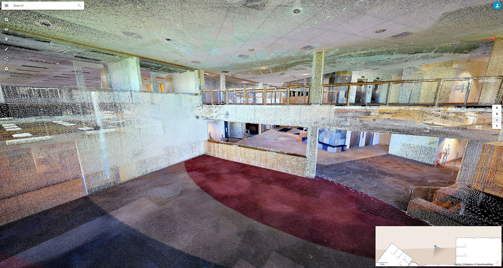
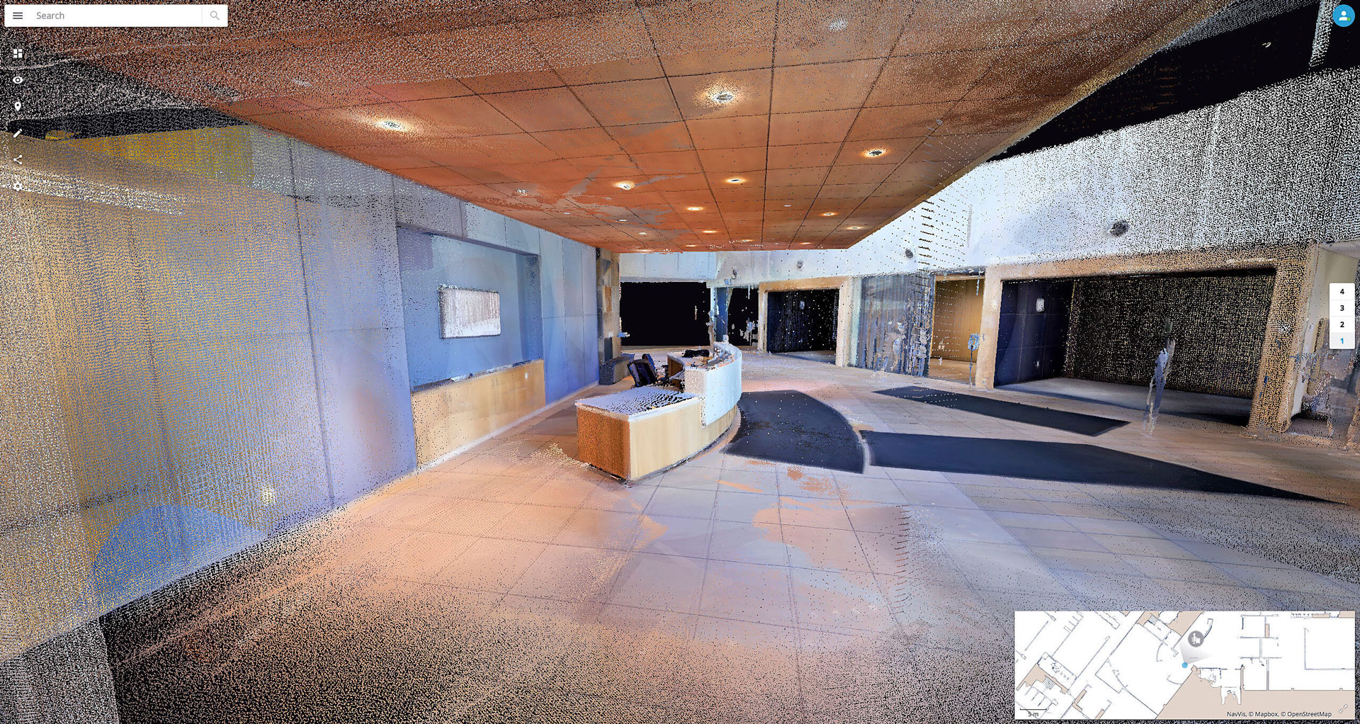
The location was a new employee office space for a global medical equipment company in Plymouth, Minnesota. The previous occupants were a mattress company who'd been using the building complex for at least a decade; that meant the original 2D construction as-built plans were wholly outdated and unreliable.
Moreover, the building had distinguishing features like a grand staircase, a two-story tall atrium, and two catwalks. These features would pose logistical challenges for traditional measurement methods.
Scanning 150,000 square feet in a single day
Using the NavVis M3 indoor mobile mapping system – which PrecisionPoint has since upgraded to a next-generation NavVis M6 – the team was able to complete the project in just a single day. The time required for one person with the NavVis IMMS was ten field hours, compared to the 40 field hours or more that would have been needed by a single technician with a static laser scanner.
This meant they could quickly process and deliver the point clouds and 360-degree imagery back to the client in only three days. And because PrecisionPoint was able to 3D scan 150,000 square feet in so short a time – covering more than 140 rooms across three stories – the recipients at Unispace was able to quickly adjust their BIM model in Autodesk Revit software and verify the existing building conditions.
“It took longer for us to actually rectify the BIM model than it did for PrecisionPoint to execute the scan and supply the output.”
“It took longer for us to actually rectify the BIM model than it did for PrecisionPoint to execute the scan and supply the output,” says Rob Shahee, Design Principle of Unispace Minneapolis. “The fact that they could travel here and do the scan for the fee they charged, it was very reasonable, and the work delivered was worth the investment.”
In addition to their 3D scanning and scan to BIM services, PrecisionPoint delivered the assets using NavVis IndoorViewer, a powerful but intuitive application to view point clouds and immersive 360-degree imagery from within any web-browser.
Users can take measurements, tag points of interest, and coordinate seamlessly with all building stakeholders – for example, architects, project managers, and contractors – to ensure accurate digital models of a building’s existing conditions as they shift from concept to construction.
The added value of using NavVis technology
When Unispace asked for a point cloud, they got much more than they expected with NavVis IndoorViewer. Their Autodesk Revit modelers could view actual images from the NavVis M3 using the dedicated Revit plug-in. And the speed to cost ratio was significantly lower than they expected.
“The technology and the equipment PrecisionPoint uses is very practical and more advanced than other solutions, because the NavVis indoor mobile mapping system combines laser scanning and immersive images in one device,” says Vincent Poon, Global Principal of Design and Digital Integration.
“Because of that, the operator can scan much more area in a much shorter time,” continues Poon. “That equates to a quicker turnaround time for us, which ultimately benefits the design team as well as the client.”
In the past, Unispace was using stationary laser scanners that were very slow and expensive. For this project, PrecisionPoint took 1,936 360- degree images covering an area of 150,000 square-feet of the medical equipment company's four-story building. And they did it in a fraction of the time at a fraction of the cost.
Since the Minnesota project, PrecisionPoint has gone on to scan several more Unispace project locations in Seattle, Washington, and San Diego and Irvine, California – all powered by NavVis.
Image credits: PrecisionPoint