

Using multiple mobile scanning devices for big commercial and industrial mapping projects offers significant benefits.

This is especially true when you have a client with a big facility that they would like mapped on a regular schedule, with minimum disruption to their operations.
Chances are your big client is unwilling to endure facility downtime while you map their building, and so you need to make the most of every minute available to you.
What are the benefits of using multiple devices?
The benefits of using more than one mobile mapping device are clear: you can map a given space faster. With its SLAM (simultaneous localization and mapping) based technology, the NavVis indoor mobile mapping system (IMMS), has been designed for mapping at speed.
The calculation is simple. One NavVis M6 can capture between 10,000 m2 and 30,000 m2 per day depending on the environment, and if your client has a big building and not much downtime, you need a way to increase the speed of mapping without sacrificing data quality.
Using additional devices that operate in parallel is the only way to achieve this, and this gain in speed and efficiency is the reason that to become a Gold Certified Mapping Partner you must own at least two NavVis M6 systems.
Our Gold Certified partners are eligible for referral to enterprise projects that are bigger than 50,000 m2, and we need to know that the partners we refer for these big projects can complete them within strict time constraints.
However, when planning a project using multiple mobile scanners there are some additional factors to consider in order to ensure success and quality.
Plan for success
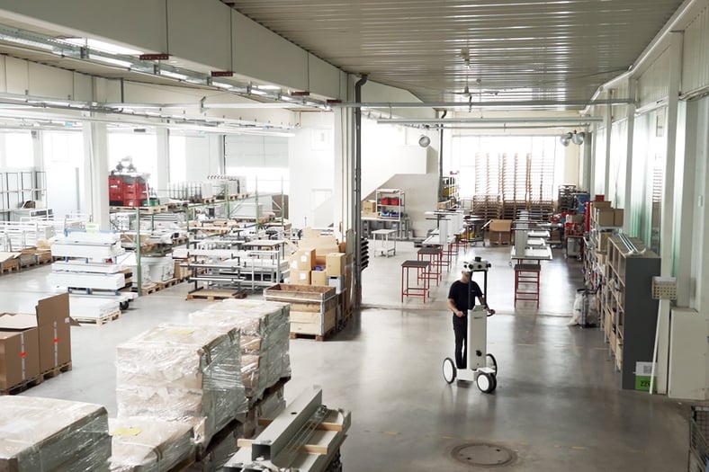
If multiple mobile scanners are operating in parallel then it is important that each device can map without seeing the other one, so that mobile scanners don’t appear in the final point clouds and panoramic images.
If the environment is complex, such as with many large machines and multiple rooms, then there shouldn’t be a problem. But in a large open space it might be impossible to hide the scanners from each other. This is why you must double check the floorplans to make sure the layout of the space makes it possible.
Buildings with these features are most likely suitable:
- Multiple floors
- Large machines or furniture that block the line-of-sight
- Many rooms and corridors
It is also a good idea to request some pictures of the site to confirm what you see on the floorplan. Is the pallet racking high enough to hide the NavVis M6? Are the walls opaque or made of glass? Gather as much information as possible about the building that you will map, so that you don’t get any nasty surprises when you turn up on-site.

Good project management
The addition of extra machines and operators to your workflow can potentially introduce some new pains. That's why it's important to stick to best practice when it comes to project management, and that everyone involved is fully briefed about what will happen on-site.
Use the floorplans to plan which device will map each area, and the order in which they should be mapped. You should also decide on a naming convention for the datasets, so that during the post-processing phase it is clear where the data came from and how it should be aligned.
During the mapping make notes on the floorplan with the dataset name, how long it took to map, and exactly who was operating the device. Before you leave the site double check the floorplan to make sure that everything has been mapped.
Time spent documenting the project before and during the mapping can add up to big time savings in the end. It can also help with accurate and efficient planning of future mappings at the same (or similar) sites.
Traveling with multiple devices
NavVis has designed its IMMS with transport in mind, and the Technical Account Managers have proven that with a single NavVis M6 it's possible to travel in a small car.
However, multiple devices equals more luggage and more operators, and we have found that the smallest vehicle for comfortably transporting two NavVis M6 systems and two people is a minivan.
One advantage of traveling with multiple people is that there are extra hands available to help with loading the boxes, carrying them on-site, and assembling the devices.
If you have a big project coming up that would be ideal for multiple scanners, but you don’t have two NavVis M6 systems, then get in touch with your Technical Account Manager – they might be able to help!