

NavVis went behind the scenes at the Deutsches Museum to field-test the new NavVis VLX, our revolutionary wearable mobile mapping system. Read the inside story.
To test the capabilities of NavVis VLX prior to launch, we worked with select partners for their insights and feedback. And some have supported its development in other ways, like granting access to their buildings for scanning.
In the fourth of a series, we’re going behind the scenes at the museum – the Deutsches Museum in Munich, Germany. Learn how this magnificent complex of buildings made the perfect testing ground for our revolutionary wearable mobile mapping device.

The Deutsches Museum of Masterpieces of Science and Technology is the world's largest museum of its kind, welcoming 1.5 million visitors per year with 28,000 exhibits from 50 different fields.
“We strive to present the complete spectrum of natural sciences and technology, beginning from the first clay brick kilns all the way through to nanotechnology,” says Georg Hohmann, Head of Digitization.
“About ten years ago we decided to put more of an emphasis on digitization, exploring what we could offer our visitors in the virtual space as well as the physical. Today, NavVis technology enables us to bring this new dimension to the Deutsches Museum.”
Tackling complex geometries with NavVis VLX
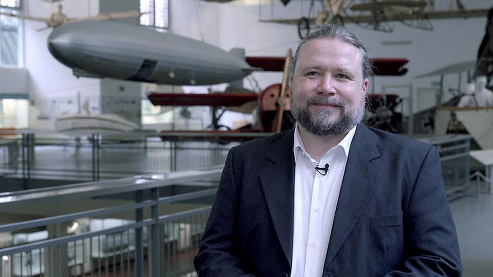
According to Georg Schroth, NavVis CTO and cofounder, the opportunity to deploy NavVis VLX inside such a venerable institution was too good to miss.
“We built NavVis VLX so that you can use it for reality capture in pretty much any environment. And the Deutsches Museum is a perfect testing ground, because here you can find anything you can imagine,” he explains.
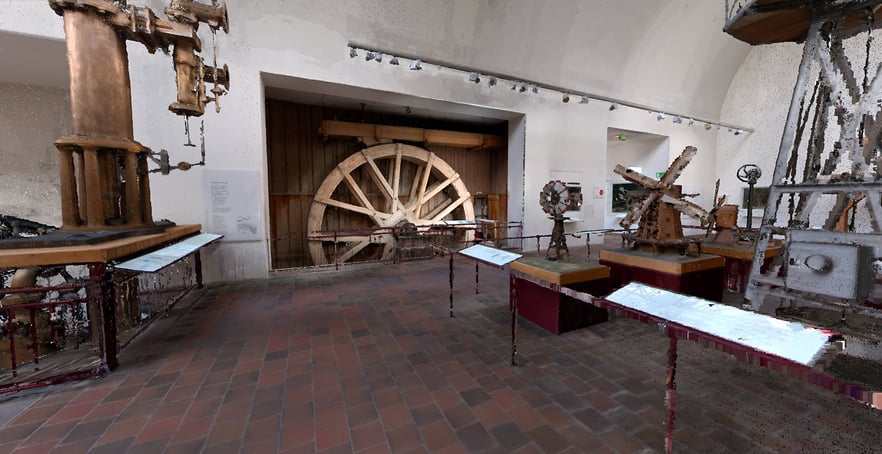
“There’s a replica mine in the basement, and you have industrial machinery laid out in a complex environment, plus the option to scan over several levels and crawl into small alcoves. You can find all that here.”

“We built NavVis VLX so that you can use it for reality capture in pretty much any environment."
Moreover, this cooperation with the Deutsches Museum is one in a long line of partnerships that have been invaluable for the development of our wearable mobile mapping system.
“We’ve also collaborated with other pilot customers who are very experienced surveyors, with a considerable amount of expertise spanning decades, and they’ve given us invaluable feedback during our pilot series program,” says the NavVis CTO.
“And all this input made it possible for us to quickly reach the right result; NavVis VLX in its current form.”
Capturing the Deutsches Museum with high-quality point clouds
The history of the collaboration between the Deutsches Museum and NavVis dates to 2013, where the Director General of the museum first encountered a quartet of entrepreneurs working on a revolutionary idea for indoor navigation at the Technical University of Munich.
“When we first learned about NavVis, our initial involvement was to lend support as a technology partner, acting as a sponsor for new, innovative ideas in science and technology,” Georg Hohmann says.
“But we quickly realized there was also an opportunity for us to preserve the museum in its current state.”
"The scan data we have from NavVis VLX can be used for much more than just a virtual tour."
Currently, the museum is undergoing an ambitious renovation project which encompasses the entire site on the famous “Museum Island” on the Isar River in the city center.
“We’re going to redesign all exhibitions from the ground up. And that’s when we realized that the scan data we have from NavVis VLX can be used for much more than just a virtual tour. We can use it to measure entire rooms; we have very precise data to do this because of the high-quality point cloud of all our exhibits.”
Moving forward, the museum intends to leverage the benefits of NavVis technology even further, to identify new use-cases for the virtual model in relation to the construction work in the building. At this point, Georg motions to one of the largest exhibitions in the hall where the interview is taking place.
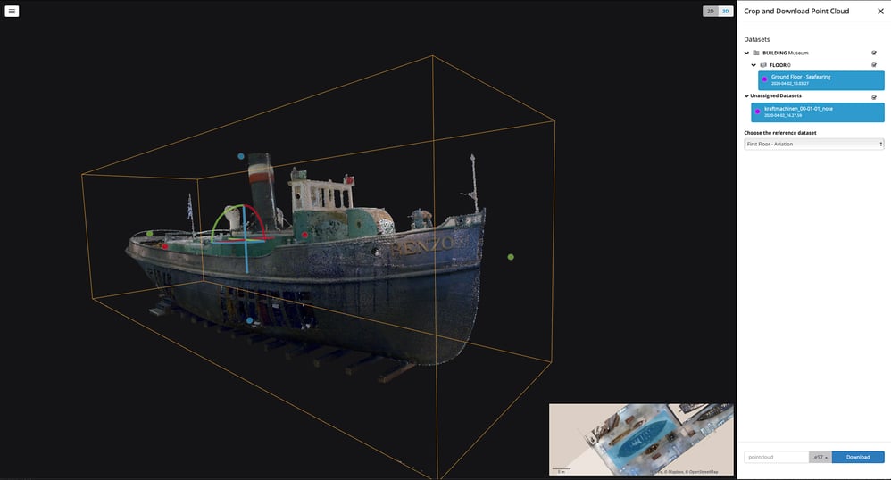
“For example, this ship here is staying, but all the aircraft will have to be taken out,” he says. “We’ll probably have to tear open the roof for that.” Using the crop and download point cloud feature in NavVis IndoorViewer, for example, it would be easy to determine the precise dimensions of the ship separately from the other exhibits and upload it to third party modeling software.
“In addition, we can also support the curators of the new exhibitions, who are beginning to think about how to bring the objects back in and where to position them in the new space. They can compare the scanned exhibits directly against their own models to visually assess the results.”
Learn more about the incredible capabilities of NavVis VLX. Book a demo now and see how it can deliver survey-grade accuracy at speed and scale.