Key takeaways
- In order to create documentation to plan an extension of the museum and the renovation of the interiors of Rochsburg Castle in accordance with German preservation guidelines, Wuttke Ingenieure GmbH scanned the 800-year-old castle complex with NavVis VLX and converted the point cloud into a 3D model with an accuracy of +/- 1 cm as well as 2D sections and floor plans.
- The modeling of the complex building was economically viable thanks to NavVis VLX, a new-generation wearable mobile laser scanner, which was used to scan the unique interiors.
- As of early December 2021, Wuttke Ingenieure scanned approximately 20,000 square feet of floor space on 7-8 levels and in rooms with few to no right angles. From start to finish, including all laser scans done with NavVis VLX, the project lasted three weeks.
- Immediately after the successful scan, the client, the district of Central Saxony, and the planning office had access to the point cloud in the browser-based software NavVis IVION and were able to start initial planning.
- Only twelve weeks later, Wuttke Ingenieure GmbH delivered both a realistic 3D model and all derived 2D floor plans.
.jpg?width=300&name=Schloss%20Rochsburg-von_Norden-1%20(1).jpg)
"For surveying complex building structures, mobile laser scanning is perfect. Without NavVis VLX, documenting this building would have been much more expensive and tedious, if not completely impossible."
M. Sc. Oliver Wuttke, Managing Partner, Wuttke Ingenieure GmbH

"Working with NavVis VLX prevents any mistakes. The operation is really simple - the scanner shows exactly which areas still need to be scanned."
B. Eng. Jan Wuttke, Partner and Project Manager, Wuttke Ingenieure GmbH

Documents available to all stakeholders
At the beginning of the year, the surveying company transferred all the point cloud data directly to the district office of Central Saxony. What was so unique in this case? Users did not need any special software to view the photorealistic rendering as an initial basis for planning and to take simple measurements. The point cloud was hosted by NavVis directly in the cloud.
Planners had immediate access after handover via a web link in the browser-based software NavVis IVION as a basis for initial planning ideas and drafts. The District Office of Central Saxony was immediately convinced by the quality of the data.
The task was then to create a design concept for the upcoming construction work. They were able to derive a 3D model from the point cloud, and it is an exact geometric image of the castle, and thus, the heart of the comprehensive renovation. The planned work also includes, for example, the building utilities.
All project participants now have access to the current status of the renovation via the 3D model - from the architect to the specialist planning department for building services to the inspection engineer. The 3D model is constantly updated and is the basis for all trades working on this project. It is truly the core of Rochsbrug Castle's renovation and planning.
"NavVis IVION is completely self-explanatory. Users don't need an introduction and can start developing ideas immediately."
M. Sc. Oliver Wuttke, Managing Partner, Wuttke Ingenieure GmbH

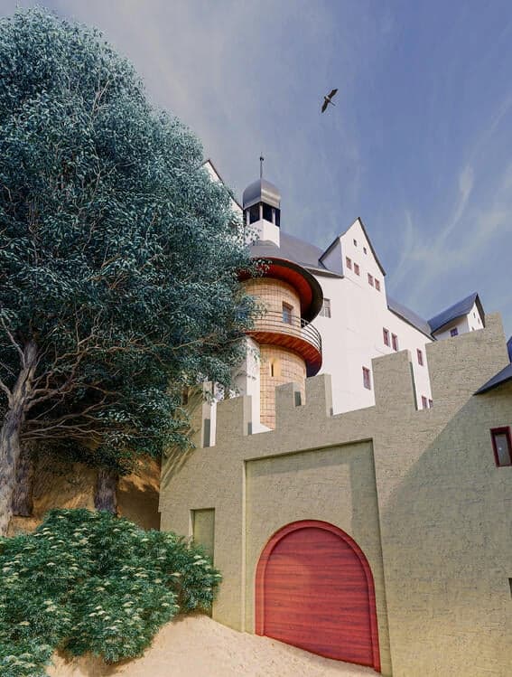
Rochsburg Castle – a tourist magnet
Rochsburg Castle stands high on a rocky peak and is flanked by the Mulde River on three sides. The castle is located amidst nature reserves and protected landscape areas, and is a popular stop for hikers and bicycle tourists. However, it is the Renaissance design that makes Rochsburg Castle famous far beyond the borders of Central Saxony. The fortifications, the watchtower, the powder tower, the castle chapel, and the inner courtyard, with its 53-meter-deep well, can be visited free of charge. Additionally, the museum regularly hosts exhibitions and events.

Try it for yourself
Learn more about how your business can benefit from
mobile mapping
Mobile mapping devices are faster and more scalable than ever before, providing survey-level quality for even the most demanding projects.
See our mobile mapper, NavVis VLX, for yourself.