

It's a question we’re asked all the time. How fast can you possibly scan with NavVis VLX? Here's the answer: 600 square meters in 6 minutes within 6 mm accuracy.
There’s no denying that NavVis VLX has made a huge impact on the laser scanning and surveying industry. Customers, partners, and the press routinely remark on multiple aspects of our flagship mobile mapping device: the simplicity in use, its versatility for jobs difficult to do with a terrestrial laser scanner (TLS), and the reliable accuracy.
But there’s one question that keeps popping up time and time again. How fast can you possibly scan with NavVis VLX?
Laser scanning pros are rightly intrigued by the capabilities of mobile mapping devices powered by a SLAM (simultaneous localization and mapping) algorithm. They’re curious about the speed of capture, while still delivering the level of accuracy the project requires, and how that might enhance their business.
So first we’ll give you a concrete answer, and then we’ll outline the conditions of our testing. NavVis VLX can map 600 square meters in 6 minutes within 6 mm accuracy. See the actual scanning as it was done in the video below:
Pushing technology to the limit (within reason)
We strove to make this demonstration of the capabilities of NavVis VLX plausible and realistic.
On that basis, the parameters of the exercise are to push our technology to their limit, but within reason. That is to say, the speed of mapping is at a normal walking pace - no need to run if you own a mobile mapping device!
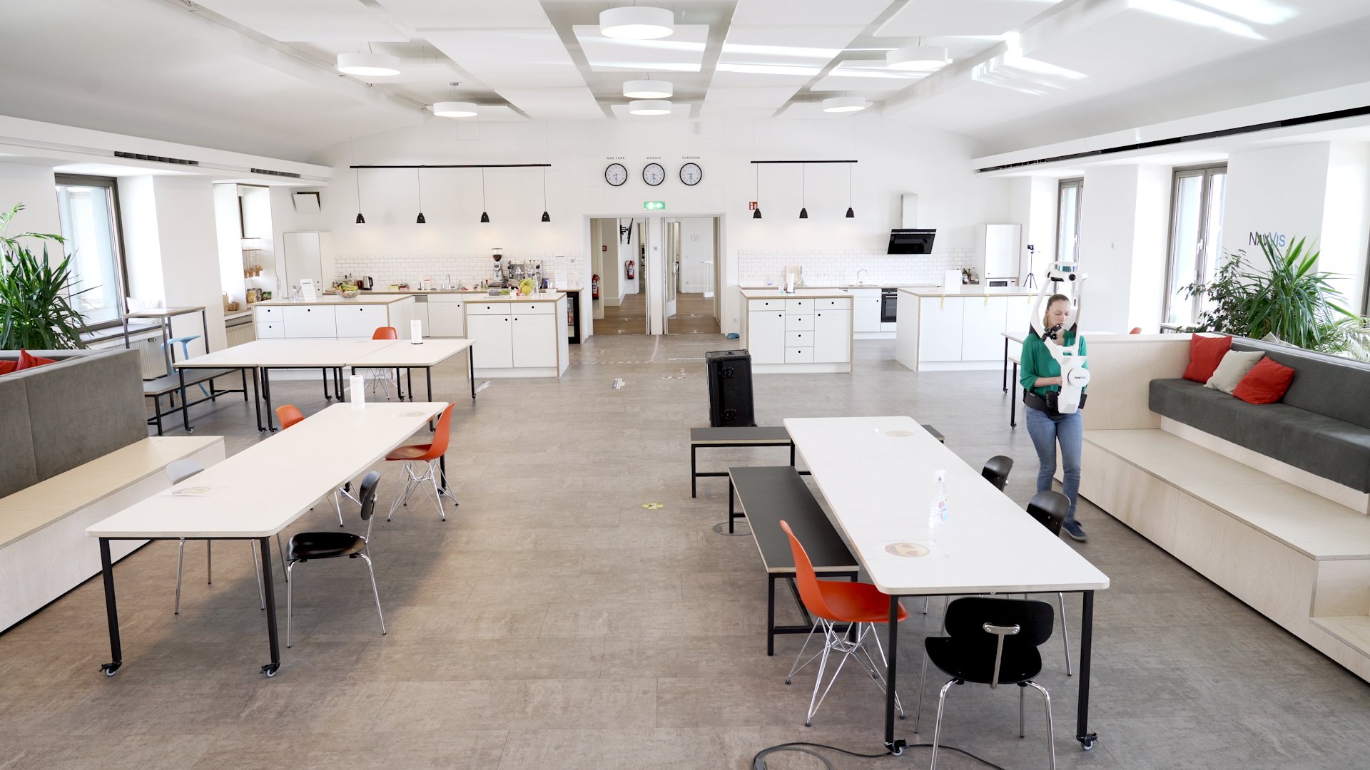
Next, we established the scenario for which the point cloud data would be applied: a 2D floorplan (or a high-level 3D model) of an office space which only required coverage of the main area and the walls. Our HQ in central Munich serves as the model here.
The rules we set:
- For this type of application, you won’t need to pause and take many 360 panoramic images; our operator confined themselves to approximately two per room.
- Nor do you have to scan every niche of the room, which means the operator can pick up the pace a little.
- Thirdly, the scope of work doesn’t require georegistration or capturing control points.
Under these conditions, it’s entirely possible to scan 600 square meters in six minutes to within 6 mm level accuracy.
And users can still expect a decent amount of information, coloring and detail, too. They’ll clearly be able to identify features like walls, doorways, windows, and stairwells.
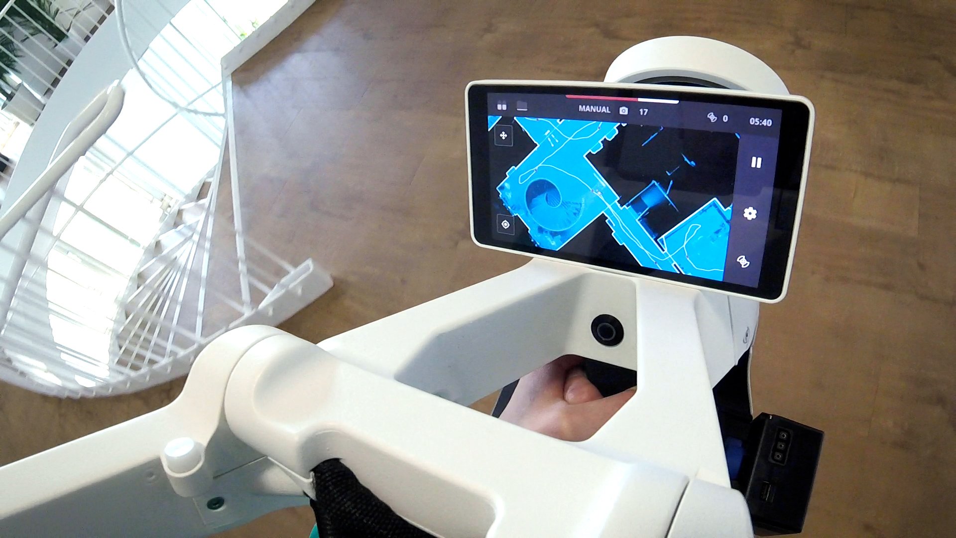
The important thing when mapping at this pace – especially without control points - is to plan your scan in advance. That includes ensuring all rooms are accessible and planning a good trajectory that includes loop closures. It’s also helpful to monitor your progress in real-time using the quality map to ensure nothing has been missed.
Assessing the accuracy of the point cloud
It’s not featured in this video, but the team at NavVis processed the whole dataset in the cloud in just over thirty minutes. They were able to upload it right away and got the scan as an e57 file plus a NavVis IVION web instance to let everyone access the scan, take measurements, or make annotations.
How do we judge on the quality of the accuracy? We already have an extensive scan of the same area using a TLS, with measurements verified with a total station. This is considered the ground truth. Taking registrations through ICP (iterative closest point) and comparing the deviations between the NavVis VLX point cloud and the TLS point cloud, one sigma of the points is within 6 mm.
Why is this so accurate? Because of our proprietary SLAM algorithm that’s continuously being refined and improved. And the way that we can probabilistically fuse the range measurements using sophisticated machine learning.
Referring to previous exercises like NavVis VLX vs TLS, in that case we considered a different application – scan-to-BIM where a point cloud would be used as the basis of a detailed BIM model – and set out to achieve the maximum quality. Plus, the scan was geo-registered via control points. That’s why the scanning time took a little longer.
Comparing the results against our speed test today, however, it’s plain to see that the accuracy has improved even further as a result of our software refinements.
Wrapping up
One last thing to note. This test was conducted with a first generation NavVis VLX featuring the latest system software updates. It’s entirely capable of delivering the same accurate results as is possible with a NavVis VLX 2nd generation - and will continue to do so long into the future.
Hungry for more details about the speed and accuracy of NavVis VLX? Check out our new white paper on the accuracy of mobile mapping devices in indoor and outdoor scenarios, or download a sample of point cloud data in .e57 format to evaluate the quality for yourself.
But hopefully now you won’t need to ask us how fast NavVis VLX is capable of scanning; that question has now been answered definitively.