

What makes NavVis VLX different from competing solutions? We caught up with Stefan Romberg, Head of Perception and Mapping at NavVis, to learn more.
Wearable mobile mapping systems offer a lot of enticing benefits for building documentation workflows. But when early solutions generated poor quality data, many professionals decided the technology wasn’t ready for day-to-day survey work.
NavVis intends to change their minds with the release of NavVis VLX. This wearable mobile mapper promises flexibility and speed while meeting the same high standards for data quality as NavVis M6, the company’s well-regarded system on wheels.
Aside from its unique form factor, what else makes NavVis VLX different from competing solutions? How can NavVis claim that its data meets the high accuracy and data-quality demands of laser scanning professionals? We caught up with Stefan Romberg, Head of Perception and Mapping at NavVis, to learn more.
A focus on accuracy
Romberg says the most important factor is that “the NavVis VLX design prioritizes accuracy above all other factors.” Though the device is flexible, compact, comfortable, and fast and easy to use, he stresses that NavVis took great pains to ensure that none of these benefits stand in the way of an accurate point cloud.
“This mission of producing high-accuracy point clouds was fully owned by every team during the development process,”he says. “You’ll see its effects in hardware design, workflow, and even software.”
“The NavVis VLX design prioritizes accuracy above all other factors.”
Hardware design
Let’s start with the device itself, which includes many small hardware details that add up to make it a more accurate scanner.
To illustrate, Romberg offers one example among many. “NavVis VLX collapses down to a compact, packable size by folding at a joint,” he says. “When designing this joint, the design and engineering team focused on factors like ease and fit with the rest of the device, but without compromising on solidity and rigidness.”
By doing this, he explains, the team ensured that the device remains steady and exhibits minimal flex when in use. This stabilizes the sensors during capture, which reduces error and helps produce higher quality point clouds.

Control point functionality
NavVis VLX offers a unique function for a mobile mapper without wheels: It can capture control points during the scan process to improve your accuracy. This function is usually not necessary for smaller captures but has proven very effective in large or complex assets where global accuracy presents a challenge for mobile mappers.
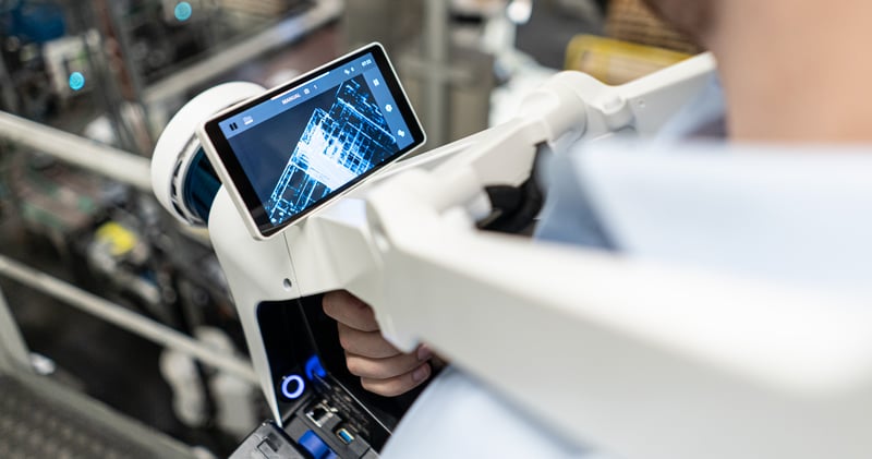
Romberg says this improves your data accuracy in two ways. First, it verifies data quality while you’re in the field. When you capture a target with the device, the tablet display will show difference between your scanner's coordinates and those of the control point. You can see whether something has gone wrong during capture and correct as needed.
Second, the control-point feature improves accuracy by reducing error accumulation in applications that challenge the SLAM technology in mobile mappers. Let’s say you’re scanning a long corridor and you want to do it with minimal drift. Place pre-surveyed targets at either end of the feature and tap the device to these targets as you pass. During the processing stage, NavVis' software will use them as reference and correct for errors in the point cloud to improve your absolute accuracy.
NOTE: If you need a quick primer on SLAM technology—also known as simultaneous localization and mapping—check out our explainer here. It includes a high-level explanation of how the technology works, how different environments can affect mobile scanning accuracy, and what you can do to ensure the best results.
SLAM computing
Even the NavVis VLX data processing scheme is designed to maximize accuracy.
Let’s start with some context. A SLAM mobile mapping device process the point cloud in a few ways. First, it can finalize the point cloud on the device itself during capture. Upside: The data is ready as soon as you’re done scanning. Downside: The processing hits a speed benchmark, not an accuracy benchmark.
“By running the number crunching with the highest quality settings, NavVis VLX generates a point cloud accurate enough to make any client happy.”
A SLAM device can also finalize the data after capture, either on the device itself or a more powerful desktop computer back in the office. Upside: The machine has more time (and often more power) to work with, so it produces a higher accuracy point cloud. Downside: It’s slower.
“NavVis VLX offers the best of both worlds,” says Romberg. While you scan, it uses on-device processing to give intuitive feedback on your progress, so you can ensure that your data is both dense and comprehensive.
Once you’re back in the office, it uses a more powerful desktop computer for final processing. “By running the number crunching with the highest quality settings,” he says, “NavVis VLX generates a point cloud accurate enough to make any client happy.”
Mature SLAM technology
It's not only the focus on accuracy in every aspect of hardware, software, and engineering design that makes the data of a high quality. It's also the company’s deep experience with SLAM.
Starting with its founding in 2013, Romberg explains, NavVis has honed its proprietary SLAM implementation. They tested the technology in controlled environments and listened to customer feedback. They learned the weaknesses of their SLAM and made each generation more accurate than the last.
"You can be certain the point cloud is an accurate reflection of the real world.”
This work paid off in 2018 with the release of NavVis M6. The device featured four laser scanners and the company’s first 3D SLAM with six degrees of freedom (6DoF). It solved many of the challenges plaguing SLAM-based mobile mapping since the technology’s early days, and finally achieved the accuracy required by surveyors. (Even when objects are in motion all around the device, for example pedestrians).
When the company began developing NavVis VLX, they pushed that 3D SLAM technology even further. They tweaked it to use two multi-layer laser sensors for a balance of small size, massive amount of scan data and very robust processing. They adapted it to account for every possible motion, in any direction. (“In theory, you could even hold it upside down,” Romberg jokes.”But we advise against it.”)
More simply: The SLAM powering NavVis VLX is highly robust—and this makes for more accurate point clouds. This claim has been proven through the evaluation of many professional users, and across a wide variety of applications.
Sophisticated point cloud processing
Accuracy is a crucial part of data quality – but it’s not the only part. That’s why the NavVis VLX uses sophisticated post-processing technologies to produce point clouds that are high quality by any metric.
To explain at a high level, Romberg says that NavVis' solutions run the data through a process they call point cloud fusion. It uses a series of filters to process and correct the point cloud, treating each point differently based on properties like angle, signal strength, and so on. The final data shows more detailed surfaces, more realistic textures and colors, and no "ghosts" from moving objects. It even exhibits higher accuracy than the laser sensors are spec'ed for.
“At the end of this fusion step, false measurements and errant points have been removed, and intelligent filters have reduced noise while retaining details. As a result, you can be certain the point cloud is an accurate reflection of the real world.”

A mission for data quality
There is no single technology or design detail that makes data from the NavVis VLX good enough for day-to-day survey. That data quality is the result of teams across the company spending years learning about various factors that affect data quality, factors like hardware design, SLAM implementation, software, and post-processing.
Romberg says that everything the company has learned in the field and the office over the past seven years went into the making of the NavVis VLX, and that’s what makes the data good enough to meet the demanding requirements of laser scanning professionals.
Sean Higgins is an independent technology writer, former trade publication editor, and outdoors enthusiast. He believes that clear, buzzword-free writing about 3D technologies is a public service.