How SurvTech Solutions rolled out the NavVis M6 Indoor Mobile Mapping System to capture 44,000 square feet of the Perfecto Garcia Cigar Factory in Florida.
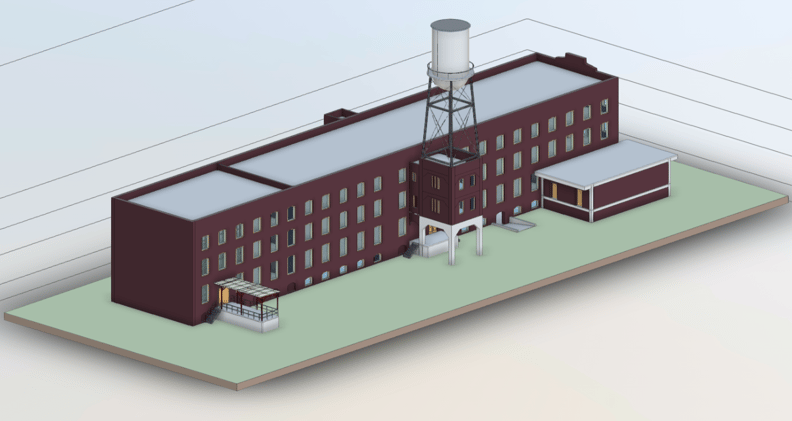
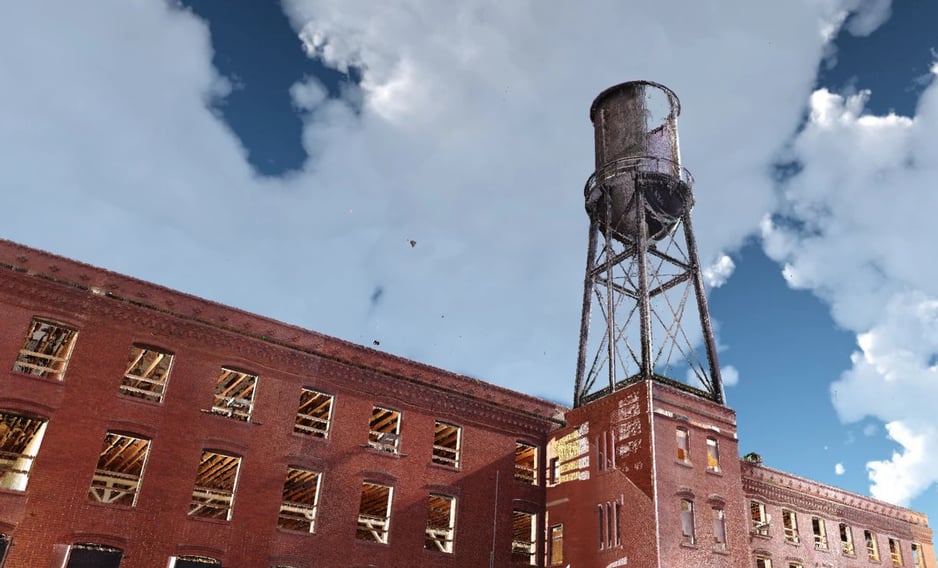
Located in the Sunshine State of Florida, the site of the old Perfecto Garcia & Brothers Cigar Factory is a 44,000 square foot brick building with three floors and a basement. It was built in 1914, and the company remained there for almost 70 years until it finally closed its doors in 1982.
The current owners of the building had commissioned a group of architects and engineers to design a new support structure to replace the old wooden beams and columns. Essential to the renovation would be to have the exact dimensions of the building and its existing structural components. But because of the building's age, there were no design or as-built documentation available to help the engineers and architects in their task.
"We are increasing our efficiency with a new style of mobile scanning specifically designed for larger indoor environments."
Enter SurvTech Solutions, the premier geospatial firm in the southeast United States. "SurvTech Solutions offers precision 3D data capture from airplanes, UAVs, boats, USV, automobiles, ATVs, and amphibious vehicles," explains founder and president, David O’Brien. "We can map above ground, underground, underwater, and inside plants and buildings."
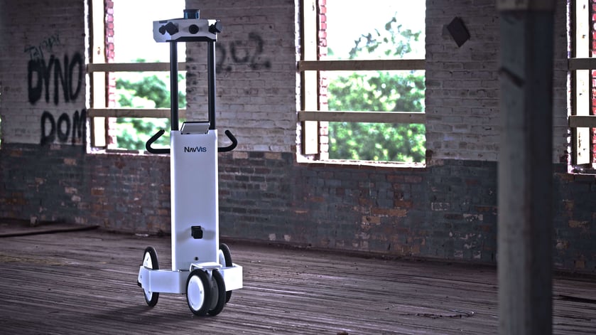
Given the opportunity to fully document the vacant building, SurvTech personnel knew immediately that the right mapping tool for the job was terrestrial LiDAR, or 3D scanning. They utilized a combination of scan data from their NavVis M6 Indoor Mobile Mapping System (IMMS) and a terrestrial laser scanner (TLS).
Historical building documentation in the 21st Century
“Recently, SurvTech Solutions added the NavVis M6 IMMS to our scanning toolbox, and this is great news for our clients,” David says. “Having provided indoor and outdoor 3D laser scanning services for over a decade, we are increasing our efficiency with a new style of mobile scanning specifically designed for larger indoor environments.”
3D scanning offers the user the ability to measure buildings and factories to within several millimeters of accuracy, by utilizing a laser to collect billions of measurements in 360° in all directions. The surrounding environment is captured in its exact size and shape through the accumulation of billions of points with x,y,z coordinates. The resulting point cloud can then be used to create a virtual recreation of its physical counterpart, often referred to as a "digital twin".
"Adding NavVis to our portfolio of 3D imaging technologies at SurvTech enables us to move beyond traditional laser scanning products to a true digital twin solution."
In addition to collecting 3D scanning data and 360° immersive imagery at walking speed, the NavVis system also includes a new way to manage and share data with NavVis IndoorViewer.
“Adding the NavVis system to our portfolio of 3D imaging technologies at SurvTech enables us to move beyond traditional laser scanning products to a true digital twin solution, which is distributed via NavVis IndoorViewer,” David says.
“While most scanning service providers can offer point clouds, web viewers and 3D models, the NavVis IndoorViewer extends these deliverables to a truly intelligent geospatial database that is linked to the client’s processes.”
Effortless Scan-to-BIM for building development
After scanning the site of the cigar factory, the data was taken back to the SurvTech office and processed to obtain a cohesive point cloud that's checked for accuracy. Next, they were able to provide two major services to their client.
“First, we can send it out to a company to do Building Information Modeling (BIM) that can be used for building development or engineering,” explains David. “Second, we can send them the registered point cloud in just about any 3D file format they require."
Downstream applications for the point cloud are numerous. Some use cases for NavVis IndoorViewer, for example, might be an architect or construction manager reviewing progress of a jobsite, or a facility manager giving a virtual walkthrough to a maintenance team on a web meeting.
“By capturing the site conditions up to 10x faster than terrestrial scanning methods, we’re eliminating much of the costs embedded in our client’s business.”
“By capturing the site conditions in survey-grade precision and 360° imagery up to 10x faster than terrestrial scanning methods,” David continues, “we’re effectively eliminating much of the communication and logistical costs embedded in our client’s business.”
On projects like the Perfecto Garcia Cigar Project, meanwhile, there's still a role for more than one type of laser scanner. To supplement the scans from NavVis M6, SurvTech utilized a TLS to capture external building features.
"One of SurvTech’s and NavVis’ strengths is the ability to combine point cloud data from numerous sources," David says. "Both scanners were used together to yield highly accurate and precise measurements of the Perfecto Garcia Cigar Factory."
Image credits: SurvTech Solutions