

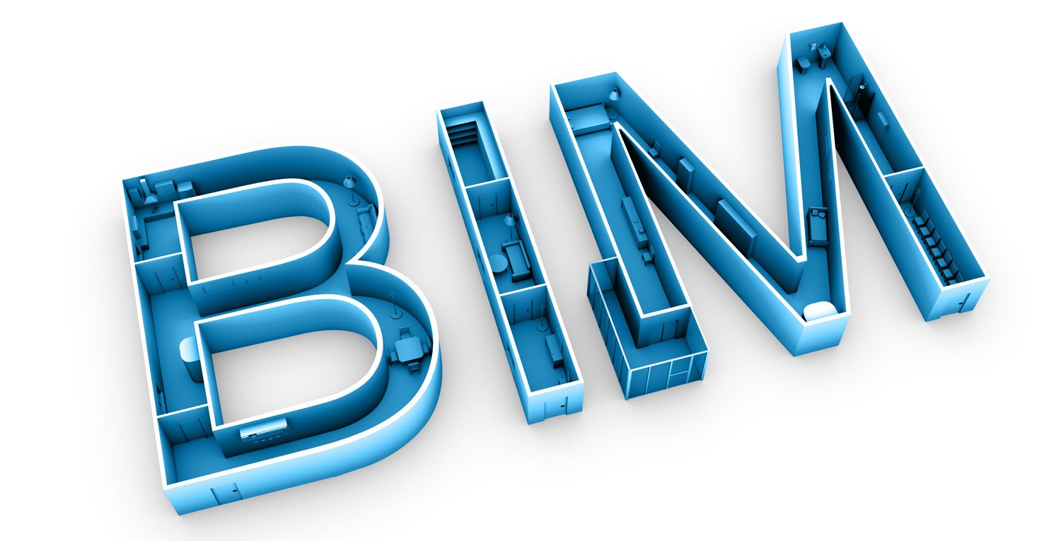
Scan-to-BIM is the process of documenting an existing building to allow for a digital planning methodology called Building Information Modeling (BIM).
3D laser scanners capture a high-density point cloud of a physical building, structure, or site, which is then used to create and maintain a BIM model that reflects "as-is" conditions.
Downstream applications for models made using scan-to-BIM can range from as-built documentation, project renovations and additions, or even facility management. Models made with scan-to-BIM are also tremendously useful for comparing against original plans, topographic registration, and more.
That's the basic summary. But for a complete definition of scan-to-BIM, we should take a few steps back and consider it in the broader context of BIM itself. And to do that, let's explore the practice of BIM today in the architecture, engineering, and construction (AEC) industries.
What is BIM?
According to The National BIM Standard Project Committee in the United States, the definition of building information modeling is as follows:
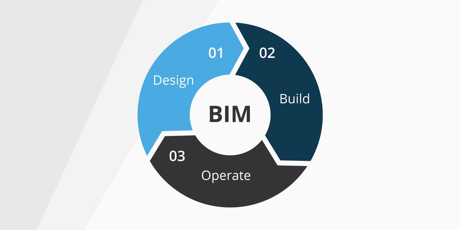
“Building Information Modeling (BIM) is a digital representation of physical and functional characteristics of a facility. A BIM is a shared knowledge resource for information about a facility forming a reliable basis for decisions during its life-cycle; defined as existing from earliest conception to demolition.”
In practice, BIM is a standardized planning method to create digital 3D models to be used by AEC professionals.A single BIM model can encompass an entire site, complete with physical and functional characteristics, all contained a single dataset
For example, a designer can create intelligent 3D models where all the design elements are clearly defined – including how they behave and relate to each other. If they alter just one single element in a model, such as a supporting pillar or doorway, every view of the model, from section to elevation to sheet updates accordingly.
But this power doesn't reside with just one isolated specialist. BIM is all about collaboration between multiple stakeholders at distinct phases of the building’s life cycle. Whether it's an architect, a surveyor, a building operator, or a general contractor, each stakeholder can insert, extract, update, or modify information in a BIM model as a natural extension of their role.
The value of BIM, therefore, is that all stakeholders can work together using carefully coordinated models, and everyone has a greater awareness of their contribution to the overall project. BIM provides them with the necessary information and means to plan, design, construct, and manage the built environment more effectively.
How does BIM relate to scan-to-BIM?
Demand is growing within the AEC industry for the implementation of BIM, and so is the demand for the creation of BIM schematics for existing buildings. Scan-to-BIM is quickly becoming an integral part of the BIM process.
Where a project involves a pre-existing structure or site (as it will in most cases), reality capture of as-built conditions can provide the model with the most critical information before a designer even gets to work.
To keep it simple, here is the summary: scan-to-BIM is the process of digitally capturing a physical space or site as laser scan data, which is then used for the creation, development, and maintenance of a BIM model.
From 3D laser scanners to point clouds to BIM models
Laser-scan data almost always takes the form of a point cloud. A point cloud is a set of data points within a three-dimensional coordinate system, positioned on the classical X, Y, and Z axes, which can represent the external surface of an object or interior environment.
3D laser scanning devices – for example, terrestrial laser scanners and mobile mapping systems – can take millions of measurements and collect information about the built environment. All this information is then processed and assembled into a virtual representation: a point cloud.
There are many different types of laser scanning devices on the market, featuring technologies such as LiDAR (Light Detection and Ranging) or SLAM (Simultaneous Localization and Mapping). These technologies provide the level of quality and accuracy necessary to generate point clouds for seamless integration with standard BIM processes.
Problems that scan-to-BIM can solve
If scan-to-BIM is the answer, then what is the question? What are the problems that scan-to-BIM is especially good at resolving?
Data collection requires careful planning and is time-consuming, even more so if the BIM model of an existing building needs to be regularly updated.
-
In the design phase, incomplete or unreliable information is used to create BIM models of existing buildings. As-built documentation is often outdated, fragmented, or both. An unlucky BIM modeler can waste much time meticulously piecing together data to create one cohesive BIM model which, even then, can't always be trusted. Errors in the model can have consequences because they could impact every other user of the model.
-
In the construction phase, collecting data to update and verify models is a challenging process. It can involve laborious tasks like physically visiting a location to take measurements and photographs. That leads to further logistical hurdles like arranging access to the site, the amount of time you're allowed to spend there, and the number of employees needed for the task. All this quickly eats up time, resources, and budget.
Using 3D scanning technology, AEC professionals can adopt a scan-to-BIM workflow with less effort. Scan-to-BIM deploys 3D laser scanners on-site to build a precise point cloud dataset and model, operating at speed and scale according to the needs of the job.
Benefits of a scan-to-BIM workflow
Let’s look at some examples of the benefits of adopting a scan-to-BIM workflow.
The most obvious: you will have fewer errors when planning renovations or extensions for buildings that don't have existing structural and design documentation in a digital format. We touched upon this topic when discussing the data collection phase above. Reliable floorplans in a modern, standardized format are now easier to obtain.
Next, scan-to-BIM provides quality assurance by allowing you to compare progress to planning at every stage of a project; inspections can take place off-site more frequently than on-site, reducing the need for travel with no impact on the quality of the assessment.
When embarking on new construction projects in challenging locations near pre-existing buildings, a scan-to-BIM workflow can also provide tremendous value. Structures in the vicinity, for example, can be protected from damage using complete and up-to-date schematics of the utility works, which can help you identify potential problems before they arise.
Also, consider that asset and facility managers of older properties can take advantage of efficiency improvements that BIM already delivers to modern buildings. They can reduce their carbon footprint by pinpointing where better insulation could be added, for instance. Plus, reporting faults for ongoing maintenance becomes more precise.
Wrapping up
Scan-to-BIM is a major component of the BIM process, and its growth is directly proportional to the uptake of BIM in construction and building maintenance overall.
Another factor is the increasing accessibility and usability of point cloud technology, which reduces barriers to entry for AEC professionals considering scan-to-BIM.
Stakeholders at all levels of a project – surveyors, project managers, building teams, engineers, and interior designers and architects – can confidently collaborate and benefit from scan-to-BIM, the same as they would with BIM itself.
For a high-level view of the end-to-end process in a standard scan-to-BIM project, you might be interested in reading another post in our series: 12 steps to bring an existing building into BIM.
In the meantime, you can also download our complimentary resource on using mobile mapping for CAD and BIM as-built documentation.
Originally published May 5th, 2020 9:00:00 AM, updated February 24th, 2022