

The first in of a series of articles about mobile mapping for experienced laser scanning professionals looking to make the jump to this new technology.
In its short life, the market for 3D as-built documentation technology has seen considerable innovation. Among the myriad new tools to hit this market, nothing has changed the way we capture buildings as much as mobile mapping devices.
This is the first part of a series of articles about mobile mapping for experienced laser scanning professionals looking to make the jump to this new technology. In this installment, we'll explain what a mobile mapper is, talk about how it’s different from a terrestrial laser scanner, and explore the technology that makes these tools possible.
In future installments, we’ll explore and demonstrate the benefits of these tools for as-built workflows, and then talk about the ways these benefits can transform your business and improve your competitive edge.
What is a mobile mapper?
At its simplest level, a mobile mapping device is a laser scanner designed specifically for capturing buildings.
These systems combine a variety of sophisticated hardware sensors and software technologies to take the system off of the tripod, enabling you to capture accurate 3D data as you walk. By doing this, mobile mappers offer laser scanning professionals a faster, more flexible method for documenting large assets and complex environments like factories, work sites, or offices.
Compared to other laser scanning technologies, mobile mapping devices are relatively new, having hit the market only about a decade ago. Though early mobile mappers faced technological challenges that tended to degrade the quality of the data – causing justifiable reluctance about reliability for day-to-day survey work — mobile mapping devices have matured a great deal in recent years.
Today’s best mobile mappers are capable of producing high-quality data suitable for a wide variety of tasks like Building Information Modeling (BIM) and floor plan generation.
The hardware
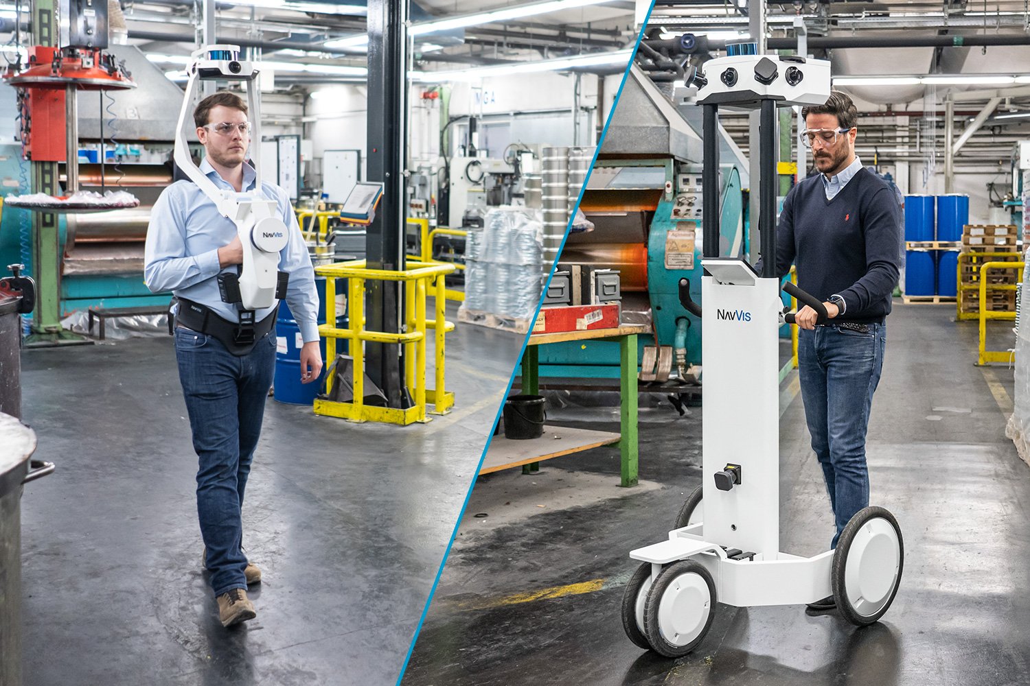
Mobile mapping devices can take a variety of form factors and sizes. On the market today, you’ll find trolley-based scanners that the operator pushes, portable scanners designed to be worn like a harness, all the way down to systems small enough to hold in your hand.
Regardless of shape and size, most mobile mappers have a similar payload of sensors. Generally, a system includes one or more lidar sensors. These sensors might be used for capturing point clouds or feeding the SLAM algorithm.
Each mobile mapping device also carries an inertial measurement unit (IMU), which the system uses to determine how it is positioned in 3D space. You can think of the IMU as a professional version of the accelerometer in your smartphone.
Most mobile systems also have one or more panoramic RGB cameras. The configuration of cameras on each scanner depends on the manufacturer, and the intended application of the scanner. A system optimized for generating digital twins, for instance, will often include more cameras, and capture at a higher resolution to produce more realistic looking 3D data sets.
The software
As you scan, these sensors generate a huge amount of data, which the system feeds to an on-board computer running a sophisticated processing algorithm. This algorithm, called simultaneous localization and mapping (SLAM), fuses the different kinds of sensor data to track your trajectory as you move and record the 3D map of the environment.
It’s worth noting that the SLAM algorithm is the most important difference between mobile mappers on the market today. Each manufacturer uses their own proprietary SLAM algorithm to process the huge amount of data generated by the sensors into a clean, final point cloud. And each approaches this extremely complex task in a different way—meaning the differences in accuracy data quality can be quite large.
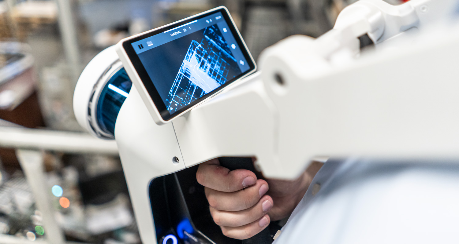
Virtually every mobile mapper includes a tablet interface. This tablet runs the software for controlling the mapping device, accessing and exporting previously recorded data, and performing certain processing steps.
The most valuable function of the tablet, however, is the real-time preview, which displays your mapping trajectory as you walk and gives you visual feedback on the progress of your scan.
Lastly, a mobile mapping system includes a dedicated desktop or browser-based application for final processing, management, and sharing of the scan data. These applications can be more or less powerful and functional, depending on the manufacturer.
Wrapping up
A mobile mapper is a laser scanner designed for building capture. It integrates a complex system of sophisticated hardware and software to enable the operator to scan as they walk—streamlining the capture workflow for offices, factories, and other facilities, while still providing 3D data that users can count on for survey tasks.
In our next article, we’ll get deeper into how mobile mappers can benefit your as-built documentation projects. In the meantime, you can also download our complimentary resource for evaluating the accuracy of a wearable mapping system.

Sean Higgins is an independent technology writer, former trade publication editor, and outdoors enthusiast. He believes that clear, buzzword-free writing about 3D technologies is a public service.