

A construction project often presents property planners with a variety of challenges that should not be underestimated. For example, loss of information during project handover can complicate subsequent planning and lead to enormous delays in the actual construction. To remedy this problem, the planning company ABP (Assmann Beraten + Planen GmbH) relies on things such as mobile mapping technologies and as-built models. This is the case for one of its current projects: the extension of Terminal 1 at Munich Airport.
At the end of 2020, ABP was awarded the contract to continue the development of the 90,000 m2 area, and in 2021, it was also awarded the contract to continue planning the technical equipment. The ABP team decided to invest in construction support measures in the form of an as-built model to ensure a smooth continuation of work for the technical equipment and carried out a test scan with NavVis VLX.
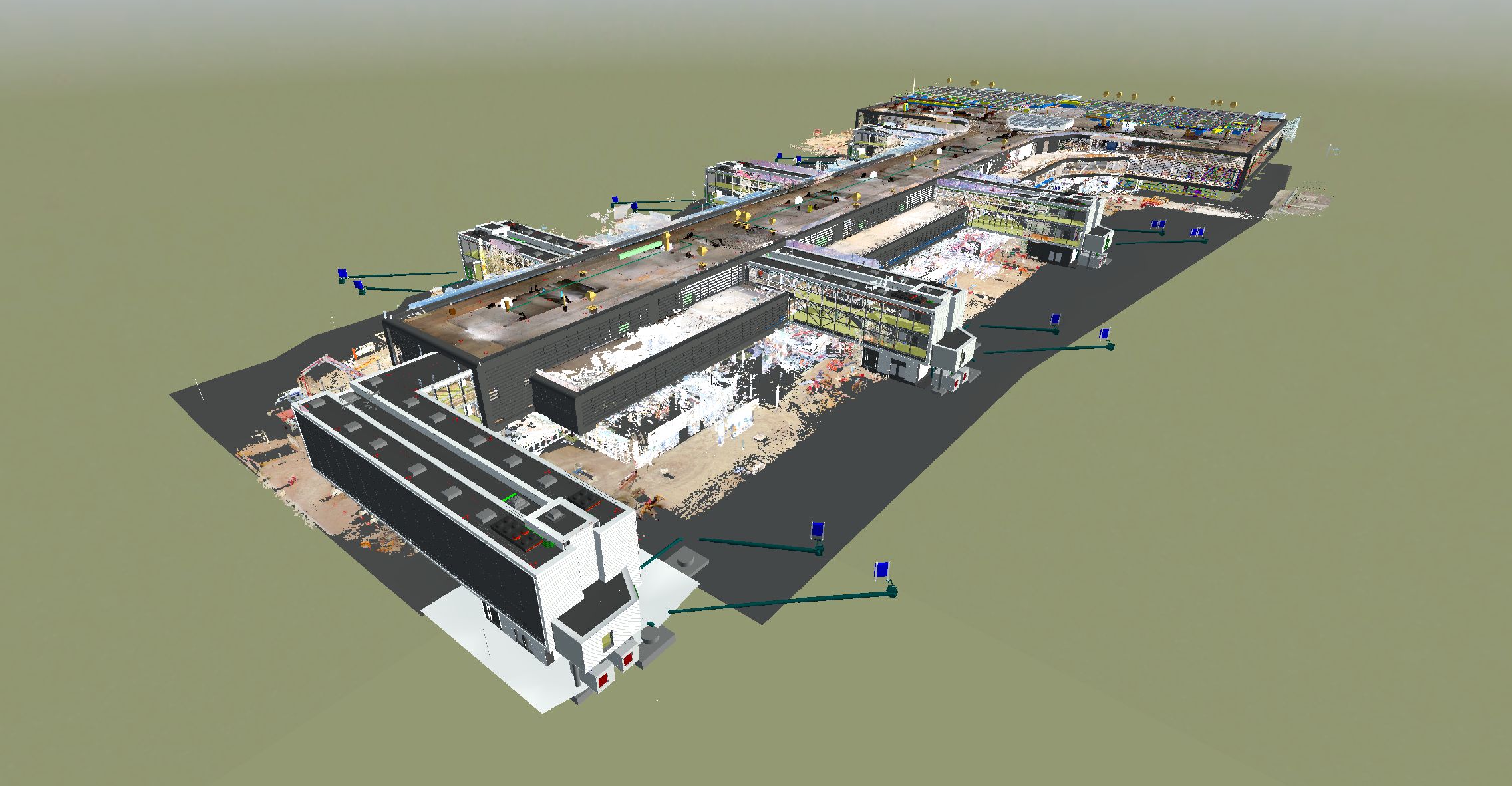
After using the mobile mapping system to scan the first level of the terminal expansion during construction, the captured data was then processed and merged into a final point cloud in NavVis IVION. NavVis IVION is an intuitive 3D platform that allows all stakeholders to access and interact with the resulting 3D model, for example, in the form of virtual measurements.
This not only enabled efficient planning of future construction measures but also helped avoid cost-intensive planning errors and the associated disruptions on the construction site. The team saw such an enormous value-add of the as-built model for construction planning that three additional levels were documented and made digitally available in spring 2022.
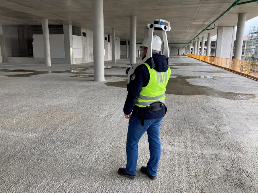
Markus Seitle, an employee in the area of Technology, Data Management, and Geoinformation, was enthusiastic about NavVis' mobile mapping technology: "NavVis VLX, which has already been in use at Munich Airport since 2020, has proven to be an ideal tool for comprehensive construction site documentation." He said the device is particularly suitable for recording large areas without any disruption or interruption to the construction process.
"The accuracy is absolutely sufficient for this purpose, and the point cloud is impressive, with a very high level of detail," Seitle continues. The ease of use and the fast and intuitive processing of the data also convinced Seitle, adding that NavVis mobile mapping technology will be used for further scans throughout the course of the project.
Although the planning project was set up conventionally, under the leadership of ABP and BIM management partner Werner Fülöp (CEO of 4PROJECT), it continued to develop towards digital planning and digital twins. Integrating the point cloud into Revizto, the model checker already used by ABP also posed no issues.
So far, the digital twin of the terminal has proven to be particularly useful for the following use cases:
- Verifying the actual number, size, and position of openings and perforations
- Inspecting structural tolerances
- Monitoring existing technical equipment installations
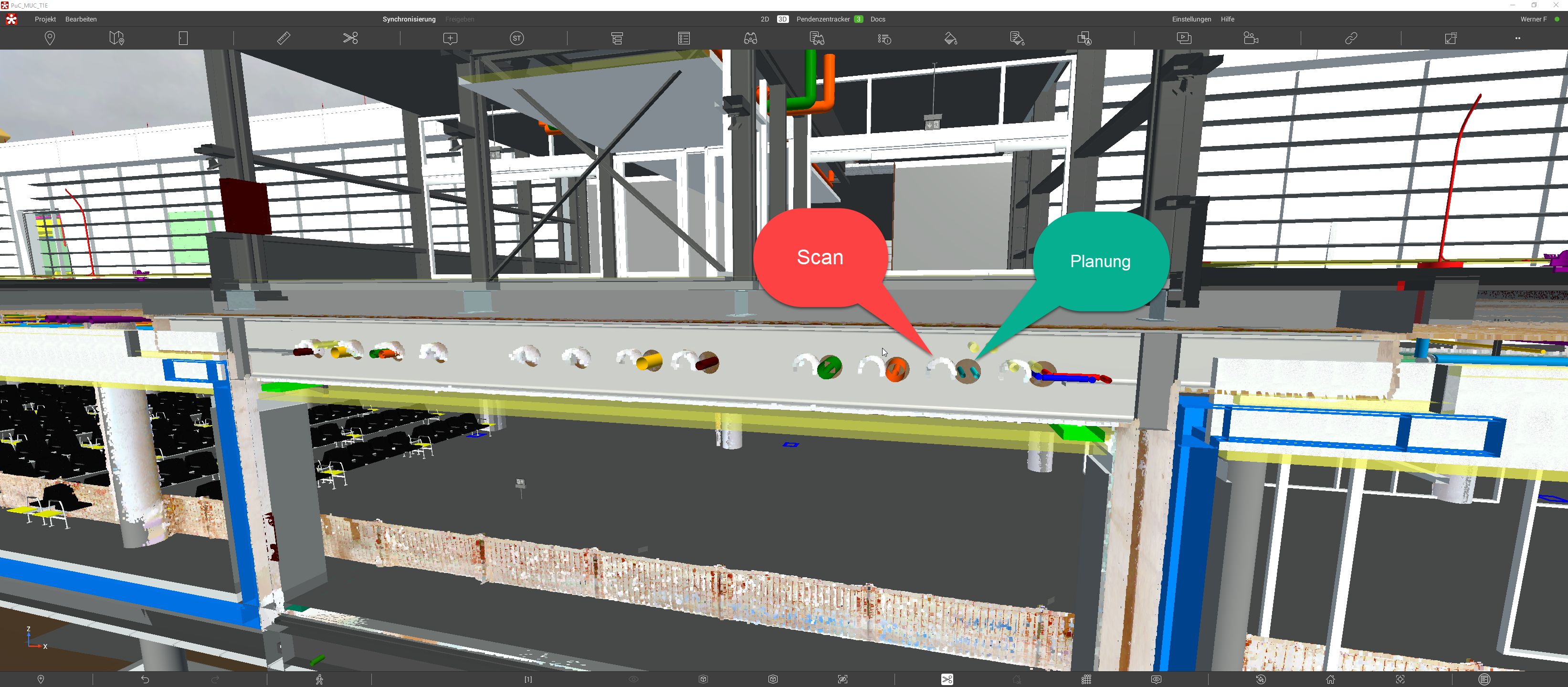
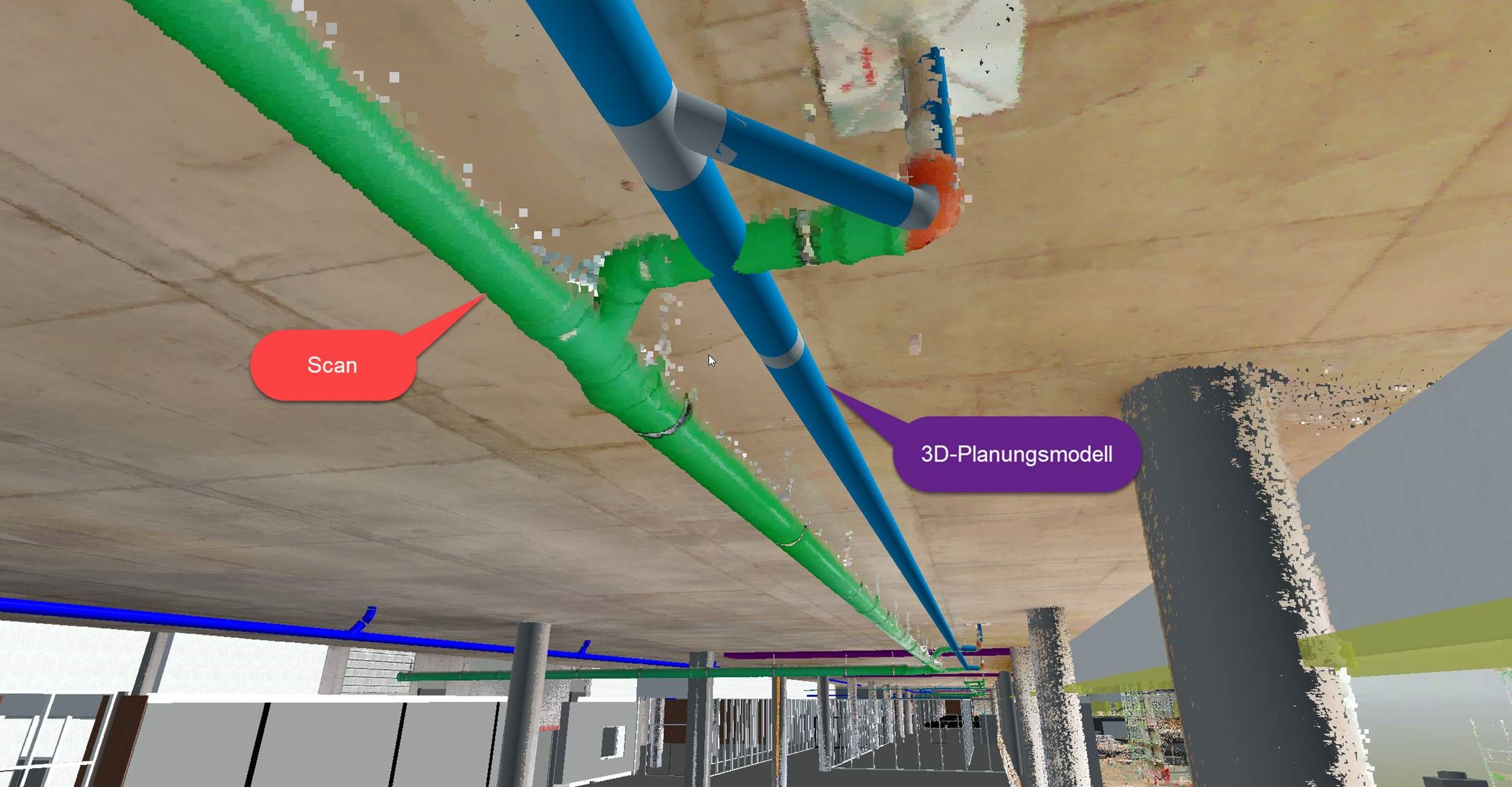
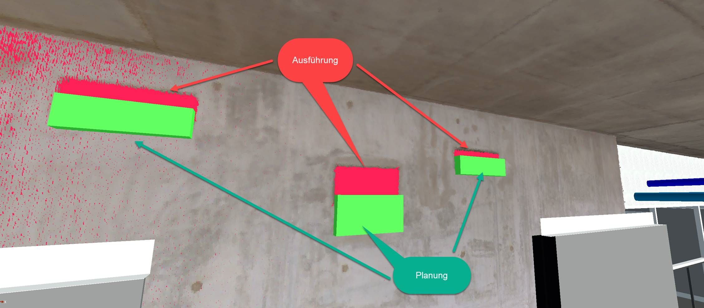
Example of a discrepancy between the planning and the actual state of the construction site
The knowledge gained from the comparison of the actual state with the planning model of the construction site was then transferred to ABP's planning documentation and models. According to Werner Fülöp of 4PROJECT, this made it possible to create a "single source of truth", i.e. a reliable, central source for all relevant information.
Based on the positive experience with the mobile mapping technology and the implementation of digital twin models, level two of the airport terminal extension will also be scanned, and a digital twin will be created. In service phase 8, i.e., in building or construction supervision, it'd be possible to link the digital twins with augmented reality applications to further leverage the range of capabilities.