
.jpeg?width=300&name=_DSC9932%20(1).jpeg)
Members of the NavVis D&E team talk about the design of NavVis VLX, and how it was precisely engineered to perform better in everyday surveying tasks.
When portable indoor mobile mapping devices hit the market around 2015, they promised unprecedented speed and flexibility for building documentation workflows.
But early products faced a variety of technical challenges that limited their usability for day-to-day survey applications, as well as quality of the data that they could produce. This gave the technology a mixed reputation among laser scanning professionals.
Starting in 2017, NavVis began designing a new kind of wearable mobile mapping device. They started from scratch to develop a tool that captures the highest quality data, in the widest variety of applications, with a minimum of effort from the operator. The result is NavVis VLX.

We caught up with members of the Design and Engineering team at NavVis to learn more about the design of this tool, and how it was engineered to better perform in day-to-day survey tasks.
The right form factor
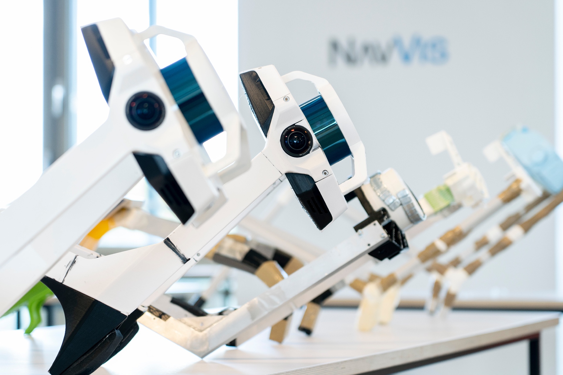
As NavVis industrial designers Sarah Godoj and Nils Christensen explain, the team considered all possible form factors. They saw that portable indoor mobile mapping systems on the market took one of two forms: a backpack or a handheld device. And each option had pros and cons.
A handheld scanner is the most flexible and compact but includes the smallest sensor payload. This usually means lower quality data. A backpack scanner includes more sensors and often produces higher quality data. But these devices tend to be large and heavy, and difficult (or impossible) to navigate into tight spots.
"I would say it’s the world’s first shape like this."
Since both options presented unacceptable tradeoffs for day-to-day scanning tasks, the team developed a novel design that offers the best of both worlds.
NavVis VLX is a compact, wearable system that includes all the sensors necessary to maximize data quality, including two Velodyne VLP-16 lidar sensors, four 20 MP RGB cameras, and professional-grade IMU. The device is also light (weighing in at only 9.3 kg), comfortable, and flexible enough for real fieldwork.
“I would say it’s the world’s first shape like this,” says Christensen.
-1.jpg?width=800&name=_DSC0334%20(1)-1.jpg)
Good ergonomics
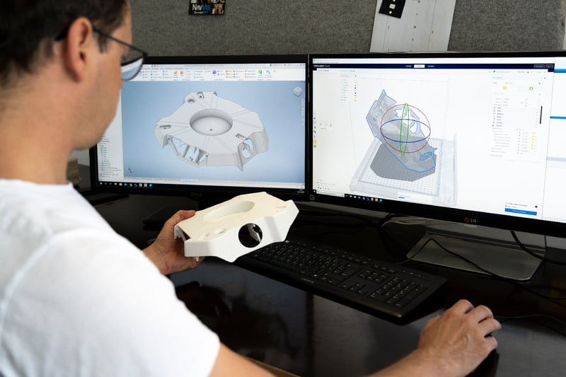
The D&E team knew that NavVis VLX needed to include a certain number of sensors. But they didn’t want the data quality to come at the expense of ergonomic comfort in the field.
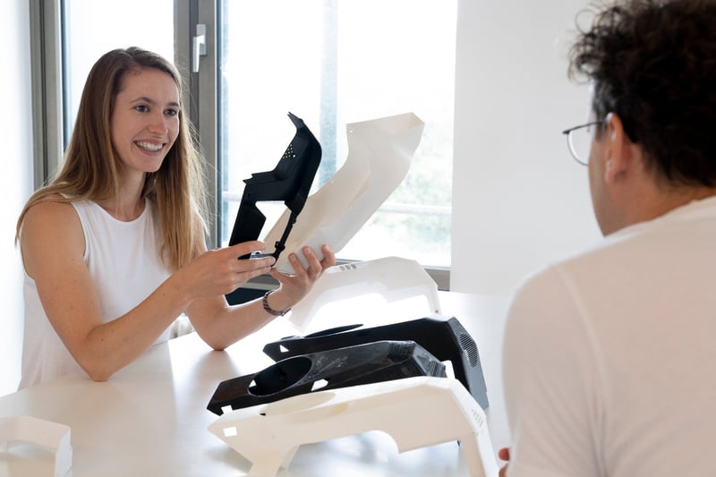
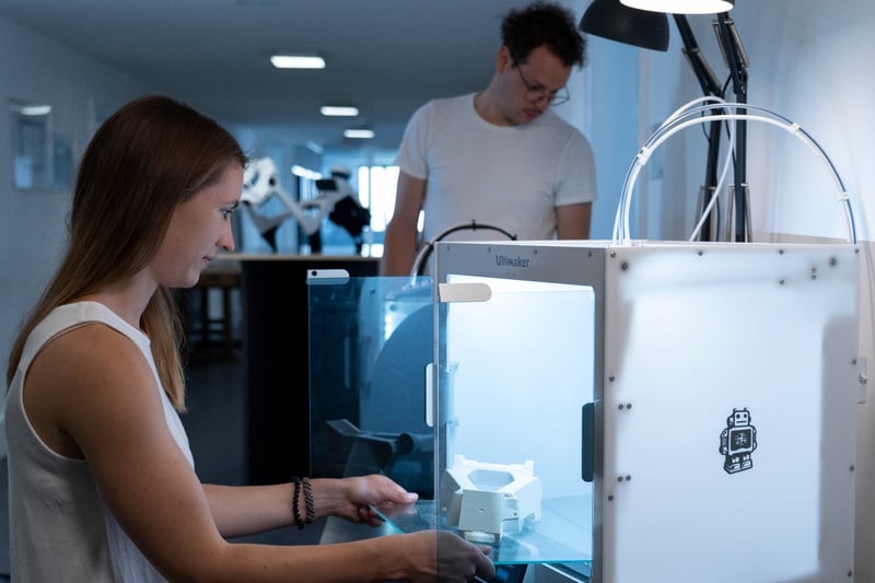
“Since you wear the device,” says Godoj, “we had to be sure it fit the human body. So we used 3D printing and made a lot of iterations. We tried different ideas to get a good combination of size, weight, and fit.”
The first place you’ll see the effects of their careful work is the absence of shoulder straps. NavVis VLX includes innovative padded hooks, which offer superior comfort for a wider variety of people.
"You can go hiking with the device if you want – it should be as comfortable as your backpack.”
The next place you’ll see the attention to ergonomics is the hip belt, which distributes weight more evenly than shoulder supports alone. This feature was added after extensive user testing, where the Design and Engineering team attached a range of weights – e.g., two-liter water bottles – to the device to simulate the weight of a sensor payload.
“Some people felt like it was super uncomfortable,” Christensen says. “So we decided we had to do something and added the hip belt. Now you can go hiking with the device if you want – it should be as comfortable as your backpack.”
Easy maneuverability
Both designers say they constructed NavVis VLX to offer flexibility for capture in the field.
To achieve this, they developed a clever hinge system. As Godoj explains, you can swing the device out in front of you while fully supporting the weight on the hip belt. You can move the device freely in space as needed, for instance to capture a tight spot—just as you would with a handheld scanner.
Painless panoramas
One of the most important design criteria for NavVis VLX was to allow for simple capture of full 360° panoramic images. Since a large (and growing) number of laser scanning professionals use panoramas to generate immersive walkthroughs on building documentation projects, this point was crucial.
As Godoj explains, the D&E team kept this goal in mind from the very beginning of the development process. “We asked ourselves – What are the sensors we want to use, and how do we place them for the best performance?”
"What are the sensors we want to use, and how do we place them for the best performance?”
As the team knew, the problem with many mobile mappers is that they often place the RGB cameras so that the operator can’t keep themselves out of the field of view. They obscure important data when the operator tries to capture a panorama.
NavVis VLX sidesteps this problem by positioning the four 20 MP cameras above the head of the operator, looking out. It achieves full 360° coverage in its panoramas, while excluding you from the capture. Simply press a button, and you’ve captured a full, unobstructed image.
Effortless full coverage
NavVis VLX’s clever sensor placement helps meet another very important goal for the device. It ensures that operators get full point cloud coverage on site without any special attention to how they hold the device.
Some systems place their sensors in such a way that they require holding the device at odd angles, performing sweeps, or even revisiting features during the scanning process to ensure full coverage.
Christensen says NavVis VLX solves this issue by placing one of its Velodyne VLP-16 lidar over your head, and the other in a vertical position out in front. This means effortless coverage both in the front and back of the device while you scan.
Better control in the field
The placement of the sensors on NavVis VLX has one more noteworthy benefit: control and confidence in navigation.
“We specifically decided not to put the sensors in the back,” says Christensen, “because we want you to see everything when you’re walking around in narrow environments.”
"We want you to see everything when you’re walking around in narrow environments.”
By placing the sensors overhead, NavVis VLX gives you a clear view of your lidar scanners and cameras as you move through difficult spots. That means, for instance, if you are moving through a packed MEP room, you’ll be able to keep an eye on how much clearance the device has and move accordingly to protect your investment.
More than the sum of its parts
Given the D&E team's attention to detail, it won’t surprise you to learn that they made a lot more smart choices during the development process (many more than we have space for here).
A few examples beyond what we’ve covered above: Godoj and Christensen iterated the placement of the handles and display for safety, comfort, and easy control of the device. They used hot-swappable batteries to maximize scan time. And they made the device compact and foldable, so that it can be collapsed down to fit into a standard piece of luggage.
Every detail of NavVis VLX has been considered to help you do your job. It has been designed so you can perform day-to-day survey work without getting tripped up by idiosyncrasies, quirks, and functional shortfalls. So you can gather the data your business relies on.
Sean Higgins is an independent technology writer, former trade publication editor, and outdoors enthusiast. He believes that clear, buzzword-free writing about 3D technologies is a public service.