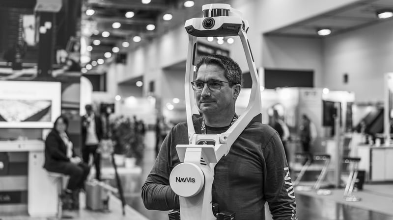
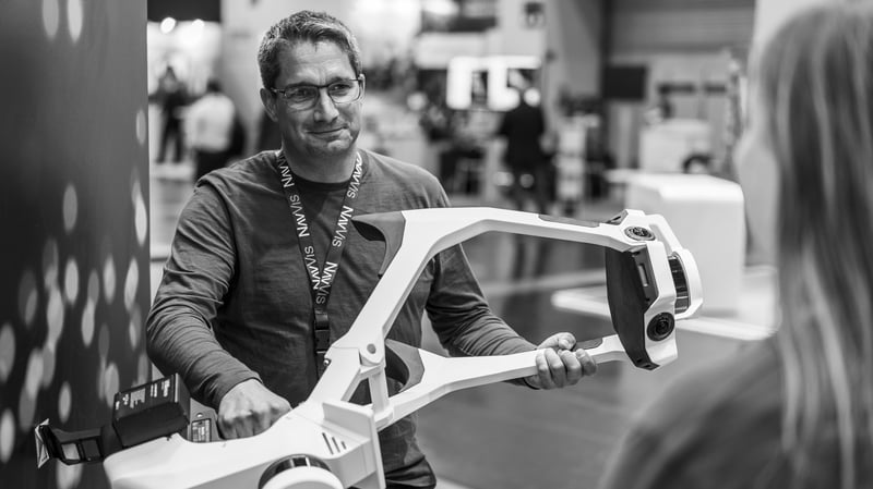
Learn how Harald Saeger, Senior Account Executive and man of many hidden talents, has turned his life-long passion of surveying into an impressive career.
Q: Tell us a little bit about your background and how you got to where you are today.
My father was a publicly appointed surveyor in North-Rhine Westphalia, Germany, so surveying has always been a pretty big part of my life. In fact, my parents ran a small surveying business with two teams of surveyors. I often tagged along with my father on his field assignments, theodolite, level, and all. Still I decided to go for a military career after finishing school. But it didn’t take long for me to realize that this wasn’t my path forward and remembering my roots, I enrolled in university in Bonn, Germany, to study geodesy. After successfully completing an apprenticeship as a surveyor, I decided to return to studying. I ended up graduating with a post-graduate degree in geodesy from the university of Bochum in 2003, where I also worked as an academic assistant for some time.
After graduation I managed to secure a position as a sales engineer with Leica Geosystems selling 3D laser scanning devices. I still remember well what got me the job back then (besides my technical expertise from my training and studies of course): My ability to explain complicated issues in a simple and straightforward manner, something that still distinguishes me today.
In addition to Leica Geosystems, I gained further experience at Zoller and Fröhlich for two years and joined NavVis in January 2021.
Funnily enough, I will already be celebrating my 20th anniversary in the field of 3D laser scanning the same exact year that NavVis will celebrate its 10th anniversary. Time really does fly when you’re having fun!
Q: You previously worked in the laser scanning industry. How do you think your background contributes to your daily work at NavVis?
In the early days of 3D laser scanning, few geodesists, let alone commercial companies, knew what a point cloud was, much less what could be done with it. There were times when my colleagues and I spent days discussing how many scanner positions could possibly be loaded into a software application. 50? 200? Or even more? We didn't know, so one day we just went for it and tried it ourselves; talk about trial and error! Sometimes the results were useful and sometimes not so much, but there was no stopping this development.
The same was also true for a wide variety of applications. Until now, hardly anyone had any experience with this novel technology called laser scanning. And again, we went through a lot of trial and error. I still remember doing underground scans at a depth of 1,600 m, crime scene scans, scanning a pig's liver for a university research project, scans of historical cellar vaults, where I sometimes had to scan upside down, to the increasingly normal applications in buildings or infrastructure projects.
Regarding today's challenges, my experience in a wide range of projects and industries helps me insofar as it enables me to evaluate the use of our NavVis VLX very accurately, just like my colleagues. We can provide our prospects and customers with a quick and informed demonstration of the applications for which the NavVis VLX is the best fit.
In particular, my extensive experience with stationary scanning systems helps me calculate the return on investment of the NavVis system very accurately. Typically, in certain projects, the NavVis VLX sensor is five to ten times faster than traditional stationary scanners, and that’s just regarding data capture. I'm not even taking into account the additional benefits of cloud processing and low to non-existent registration overhead. Doing sample calculations for our customers, I discovered that the savings in regard to time savings during data collection alone justify an investment in the NavVis VLX.
Q: How has working at NavVis challenged you to further improve on previous experience?
We are all learning every day. That is also true for me, of course. Nevertheless, I have to say that, from a technical point of view, I got to grips with the basic principles of mobile mapping very quickly. After having completed a few projects with the support of my colleagues to practice the implementation of this technology in theory and practice, it's become a no-brainer for me. Capturing the data is straightforward and processing and providing the data in NavVis IVION is, for the most part, fully automated.
Still, it was hard for me personally, especially as a surveyor and thus "doomed" to always aim for absolute accuracy (and I say that now tongue in cheek, but do ask my wife for details ...), to get away from the "millimeter thinking" in the beginning. For years, scanning has been about how fast a scanner is, what resolution it has, and what range and 3D point accuracy it can deliver. I grew up with these values, facts and figures, so to speak, and I had to make this shift and learn to also look more closely at what the specific use case requires and not just cling onto specs and numbers.
After all, it is certainly possible to complete almost all projects with stationary scanners. That’s the way it’s always been for a lot of customers, too. My job is to determine for our customers and interested parties whether these projects can be completed much more economically using NavVis technology.
Over the years, scanning has established itself as a "must-have" technology for certain applications, at least that’s how I see it. This means that the requirements of most applications, at least those that are familiar and commonplace, can be defined very precisely. Thus, it is clear to all parties involved which result has to be delivered in which quality and in which time frame, and sometimes this is where old ways of thinking have to be broken up and new ways of thinking need to be explored.
Let's take 2D as-built plans or even 3D models up to LOD200-300, certainly still one of the most common applications for 3D laser scanning. It is precisely in this field that projects keep increasing in terms of area that needs to be scanned. In this case, using a NavVis VLX makes sense in any case and is many times faster than using stationary scanners. And time, as we all know, is one of the most valuable commodities we have as humans, and therefore also as companies.
Personally, I had to come to the realization that we at NavVis certainly don't have the most accurate or, in terms of points per second, the fastest 3D laser scanner on the market. But what we do provide is by far the best overall solution for most everyday applications. But, as I said before - we all learn something new every day, and I am always happy to convince interested parties of exactly these facts.
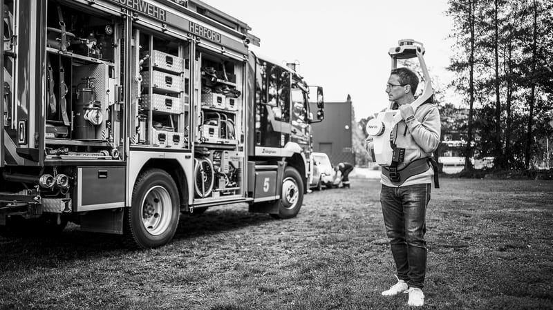
Q: Can you tell us about your work with the German Red Cross?
The Red Cross was still missing a scan as a basis for modeling an ambulance. We then carried out this requested scan in Herford and, as we had finished it very quickly, we took this opportunity to also scan the entire carriage hall.
NavVis für das DRK im Kreis Herford an der Leitstelle + Feuerwehrzentrale in Hiddenhausen - YouTube
Another project was supporting an international weekend seminar, again with a focus on VR technology. Here, the Red Cross simulated various accident scenarios in impressive detail, which we then mapped with the NavVis VLX. The data is now available to the Red Cross for providing virtual trainings to new employees. It never ceases to amaze me what incredible opportunities VR technology offers and how ingeniously it can be supported by laser scanning technology. It is exciting to see how rapidly this development is progressing.
Q: Is there anyone you rely on to get things done?
In our DACH North Team we work together very closely, even though we are spread all over Germany. We take advantage of all sorts of channels to exchange information digitally, including within the entire DACH region. We meet here virtually at least twice a week.
I particularly like the fact that it is part of the general NavVis philosophy to maintain a lively exchange between the departments. This way, I always know who to go to if I have a specific question. Accordingly, it goes without saying that not only I, but inversely also my colleagues, are happy to provide answers and guidance.
Q: What motivates you to get up every day?
Since my early beginnings in a traditional surveyor's office, through university, to working in the 3D laser scanning industry, I have always been fascinated by new technologies and their possibilities, which seem to be increasing every day. When I first came into contact with a laser scanner while I was still a student, I could hardly believe my eyes.
So far, I had only ever encountered standard surveying tools, which may still have their place for certain applications, but suddenly, a whole new world has opened up. I put a box somewhere, it makes some noise and light, and as if by magic, a cloud of dots depicting the environment appears on my computer screen. Isn't that incredible?
I wanted to know more about that and since then, together with my colleagues, I have tried numerous things over many years. What can be scanned? How far can you scan? What is the minimum resolution that can be achieved, and what is the accuracy to be achieved? Will the scanner also work in my sauna?
"I am convinced that with NavVis technology there is still a myriad of applications that I have not yet discovered, and every day I look forward to discovering what else is possible. To me, NavVis is the epitome of next-level scanning."
Q: What is something that might surprise us about you?
A long time ago, I spent a good eight years volunteering a lot of my time as a board member, director, and coach of a kids’ circus. Naturally, I enjoyed working with these kids and teens the most, focusing on juggling and unicycling.
In some cases, I organized up to seven practice groups, 130 children and young people, 25 trainers, and several events each year with sometimes hundreds of spectators, together with fellow volunteers. For this purpose, we bought and set up the necessary technical equipment, acquired some props, took care of the finances as well as the well-being of the small artists (as well as their small aches and pains when something went wrong).
That was a brilliant time in my life, and I still salute every volunteer. I can only recommend everyone to volunteer in their respective communities, often times you get more out of it than you give.
Today, I am very happy to promote a technology that borders on magic, for all intents and purposes.
Do you want to join Harald in a flexible, dynamic, inspiring work environment? Check out our open positions, we are hiring across all departments!