


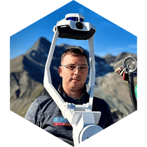
Our customers' success is our success
NavVis is dedicated to your success, going beyond simply providing solutions. Explore the real-life stories of customers and experts who have used NavVis technology to overcome challenges, create value, and reach their goals.
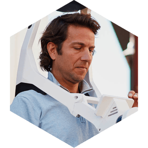
What our customers say

“We've gone through different methodologies over the years and as the technology has grown. Now, with NavVis VLX, we can race through different floor plates, sizes of buildings, and complexities without really worrying too much. NavVis VLX will handle most circumstances. So we've had a lot of success with that, and we've quickly ramped up. We now have 4 NavVis VLX in operation every day, 5 hours a day. Those scanners run and produce around 1 to 1.5 million square feet of as-built capture per week. ”

"We were looking for a solution for scanning as-built conditions in a faster process, and we found NavVis VLX to be extremely fast. We're saving 75% of our time on capture, and we're getting a point cloud out of that that's processed and used to either evaluate against an existing conditions model or to produce an existing conditions model. That accuracy is perfect, actually more than enough for what we're doing, so that whole process streamlining for us has been a huge cost saver."
"Using NavVis VLX, Asset Survey Solutions were able to reduce time on the road from four days (traditional survey done with a total station and GPS) down to four hours of total scanning time, representing a reduction of 87.5% in time spent in a hazardous environment. Along with these huge benefits in safety and efficiency, Asset Survey benefited from an infinitely more in-depth condition survey that can be used to settle any disputes once the project is handed over."

"One of the first benefits is that we’re able to do big projects faster. With mobile mapping, we can travel to a site and spend one or two days instead of four or five — and that’s helping us with one issue in the industry that everyone knows about: lack of resources. Everyone’s trying to hire laser scanning professionals, and there’s a lack of people. So, we look at tools like this as efficiency gainers. We’re able to do more with what we have by buying a new tool rather than hiring another person."

"For boundary and topography, it really is an excellent option. Our crews are able to spend more time on boundary and less time on topo. We can collect all of the topo information with NavVis VLX and then survey it from the office, that's an amazing advantage to us. We are able to survey larger amounts of information quickly."

"The Cloud Processing Add-on for NavVis IVION has really paved the way to better efficiency. We can process a multitude of scans at the same time. We can dump an entire terabyte of data, come back the next morning, and we’ve got our Lego pieces. Then we can go back and assemble them. It’s been a complete game-changer. It’s helping our small team to address the needs of our 1400-person company."

"NavVis is helping us by allowing us to capture data very quickly. And what that means is that I can be on-site for less time, which is less travel costs. I can turn data around to my customers faster, and we're able to do a lot of things faster than with a traditional terrestrial scanner. There's an awesome use case for NavVis VLX and NavVis IVION on any project size. So, time savings means I can get data in the customer's hands faster and we're on site less, causing less disruption."

"We utilize NavVis in upfront planning sessions where maybe the scope isn't fully defined. So instead of adopting a surgical approach with a traditional laser scanner - where we set up a tripod, it shoots an object, and we lose anything behind it... With this, you can walk around and you're going to build a 360 capture. You're going to grab all the data, and then there might be extra to be utilized when the scope changes. It's going to save me time and save you money. For me, for the client, it's a win-win."
"NavVis enables us to create accurate, real-time digital twins of indoor spaces for our customers. This capability enhances operational efficiency by providing a clear, detailed overview of the environment, facilitating streamlined logistics, resource allocation, and decision-making. NavVis simplifies complex processes by providing an intuitive platform for managing and visualizing indoor data. This streamlines workflows, reduces errors, and minimizes downtime, all contributing to a healthier ROI."
"For us, 3D mapping with NavVis VLX means reduced project risks and increased confidence in planning decisions, resulting in more robust designs and less friction during project deliveries."

"When we export all our NavVis VLX data and pull in our 3D models for underground infrastructure, everything lines up neatly. The best part is our customers using NavVis IVION to visit their sites virtually. On a productivity level, it's really taken our underground utility modeling workflow to the next level."
"Sometimes it's very difficult for a client to see exactly where things are in relation to a property line in a 2D space. I used our NavVis demo scan and created an exhibit in 3D using NavVis IVION. And if I had to go to court, I would feel comfortable explaining to any lawyer or judge exactly how things were. Using NavViis IVION I can create a very clear picture for them."

"Oftentimes, land surveyors do not capture reality for their topographic surveys. We use NavVis VLX for bridge work, outdoor site topography and feature extraction of intersections and utilities, etc. In many cases, this helps clients because they have more data in roughly the same amount of time. For land surveyors, it is important to know that scanners are not only for indoor use, but for outdoor surveys too."

"We like the NavVis IVION Add-in for Autodesk Revit. We found that we can save a lot of time when we do modeling from point cloud to BIM - we have estimated about a 10% time-saving in this process. The modeler has a clear view of what's in the building and how to model each element, taking decisions that would normally require a lot of time to translate from the field worker to the office worker. Usually, we would take a lot of pictures and hand over the information manually. But with the plug-in, we have a fully automatic way of telling what's in each room and giving a 360 photo overview - and that's a big benefit."
What our experts did with NavVis technology


-customer-success-page.jpg?width=300&name=NavVis-VLX-3-CustomerValidation-3433%20(1)-customer-success-page.jpg)

E-book
Beyond Boundaries: NavVis VLX in the field

Download a slide deck that includes everything your boss needs to know about why it makes sense to adopt the latest in wearable laser scanning technology today.
Unlocking Growth: 7 Essential Strategies for Surveying and Reality Capture Businesses


Read more success stories from around the world
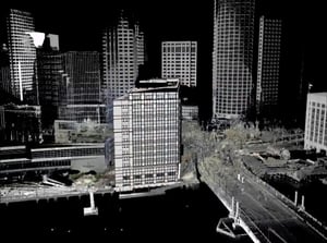
- 14-floor, 350,000-sqft, 100-year-old building
- 75% field time reduction
- 25% budget reduction
%20(1)%20(1)%20(1)-1.png?width=300&name=2022-07-28-MOTE%20Full%20Bldg%20-%20PointCloudCoord%20(2)%20(1)%20(1)%20(1)-1.png)
- 2-tower, 450,000-sqft healthcare facility
- 10 scan days per 11-story tower
- NavVis technology combined with PointFuse Pro
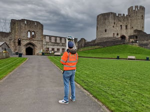
- 44.7-ha hilltop fortification surrounded by a public zoo
- NavVis VLX tested against a TLS
- Reduced field time from 40 to 2 days
BUILD BETTER REALITY
Laser scanning professionals around the globe continue to grow with NavVis
Join the global movement
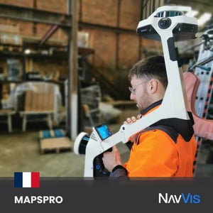
Teams like MAPSPRO are always looking for the best solutions to deliver top-notch results to their clients. However, some environments are more challenging to work in than others. With NavVis VLX, the team efficiently captures and processes every single detail, delivering high-quality point clouds without much interruption to operations or other setbacks.
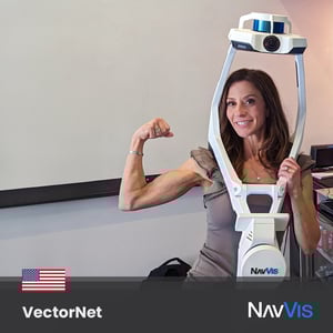
The VectorNet3D team in the USA pushes the boundaries of laser scanning, and leading the charge is the one and only Angela Somerville, a true expert in harnessing the full potential of our NavVis VLX, particularly in the construction industry. Her team got to Innovate with NavVis, and the results transformed their workflows.
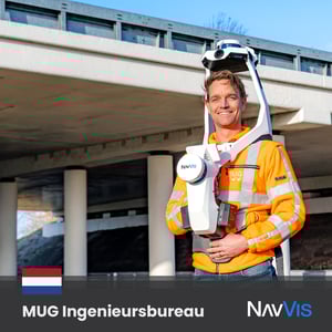
The crew at MUG Ingenieursbureau is happy to be a part of our global movement. Easy, fast, and efficient data capture is now possible with our tech, and their team couldn't be more satisfied by the results. Roads, rail, cables, pipes, and more are now digitally deliverable in various formats - the possibilities are endless when you Innovate with NavVis.
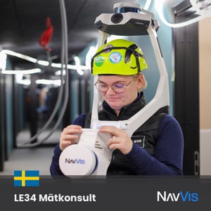
Surveyors from all around the globe, just like LE34 MÄTKONSULT, take initiative to provide next-level results to their clients - by using NavVis VLX. With our laser scanning tool, your data can be more accurate, and even in challenging environments, it enables the capture of data at unprecedented speed thanks to its wearability and technology.
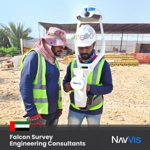
The Falcon Survey Engineering Consultants team wanted to use NavVis VLX to improve their workflows. They quickly realized that, by using our mobile mapping tool, they can now achieve more accurate results, reduce project errors, lessen their time on site, and even save money!
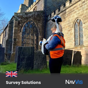
SURVEY SOLUTIONS quickly learned how valuable mobile mapping is for their workflows for survey and inspection purposes. NavVis VLX can tackle anything from complex indoor spaces with challenging lighting conditions to outdoor environments and construction sites.
.jpg?width=300&name=221010_innovate-with-navvis-Position-Partners%20(1).jpg)
Matthew Jones from Position Partners as he puts our NavVis VLX to the test in some underground, low-light conditions. Our #LaserScanning device can help you deliver results with survey-grade accuracy even in these challenging environments.
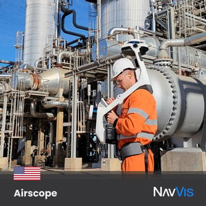
To tackle complex buildings, construction sites & more, the Airscope team chose to Innovate with NavVis. Our unique SLAM algorithms have been specifically developed to overcome the challenges of capturing high-quality point clouds with a mobile system - helping this team (and more all around the world) deliver accurate results!
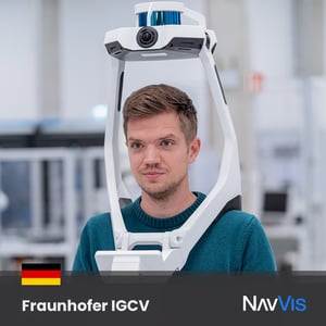
The Fraunhofer IGCV crew has cracked the code - work smarter, not harder! Our mobile mapping tool provides reliability, accuracy, and agility, making things easier when and where it's needed. Reduce costs and enhance your workflows, using the right tool for the job.
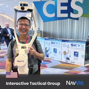
Michael Quan, founder of Interactive Tactical Group, was spotted cheerfully using his NavVis VLX while sharing the benefits of our laser scanning technology. Our wearable mobile mapping device offers accuracy, efficiency, and speed to those who want to positively transform their workflows!
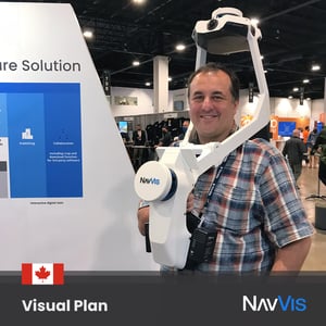
Our friend Kelly Watt from Visual Plan Reality Capture & Digital Twins Solutions knows it! His team was delighted to add NavVis VLX to their toolbox, and they can now tackle anything from complex indoor spaces with challenging light conditions to outdoor environments and construction sites - with time to spare!
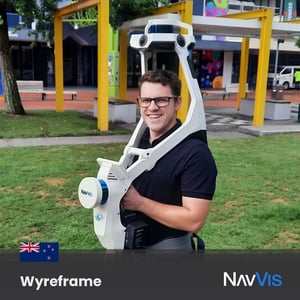
Check out Tiaan Hattingh from Wyreframe wearing NavVis VLX - his smile says it all! Our mobile mapping tool is accurate and convenient, allowing you to capture high-quality point clouds in less time on the field.
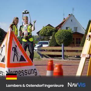
Surveying professionals André Frerichs and Miriam Krusch decided the way to offer their best services to clients is with NavVis VLX. Our mobile mapping tool helped them achieve precise, cost-effective, and time-efficient results in their projects. What a team!
.jpg?width=300&name=220718_innovate-with-navvis_AxisAdvanced2%20(1).jpg)
The laser scanning market in Israel is changing rapidly, and the expert engineers at Axis GPS & Advanced mapping solutions decided to Innovate with NavVis
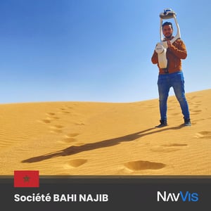
We love to see all the places our technology goes to Innovate with NavVis! Thanks to our friends from Société BAHI NAJIB for sharing this amazing photo from the Morrocan desert with NavVis VLX.
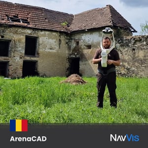
Our friend Andrei Oros from ArenaCAD in Romania chose to Innovate with NavVis and use NavVis VLX. It provides accurate data and high-quality point clouds and fits perfectly into scanning workflows.
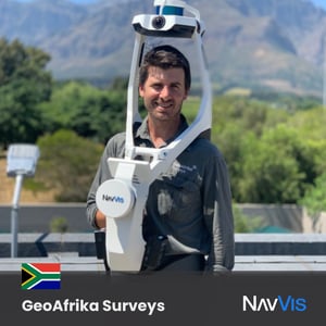
Terrence Elliott from GeoAfrika Surveys captures the true essence of what it means to Innovate with NavVis. As the first adopter of NavVis VLX in South Africa, we couldn't be more excited to see what you can accomplish with our next-generation mobile mapping technology!
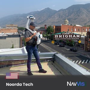
This is what Ty Phifer, COO of Noorda Tech, recommended. They often use NavVis VLX to create architectural existing condition models because of its accuracy level, wearability, and velocity - making their job easier!
Talk to us to discover customized solutions, unique applications, and significant ROI opportunities.
Our experts will clarify pricing details and assist you in optimizing your toolkit and services.
And if you would like a demo, don't hesitate to request one!
“As soon as we got our hands on a NavVis VLX, we were just blown away. We simply got more than what we were expecting, from data accuracy to data density with little to no noise... NavVis IVION is a real game-changer in the digitalization of assets and virtual visits, which facilitates the collaboration of different stakeholders. We found that NavVis is one of the few companies where the products are of such quality that the customer buys more than a solution, they buy a game-changing experience."
- Mohamed Mahmoud, Prime Zone Systemes
New to mobile mapping? Let us know. We'll answer your questions and help you get started.
