Process industry
Optimize your operations with NavVis digital twin technology
Ensure regulatory compliance, enhance safety, streamline inspection workflows, minimize downtime, and optimize capital projects with leading laser scanning and collaborative planning solutions.


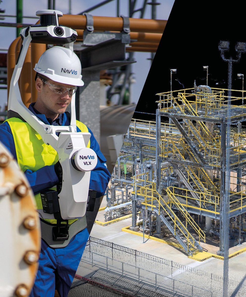
The process industry faces challenges in regulatory compliance, operational efficiency, and safety management. NavVis digital twin technology, together with the enterprise-level reality capture services provided by NavVis IVION Enterprise, offers a powerful solution through the combination of accurate, up-to-date spatial data and ease of access and collaboration. Accessible via web browser or mobile devices, your digital twin will allow you to:
- Ensure compliance: Maintain accurate piping and instrumentation diagrams (P&IDs) and meet regulatory requirements
- Streamline inspection workflows: Efficiently manage and maintain inspection processes
- Minimize downtime: Reduce downtime during turnarounds with precise planning
- Improve planning: Enhance planning and management with complete, accurate and detailed data
- Optimize capital projects: Support scanning of capital projects in the front-end loading (FEL) planning phases with rapid data capture
Partnering with industry leaders like AVEVA, NavVis breaks down silos between tools and teams, ensuring seamless collaboration and data access for everyone in your organization.

Digital twin technology for every process industry

Enhancing safety, regulatory compliance, and operational efficiency while minimizing downtime and mitigating risks in hazardous environments.
Learn more
Enabling detailed process monitoring, ensuring regulatory compliance, and improving safety, while significantly reducing the costs of late changes and increasing production efficiency.
Learn more
Ensuring stringent regulatory compliance, enhancing quality control, and improving operational efficiency, while minimizing downtime and ensuring traceability to meet GMP standards.
Learn more
Ensuring stringent quality control, enhancing traceability, and streamlining operations, while minimizing downtime and maximizing production efficiency to meet regulatory standards.
Learn more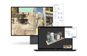
Ensuring compliance with strict regulations and safety standards is critical in the process industry. Maintaining up-to-date documentation for inspections and audits is a complex and ongoing task. NavVis provides accurate digital representations of plants for every stakeholder accessible from a standard web browser, making regulatory compliance easier to manage.
Digital points of interest (POIs) and virtual tours enable remote inspections and pre-audits, ensuring that compliance requirements are consistently met and reducing the time and effort required for on-site inspections.

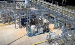
Conducting regular maintenance while minimizing disruption and ensuring compliance with safety, hygiene, and environmental standards is essential for operational efficiency. NavVis digital twins include all critical infrastructure and equipment, helping maintenance teams to plan and execute tasks more efficiently. High-quality point clouds provide accurate sizing and fit data, allowing companies to capture existing equipment measurements with laser scanners and determine if replacement parts will fit correctly. Up-to-date digital records ensure thorough inspections, prevent contamination, and support continuous production. Additionally, detailed point clouds help manage emissions and waste for environmental compliance. For future plant expansions, accurate models enable precise planning of new designs and speed up development schedules, enhancing overall operational efficiency.
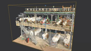
Relocating machinery and equipment in a highly regulated environment requires careful consideration of safety zones and explosion-proof areas, as well as accurate planning to avoid costly mistakes. NavVis technology offers virtual visualization and virtual walkdowns to maintain accurate P&ID's, enabling planners to create a comprehensive digital twin of the facility. This allows for precise equipment placement, identification of cost-saving opportunities in Ex zones, and efficient relocation planning by visualizing critical safety zones and pathways.

Preparing for audits in the process industry involves ensuring compliance with numerous regulations, maintaining up-to-date documentation, and coordinating inspections across departments. NavVis streamlines the audit preparation process by capturing high-quality point clouds and creating detailed digital models of the facility. These digital twins allow for virtual tours, remote inspections, and accurate documentation, ensuring compliance and reducing the time and effort needed for audit readiness.

Managing planned shutdowns for maintenance, upgrades, and inspections is complex, requiring meticulous planning to minimize downtime and associated costs. NavVis enhances turnaround management with accurate digital models that enable precise planning and visualization of maintenance activities. Detailed digital twins help identify potential issues, optimize workflows, and coordinate tasks around safety zones, ensuring efficient execution and reduced downtime.
AVEVA Technology Partner
AVEVATM Point Cloud Manager takes NavVis point cloud data and panoramic images into the whole AVEVA portfolio where it can be accessed and contextualized with the rest of engineering and operations data for better, safer, more informed decisions among all stakeholders
Our service offering
NavVis offers a streamlined quality assurance process and digital twin solution with comprehensive end-to-end responsibility. Benefit from lean and scalable process that delivers exceptional service seamlessly.


NavVis process industry resources

.jpg?width=300&name=NavVis-point-cloud-refinery-1%20(1).jpg)