3D laser scanning with
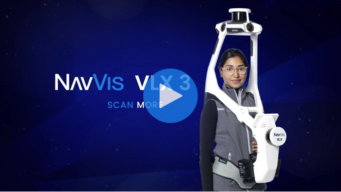
NavVis VLX 3
The cornerstone of reality capture
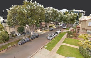
NavVis VLX 3 is the industry-leading, wearable dynamic scanning system that efficiently delivers comprehensive, highly detailed reality capture data to laser scanning professionals and surveyors for large, complex sites, both indoor and outdoor.
Unique benefits
From design to deliverable, NavVis VLX 3 is optimized to offer unparalleled results. Robust SLAM coupled with state-of-the-art system and processing software, NavVis VLX 3 generates data that preserves original details, detects and removes dynamic objects, minimizes drift and captures high detail at range.
With an unobstructed field of view, NavVis VLX 3 delivers comprehensive, detailed coverage of complex indoor and outdoor environments so you can confidently scan more with speed and survey-grade precision.
For accuracy that exceeds industry standards from any wearable device, NavVis VLX 3 is powered by precision SLAM technology that's entirely in a class of its own and is fully equipped to capture control points in a global or local coordinate system.
NavVis VLX 3 is expertly engineered to generate the perfect scan, every time. Panoramic images can be taken automatically with no need to reposition or adjust the device when capturing point clouds or imagery, especially ideal for large areas that require more time to scan.
Differentiate yourself from competition and win more projects with uniquely innovative technology that goes beyond traditional workflows. Stand out from the crowd with device that boosts efficiency and exceeds client expectations – all without compromising on quality.
NavVis VLX 3 features
Comprehensively capture 3D measurements with two 32-layer lidar sensors in combination with groundbreaking SLAM software to deliver industry-leading point cloud quality for a wearable device. Four cameras positioned on top of the device take high-resolution, sharp images in every direction for a complete 360º image - all without the operator appearing in the field of view.

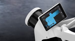
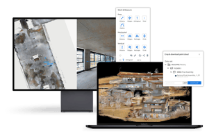
Monitor your scanning progress in real time with a built-in touchscreen interface to ensure complete coverage as you move.

The unique hinged design folds up and fits into a protective case or backpack, so that a single operator can easily transport and set it up.
With multiple methods of transporting NavVis VLX 3, moving around and between sites has never been simpler. A protective, hard-shelled case on wheels enables air and rail travel, while a compact, sturdy backpack allows you to move to and from your site with ease.
*Backpack is currently only available in Europe.

NavVis VLX 3 takes your laser scanning and survey workflows to the next level. It’s fully compatible with standard tools in the field, and can capture control points in a local site coordinate system measured by both Total Stations and GNSS rovers. It also supports national and global coordinates for precise geo-registration and alignment of datasets.


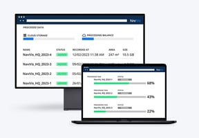
Learn more about integrating NavVis VLX 3 into your workflows