Interact with 3D building scans in a new way
NavVis develops technology that optimizes and extends existing workflows for laser scanning professionals capturing the built world. With scalable capture of survey-grade point clouds for scan-to-BIM and CAD as well as unobstructed 360° images for realistic digital twins, NavVis sets a new standard for all-in-one reality capture.
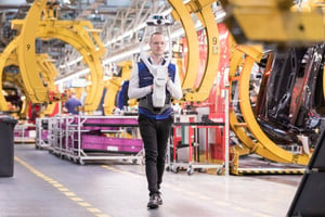
A first-of-its-kind, wearable mapping device that brings high-quality reality capture to the AEC industry in a versatile, compact design.
I was really impressed by the high quality point clouds NavVis VLX captures. The accuracy, speed and versatility of this scanning system means that we can apply mobile scanning to even more applications such as construction sites and towers, where we need to efficiently capture as-built data for BIM modeling."
Christof Rek
Managing Director, Rek & Wieck
A fast, fully scalable mobile mapping system on wheels that captures at the speed of walking through commercial and industrial environments where every second of downtime counts.
NavVis M6 made it possible for us to apply 3D scanning to manufacturing facilities where both minimal disruption and high-quality data are essential.”
Christoph Wintrup
Managing Director, Hemminger Ingenieurbüro GmbH & Co. KG
NavVis IndoorViewer enables laser scanning professionals to create and publish web-based digital buildings in just a few clicks. Find out how you can leverage point cloud files to give building stakeholders an entirely new way to access and interact with scan projects as fully immersive digital twins.
NavVis provides a fully managed service for manufacturing enterprises, including fast data capture for minimal disruption by our certified partners, 3D visualization software, hosting and custom solutions including integrations and location-based services. Our expert team will work with you to build a custom digital twin that will meet your business needs and improve the entire manufacturing workflow, from production planning to facility management.
Inspect and compare highly-detailed, realistic production sites from around the world on any device.
Assess current conditions on the shop floor, take accurate measurements and even download sections of the point cloud.
Review, document and share best practices online with an annotation tool that is tagged to real-world objects and locations.
View and share the location, size, surroundings and documents of important assets.
Integrate your existing software systems for a realistic, location-based master interface.
NavVis employees share what a company guiding principle means to them, and how they strive to embody these ...
What's a point cloud? How do you capture them? And what do you do with them? Writing for NavVis, independent ...
NavVis sees a bright future for robotic mapping, actively exploring proof of concept models both ...