You know that NavVis VLX can capture an indoor environment with unprecedented ease. But you might not know that the scanner is just one piece of the holistic NavVis Reality Capture Solution. This solution includes several advanced software tools — like our Cloud Processing Add-on and NavVis IVION spatial data platform — that are designed to improve your whole workflow, from end to end.
Taken as a whole, NavVis’ solution can do a lot more than speed up your capture. It can transform the economics of your laser scanning business.
That’s a big claim, but I’ll prove it.
First, we will explore three ways NavVis’ reality capture solution reduces your expenses: during the scanning, processing, and alignment stages of your workflow.
Then, we will explore what these cost savings mean for you. In short, you’ll gain the ability to offer new value-add services and adopt new pricing models to make your services more enticing to customers.
NavVis reduces scanning costs
To start, let’s consider where the real cost of scanning comes from. It’s likely that you already own the equipment before work begins, so your expenses will depend on the time you and your employees spend in the field.
That means there are two primary factors to consider:
- Project size: As a project grows in terms of size, costs will also increase. Larger projects require more time to scan. That means higher costs to pay for extra hours in the field, or even to pay for transit to and from the project site.
- Project complexity: More complex projects will require more scanning time to capture, even if they’re on the smaller side. Here’s an example to illustrate: An office with several rooms requires you to move the scanner significantly more often than you would do in an empty warehouse. That means it will cost more to scan even though it covers a smaller area.
If you’re familiar with scanners like NavVis VLX, the economic benefits of a mobile mapping system should be clear. These devices can capture environments faster than a TLS, whether they’re small or big, simple or complex.
By reducing the time it takes to scan, you reduce your expenses and still provide high enough accuracy for the great majority of use cases and customers.
NavVis reduces processing costs
Traditionally, laser scanning professionals (LSPs) perform data processing with desktop software running on a computer in the office. This can be time-consuming. For one, you can only process one data set at any given time. Additionally, this workflow requires a technician to get the process started so a new data set may have to wait until morning for processing to begin.
NavVis’ Cloud Processing Add-on changes this. It processes your data using numerous secure servers located offsite, which increases your computing power and automates the process. You can process data sets faster, process multiple data sets at the same time, and even do so without any input from a technician.
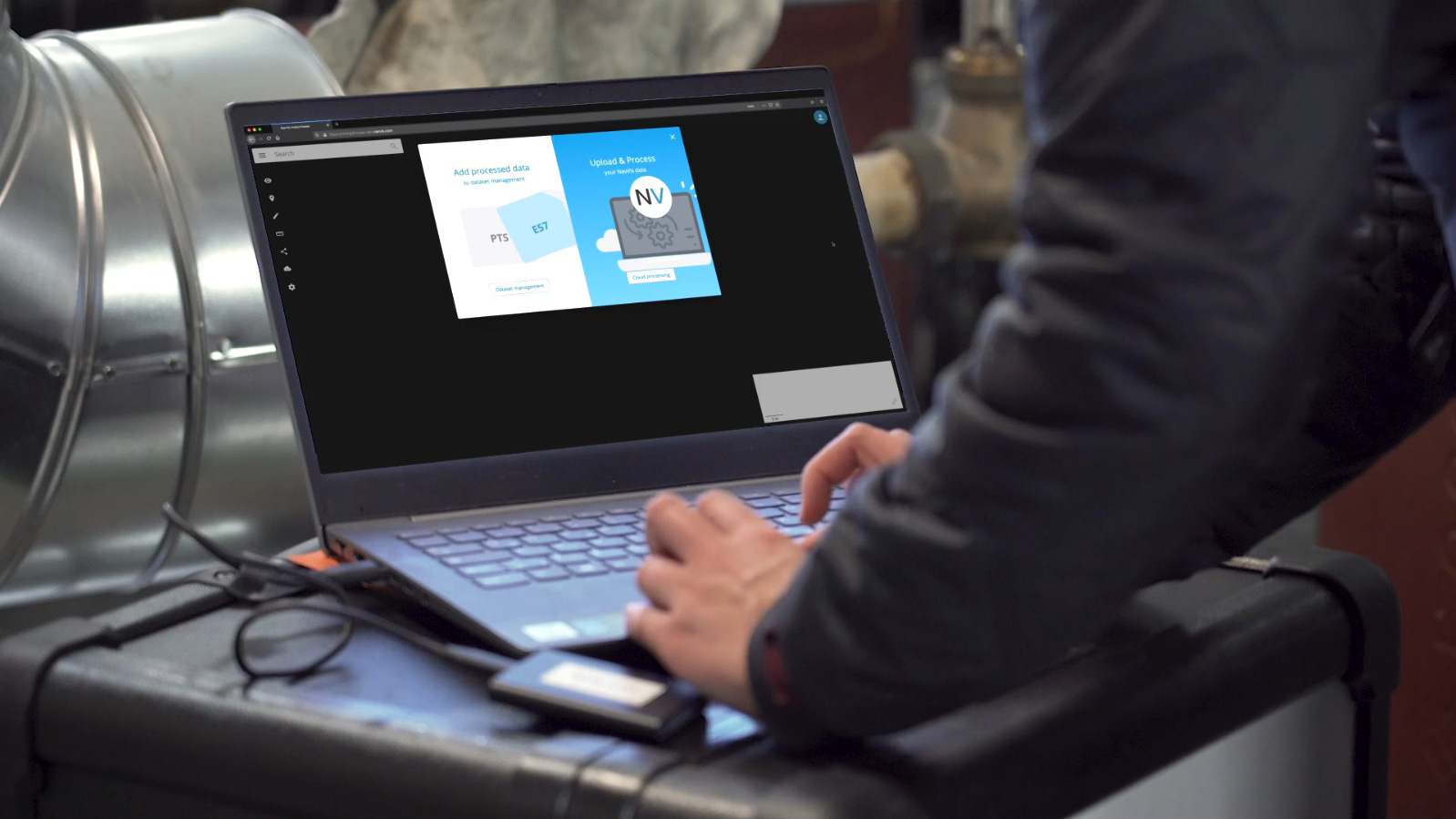
It’s possible to queue up datasets with predefined settings in the evening and have them processed and ready to go the next morning with no extra effort. In this way, cloud processing reduces time in the office, saving time for the tasks that require individual attention – and that reduces your expenses.
NavVis reduces alignment costs
The alignment of TLS scans is often a time-consuming process that involves correcting the work of cloud-to-cloud algorithms or locating control points manually to tie point clouds together. NavVis VLX improves on this.
Regardless of whether you use control points, NavVis’ mobile mapping software and hardware can speed up your alignment process.
If you do use control points during your capture, NavVis’ spatial data software, NavVis IVION, can perform a fully automatic alignment of the data set. Your manual work will be minimal. You’ll need to do little more than check the aligned point cloud for QA/QC purposes.

If you don’t use control points, NavVis can save you alignment time as well.
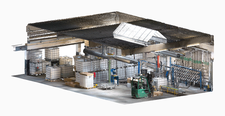
NavVis VLX can capture between 1,000 and 4,500 square meters in a single data set. Even on the low end of that range, you can capture much more in a single scan than you would with a TLS, which can get only about 50 square meters per dataset. Working with fewer data sets means faster alignment and lower costs for you.
That means new income from value-add services...
NavVis VLX and its software offer time and cost savings that span across your workflow. And this enables you to include additional services without adding to the project budget.
For example, you could use the extra resources you’ve freed up to offer 3D BIM and CAD modeling from the point clouds you capture. This service often has a higher margin than 3D capture, so it can increase your profit on any given project.
Or you can host data sets for your customers in the NavVis IVION spatial data platform. This platform offers you the intuitive tools you need for the creation and publication of point clouds. It also provides the viewing and collaboration tools your stakeholders need. So project managers, building owners, architects, engineers, and end customers can access any information they need at any time.
With these value-add services — some of which don’t require any extra work from your firm — you can increase your profit margins even more.
...and new pricing strategies
With your faster workflows, reduced costs, and new value-add services, you can apply new pricing strategies to increase profit or grow your appeal to new customers.
You could consider:
- Keeping the current project pricing and increasing your profit margins
- Reducing project pricing while maintaining good profit margins, and presenting a more competitive price to the market
- Offering reality capture services to other market segments that find TLS-based projects too costly
Wrapping up
The NavVis Reality Capture Solution can improve your business in several ways. With the mobile scanner, NavVis VLX, Cloud Processing Add-on, and NavVis IVION, you can reduce your prices and speed up your workflow. And that enables you to grow your profits, change your business model, and even work your way into new markets previously inaccessible to laser scanning professionals.
In other words, a NavVis mobile mapping system can do a lot more than speed up your scanning: it can transform your business.
Learn more today by setting up a chat with one of our experts today, we'd love to find out how we can add value to your business: