
Skip to content

NEWSLETTER

Get the latest news as it happens.
You will receive our newsletter once a month about upcoming events and webinars as well as latest news from the field.

Explore where NavVis shows up next

Join us at tradeshows, virtual sessions, and local events worldwide.
CLX-page-hero_final

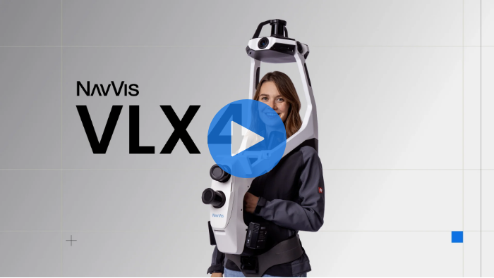
NavVis VLX 4

Capture details in motion

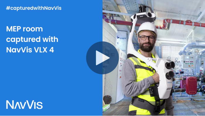
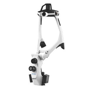
NavVis VLX 4 is the first dynamic reality capture device built for projects that need high-detail data. It combines dynamic scanning speed with true 3 mm point cloud resolution for demanding LOD350+ Scan-to-BIM, MEP and industrial applications.

Unique benefits
Bring dynamic speed to high-detail projects.

NavVis VLX 4 brings fine geometric detail to dynamic reality capture, enabling you to capture thin pipes, sharp edges, bolts, brackets and densely-packed technical environments while moving.

One investment. More opportunities.

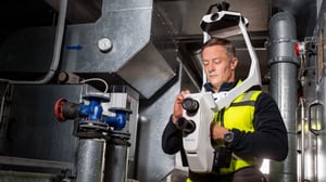
Take on higher-value engineering, industrial and high-detail reality capture projects with confidence. NavVis VLX 4 expands the range of services you can offer, helping you win more projects, reach new customers and grow your business with a single solution.

One_Investment_More_Opportunities-2580x1452_final
Scale your business, not complexity.

Increase project capacity without increasing operational overhead. NavVis VLX 4 gives your team a repeatable, efficient workflow that makes it easier to deliver more projects as your business grows.

NavVis VLX 4 Resources

Download the NavVis VLX 4 data sheet and a sample of point cloud data in .e57 and .ply formats.

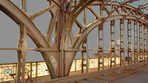
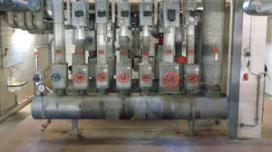
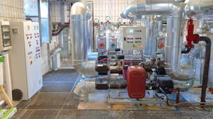
Pointcloud-Still-Slider_1_2000x1125 1
Pointcloud-Still-Slider_2_2000x1125 1
Pointcloud-Still-Slider_3_2000x1125 1-1
Pointcloud-Still-Slider_4_2000x1125
Pointcloud-Still-Slider_5_2000x1125
Pointcloud-Still-Slider_6_2000x1125

NavVis VLX 4 features

Highest level of detail from a dynamic scanner

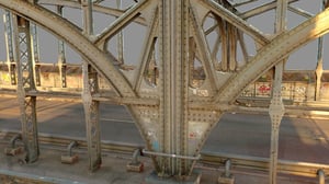
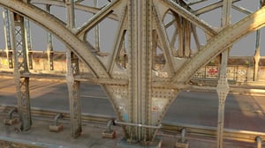
True 3 mm point cloud resolution, three lidars sensors specifically designed for reality capture, and industry-trusted NavVis software work together to capture exceptional geometric detail - clearly resolving thin pipes, bolts, sharp edges in complex industrial and technical environments for LOD350+ Scan-to-BIM and demanding engineering workflows.
Highest_Pointcloud_Detail-2580x1452_final-1
Triple_LiDAR-1480x828_final
Triple-lidar Architecture

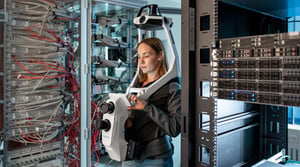
Three lidar sensors deliver the high point density needed to resolve fine details and sharp features, capturing complex geometry from multiple angles in a single pass for cleaner, more complete point clouds.
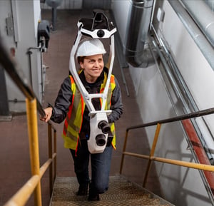
Wearable_High_Precision-1440x1388_final
Wearable Reality Capture for High-LOD Projects

Cover more ground in less time. Move freely through complex environments while continuously capturing the high-detail data you need for demanding projects.

Proven NavVis Technology

Trusted NavVis SLAM software delivers the positioning reliability and consistent data quality demanding projects require.

VLX4_SLAM_Technology-1388x1388 2 (1)
One Connected NavVis Workflow

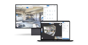
Go from capture to deliverable in one connected workflow with IVION. The NavVis ecosystem brings capture, processing, collaboration and integration together - reducing manual steps and keeping projects moving efficiently from site to final output.
Integrated_Ecosystem-1440x742-1
Rendering_left-800x800
Rendering_right-800x800 1 (1)

Purchase NavVis VLX 4

Capture details in motion

How it works

Software


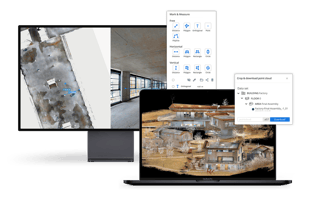
NavVis VLX 4 is optimized to work seamlessly with IVION Processing and IVION, helping teams move efficiently from capture to processed data, access, and deliverables. Capture reliable as-is and as-built data with minimal effort, then process, manage, and share it in one connected workflow.


FAQs

What exactly is NavVis VLX 4? NavVis VLX 4 is a wearable reality capture device where fine geometric detail matters. Combining dynamic scanning speed with true 3 mm point cloud resolution, it enables fast, efficient capture of complex environments for high-detail Scan-to-BIM, MEP, and industrial engineering applications.
What project types and environments is NavVis VLX 4 best suited to? NavVis VLX 4 is best suited to large, complex indoor and industrial environments where high geometric detail is required. It is designed for demanding Scan-to-BIM, MEP and industrial documentation, engineering design and retrofit, and construction verification projects, particularly in environments with dense pipework, steelwork, equipment, and other fine structural details.
What is the difference between NavVis VLX 3 and NavVis VLX 4?

NavVis VLX 4 is designed for projects that demand a higher level of geometric detail than NavVis VLX 3. It features three high-precision lidar sensors and true 3 mm point cloud resolution for clearer edges and better definition of fine features. This makes NavVis VLX 4 particularly suited to high-detail Scan-to-BIM in LOD350, deviation verification of MEP and industrial engineering applications, while NavVis VLX 3 remains a versatile choice for high-quality indoor and outdoor reality capture.


What does the capture workflow look like in practice, and how long does it take a team to learn? NavVis VLX 4 follows the proven wearable workflow of the NavVis VLX series. Operators move naturally through the site while three lidar sensors and integrated cameras continuously capture the environment, with the built-in display providing real-time feedback on trajectory and coverage, and when there is a SLAM break or drift. Teams familiar with dynamic scanning can get up to speed quickly, while new operators can learn the core workflow with straightforward training on principles such as loop closures and capture planning.
Can NavVis VLX 4 be used alongside our existing NavVis devices on the same project?

Yes. NavVis VLX 4 integrates into the wider NavVis reality capture ecosystem and can be used alongside other NavVis devices within the same project or fleet. Teams can select the right device for each environment and level of detail required, using NavVis VLX 4 for areas demanding high geometric detail while deploying other NavVis devices where different capture requirements, environments, or workflows are better suited. Data can then be processed, managed, and brought together within the NavVis ecosystem.

How does NavVis ensure data security and privacy?

At NavVis, security and privacy are built into the very heart of our products and services. IVION data is stored on the Amazon AWS server location that the customer selects when creating their instance. All hosting locations are highly scalable, to support variable load, ensuring customers receive a stable and performant service globally. In addition, we use automated monitoring and alerting throughout to ensure we are able to proactively support our customers where necessary.

IVION has sophisticated and granular access and user management inbuilt, empowering instance administrators to flexibly and powerfully grant or rescind access to data held within the instance.
IVION undergoes four annual rounds of penetration testing by external companies. These experts look for vulnerabilities in our software and infrastructure.

All data at rest is encrypted, regardless of sensitivity, providing a uniform layer of security across all our cloud products.
NavVis has a Secure Development Policy covering all aspects of the software development and test lifecycle, to ensure that the software we produce continues to meet our own high standards for security.
To confirm our approaches meet industry best practices, NavVis undergoes regular assessments from external auditors, aligning our practices to applicable standards.

Learn more →

Still have questions about our product?

Book a demo today and discover how you can benefit from NavVis VLX 4.

Highest_Pointcloud_Detail-2580x1452_final-1

Check out NavVis VLX 4 a in person at one of our upcoming events and test it for yourself!