



The NavVis story, told by customers.
Small teams, big output
Surveying & Reality Capture

"NavVis means precision, speed, and the ability to deliver a digital product that creates value."
Nevsky

"It really is an excellent option for our crews to be able to spend more time on boundary and less on the topo."
Denn Engineers

More than
captured in 2025

"Integrating accurate data capture solutions (such as NavVis VLX 3 and NavVis MLX) with a user-friendly platform (such as NavVis IVION) is key to unlocking real operational value from a digital twin."

"The partnership between BIMnD and naext, powered by NavVis technology, has established a digital foundation that enables scalable and future-proof indoor wayfinding in complex environments."
Read the Q&A →

"My advice? Good survey planning and utilizing multiple solutions – whether the NavVis MLX and NavVis VLX alone or in combination with a terrestrial scanner and good survey control."
Read the Q&A →
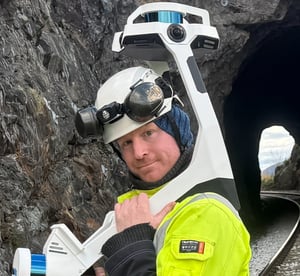
"We saved time by using NavVis VLX and could return home knowing that there would be no surprises, even in a demanding environment like this one."
Read the Q&A →
From design to delivery
Architecture, Engineering, and Construction

"BIMstream would not be in the position it is right now if NavVis did not exist."

"It allows us to be more lean and maximize ROI."
Rogers O'Brien Construction

How Rogers-O’Brien Construction compared NavVis MLX to Trimble X9 for scanning above-ceiling on a healthcare renovation project.

"With NavVis VLX we were able to get every floor scanned in 32 minutes."
JTM Construction
Operational reality at scale
Owners & Operators


"We're in the process of executing the largest digital twin foundation in the world."


See how NavVis VLX helped to minimize train traffic disruptions during the project


Digital Intelligence
How KION, NavVis, and NVIDIA are collaborating on Industrial Digital Twins

Get the latest news as it happens
You'll get the latest updates, news, and industry insights – plus the occasional newsflash – direct from the team at NavVis.