

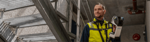
Munich, September 1, 2026: NavVis, the Source of Spatial Truth for the built world, is setting new standards for capturing and documenting with NavVis CLX. The new agile, handheld capture device complements NavVis MLX and NavVis VLX and is specifically designed for high-volume, everyday documentation. With NavVis CLX, companies can put trusted, professional reality capture in every hand and on every job, accelerating access to reliable as-built data.
NavVis CLX features dual LiDAR architecture, designed to ensure complete, comprehensive data capture, producing clean, low-noise point clouds that can be used for everyday downstream documentation workflows. NavVis CLX is ideal for companies managing a high volume of routine as-built documentation projects, as well as general surveying and reality capture firms with mixed project portfolios and where high-precision scanners may be unnecessary or inefficient for standard documentation-grade work. It is particularly suited to area referencing, site assessment, and quantity surveying, as well as LOD200 Scan-to-CAD/BIM and 2D drafting.
Dr. Georg Schroth, CTO and co-founder of NavVis, states: "With NavVis CLX, we are introducing a new device that bridges a critical gap in the market. For the first time, we are combining the everyday usability, speed, and scalability required for high-volume documentation with the quality and reliability that companies expect from high-end devices. This innovation addresses the trade-off between accessibility and efficiency and professional-grade results, giving teams a faster path to reliable data at a lower cost of ownership and operations."
Professional Data Capture on Every Site
With NavVis CLX, companies aren't just buying a device. They're buying faster access to professional as-built data.
Dual LiDAR combined with live 2D and 3D coverage feedback gives users confidence that they have captured the data they need before leaving the site, reducing uncertainty and the risk of costly revisits. Clean, low-noise point clouds provide a reliable foundation for downstream documentation, helping teams move efficiently from capture to deliverable.
Compact, lightweight and adaptable for occupied, confined and hard-to-reach spaces, NavVis CLX is built for the realities of everyday capture. Its straightforward operation makes it easy to deploy across teams, helping companies expand capture capacity and complete more projects with the same resources.
Workflow with IVION: From Capture to Deliverable
The integration with IVION Processing and IVION provides one continuous path from capture to processing to usable data, accelerating projects and increasing efficiency. IVION Processing turns each capture into registered, ready-to-use data, while IVION helps teams manage project data and deliver it to customers in an accessible way. Teams and their customers can explore, measure, verify, and share reality data, or stream point clouds directly into Revit to author CAD or BIM on reliable ground truth. Together, NavVis CLX, IVION Processing, and IVION help teams move faster from site capture to a quality-controlled customer deliverable, reduce rework, and get more value from every capture.
Built for Reliable, Everyday Capture
NavVis CLX combines lightweight design, ergonomics, and reliability in one sophisticated device. Key features include:
- Dual LiDAR for complete, reliable capture – Two strategically positioned LiDAR sensors provide complementary fields of view supporting more comprehensive capture across environments as well as stable SLAM tracking.
- Live 2D and 3D coverage feedback – Real-time visualization on the integrated screen lets operators see their capture progress and identify potential gaps before leaving the site, reducing the risk of costly revisits.
- Clean, low-noise point clouds – High-quality, documentation-grade data provides a reliable foundation for downstream workflows including area referencing, site assessment, quantity surveying, and LOD200 Scan-to-CAD/BIM.
- Flexible capture for different environments – Use NavVis CLX with the included pole for elevated or difficult-to-reach areas, or with the optional harness for hands-free operation or extended scanning periods.
- Efficient field-to-deliverable workflow – Together with IVION Processing and IVION connect capture with processing, access and downstream use, helping teams move faster from the site to usable as-built data.
By combining reliable capture, trusted documentation-grade data and an efficient end-to-end workflow in a cost-effective device, NavVis CLX gives companies a practical way to scale reality capture across more projects. Teams can increase capacity and complete routine documentation efficiently while keeping specialist equipment and expertise focused on the projects that require them most.
NavVis will unveil NavVis CLX to the public for the first time at INTERGEO 2026 taking place from September 15 to 17, 2026 in Munich at the NavVis booth in Hall C5.
You can find a photo library for this press release here.
About NavVis
NavVis is the Source of Spatial Truth for the built world. Founded in 2013, the company was built on a single conviction: the people who build and operate the physical world deserve to know exactly what that world looks like, and to keep knowing it as that world changes. Today NavVis combines survey-grade mobile reality capture (NavVis VLX and NavVis MLX) with IVION. Together, they provide a managed, versioned and accessible System of Record, reflecting a facility or work site as it stands today. Every engineering tool and every intelligent system reads from the same source. More than two billion square meters of industrial plants, construction sites, and buildings are held on IVION, cutting rework and downtime and forming the foundation for automation, analytics, and AI-grounded decisions at scale.
Press contacts
NavVis:
Janine Ege
press@navvis.com
Schmidt Kommunikation
Alexandra Schmidt
+49 170 3871064
Thilo Christ
+49 171 6220610