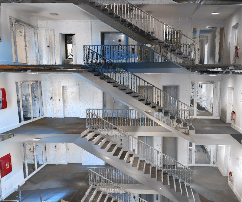
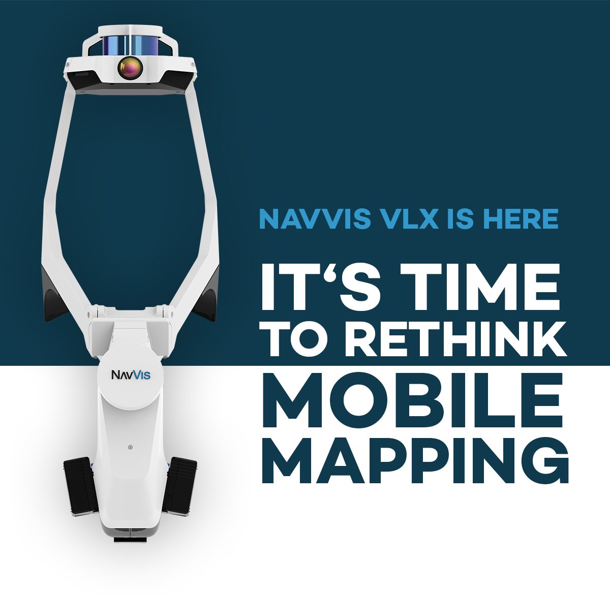
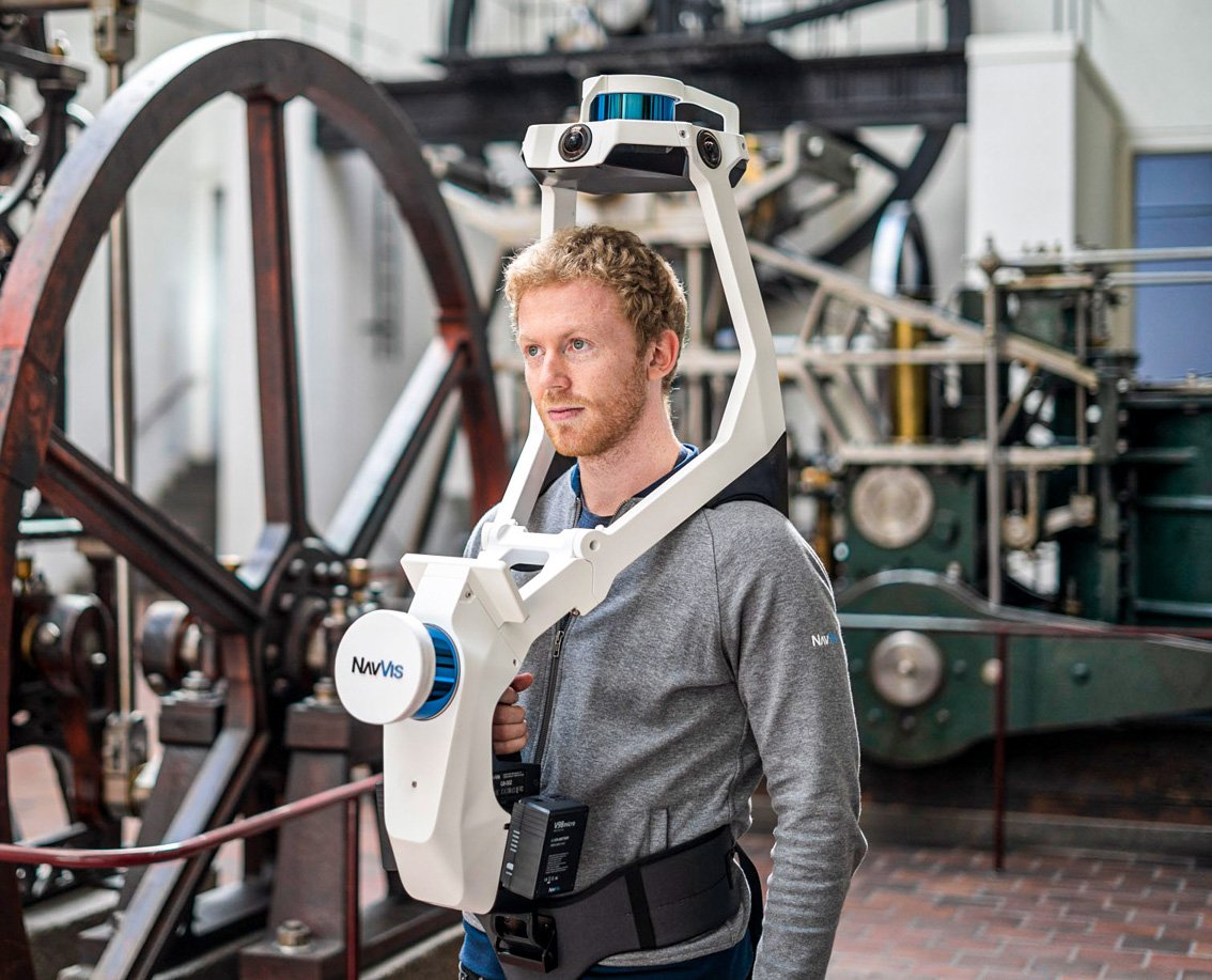
NavVis VLX is a first-of-its-kind wearable mapping system designed for hands-free, all-in-one reality capture, including survey-grade point clouds, in even the most complex environments such as construction sites, staircases and technical rooms
We are very proud to announce the launch of NavVis VLX, a first-of-its-kind wearable mapping system that captures high-quality data in even the most complex built environments. The unprecedented data quality delivered by a compact, versatile device sets a new industry standard and is a big step towards mainstream adoption of mobile mapping for surveying buildings.
The all-in-one reality capture capabilities of NavVis VLX include both survey-grade point clouds and high-resolution panoramas. NavVis VLX is equipped with two LiDAR sensors and is able to quickly and efficiently capture survey-grade point clouds using the same ground-breaking SLAM technology that NavVis has developed for its industry-leading system, NavVis M6. Along with point clouds, NavVis VLX captures high-resolution panorama images in a complete 360° field of view, which is a result of four strategically positioned cameras.
The first-of-its-kind design for a wearable device positions the hardware on the front and top of the operator. This provides several advantages over backpack models. Wearing the device on the front enables the operator to have more control over where the sensors are scanning, which improves data quality. The operator is also able to view and interact with the built-in screen that provides live feedback of what has been scanned and the quality of the data being captured. The combination of greater control over the device and hands-free scanning is particularly well-suited to complex environments such as construction sites and manufacturing facilities with obstacles and staircases.
“We designed NavVis VLX to provide the AEC industry with a compact, versatile device that efficiently captures buildings and still delivers survey-grade point clouds,” said Georg Schroth, NavVis CTO.
“Our industry-leading indoor mobile mapping system, NavVis M6, has really taken off in the two years since launch because of its ability to quickly capture high-quality data in large commercial and industrial properties. Knowing that there is still an unmet need for high-quality mobile data capture in a wider range of building documentation applications, we set out to develop a more versatile device that can achieve what NavVis M6 does at a smaller scale and on a lower budget."
"We are very proud to announce today that this ambition has resulted in a wearable mapping system that is convenient and economical but delivers the data quality you would expect from a high-end device. In fact, we are so confident in the quality of the data that we believe even the biggest skeptics of mobile mapping will be convinced when they see the point cloud and panorama quality NavVis VLX can achieve.”
The data captured by NavVis VLX can be applied to a wide-range of applications including conventional building documentation such as CAD drawings and BIM models, but also to innovative digital twin solutions, such as NavVis IndoorViewer. NavVis is launching collaborations with PointCab, ClearEdge3D and Hemminger for Bentley Microstation, in addition to the existing integration with Autodesk Revit, to ensure that NavVis VLX and NavVis M6 seamlessly fit into existing workflows of third party solutions.
For more information visit: www.navvis.com/vlx-2