
.jpg?width=300&name=Construction-Site-742342%20(1).jpg)
You've heard good things about 3D mobile mapping systems. Maybe a colleague has raved about the accurate spatial data they capture. Maybe a leader in your industry has spoken about how the technology has enabled applications that weren’t possible before. Maybe your friend posted an unboxing on LinkedIn.
Now you’re curious. Can these tools do anything for you?
You’ve tried to learn more, but there’s a snag: Virtually every blog post and explainer about 3D mobile mapping is aimed at experts who already use other 3D mapping technologies. They're full of technical terms and lingo that are impossible to understand without years of experience.
This guide is different.
We'll start at the very beginning to provide you with a total and comprehensive understanding of mobile 3D mapping — including how the technology works, what it can do for you, why you might pick one mobile mapper over another, when it's best to use mobile mapping, and a lot more.
Here are some quick tips for using the guide: If you want to go deeper on a topic, simply click through to one of the explainers in the pertinent section and you’ll find as much detail as you need. If we’re covering a topic you already know, skip ahead. If the guide is missing something essential, let us know and we’ll add it.
With that out of the way, let’s start at the start.
Lidar for beginners
Lidar is an acronym for (li)ght (d)etection (a)nd (r)anging. The technology has roots in weather applications, where it was used to measure clouds, particles, and gases in the atmosphere. Today it is best known as a tool for capturing 3D data, and it’s here that lidar has hit the mainstream in a big way. You'll find it today in iPhones, cars (but not Teslas), real-estate capture cameras, and more.
How does it work? Lidar can work in a number of ways, but most lidar sensors use lasers to generate 3D maps by a principle called "time of flight." The lidar fires a laser, counts off the time it takes for the laser to reflect off a surface and travel back, and then uses that time to calculate the distance to that surface. Then, the sensor records that data as a 3D point relative to its own position.

A lidar sensor uses spinning mirrors to direct the lasers and sweep its surroundings, enabling it to capture hundreds of thousands of 3D points every second. The result is a data set called a point cloud.
Read more about how lidar works here →
Point clouds 101
A point cloud is a "cloud" of 3D measurements, each one with an x, y, and z coordinate. It can be captured by a variety of methods, including photogrammetry (image-based capture) and lidar (laser capture), as described above.
Find out what's better for building capture, photogrammetry, or lidar →
Point clouds are often referred to as "dumb" or "raw" data since they contain no information beyond what the 3D capture system has gathered. That means the most basic point cloud is nothing more than spatial information — they don’t even contain color unless the lidar system happens to include an RBG camera as part of its sensor payload.
You can use a point cloud to take precise measurements or eyeball a building's conditions, but not much more.
In order to use a point cloud for most applications, you'll need to post-process it. That might mean using automated 3D modeling software to generate a 3D CAD model, using software to compare the point cloud to the original design model, or manually drawing a floor plan.
Learn everything you need to know about point clouds here →
What are the different kinds of lidar scanners?
A lidar sensor can be implemented in a number of different hardware configurations, some so large they need to be strapped to the bottom of an airplane, small enough to fit in your pocket. In built-world industries like manufacturing and architecture, engineering, and construction, the two most common types of lidar scanners are terrestrial and mobile.
Is it LiDAR or lidar? And other questions you want answered about this topic →
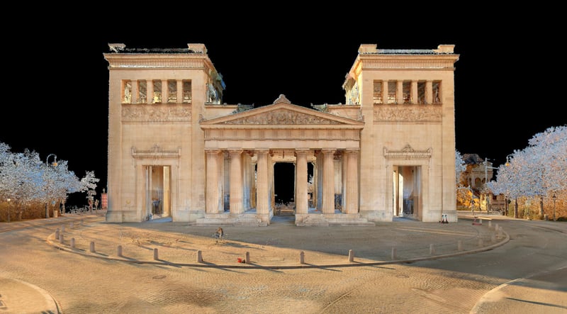
Terrestrial laser scanner (TLS)
Imagine a lidar sensor in a metal box. Now add:
- a spinning mirror that directs the lasers to sweep the sensor's surroundings
- a computer to process 3D measurements and produce a point cloud
- an inertial measurement unit (IMU) sensor that tells the device which way is up
- and an RGB camera.
Now, put that box on top of a tripod with a motor that spins it around. Congratulations! You’ve got a terrestrial laser scanner, also known as a TLS.
This is the traditional implementation of lidar technology for 3D mapping and still produces point clouds with the highest possible accuracy. But not by a wide margin, as we'll see later.
Mobile mapping system (MMS)
A mobile mapping system expands on this paradigm (and some would say improves on it).
Mobile systems include much of the same hardware as terrestrial systems, but they take a much different shape. They are designed to be held in the hand or worn on the back so that a single person can carry the device.
A mobile mapping system also takes much more advantage of the futuristic potential of software. These systems include SLAM software that enables you to scan as you walk. (For more about SLAM, keep reading.)
An explanation of the tools and technology behind mobile mapping devices →
This makes the scanner significantly faster than a TLS. In many cases, a mobile mapping system can capture an environment at 10X the speed of a TLS.
In the past, many professionals were wary of mobile mapping systems because their speed came with a significant decrease in data quality. Today’s best systems produce data fit for many demanding applications, hitting accuracy numbers of 6mm or less.

How do I use a mobile mapping system?
Since terrestrial laser scanners and mobile mapping systems both produce a point cloud of an environment or object, their applications overlap quite a bit. You can use either kind of 3D lidar scanner for a wide variety of applications, for instance, to capture a building, a bridge, or a steel beam. The possibilities are huge.
But since terrestrial scanners and mobile scanners work differently, they excel at different applications. Here’s where you’ll want to use mobile mapping.
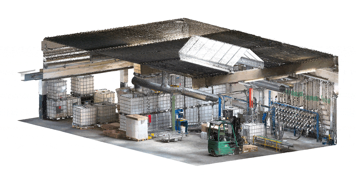
As-built documentation
In this application, you'll use your mobile scanner to walk through an asset and capture a point cloud that reflects the asset’s current conditions.
That will enable you (or your clients) to:
- compare the final state of the asset to the design model -- and find out where the real building differs from the original intent
- produce spatial data sets for owner-operators to use in facilities management applications
- generate floor plans for space management
- model an old building in CAD software as the first step of a refurbishment or retrofit
- and more.
Learn all about as-built documentation here →
Scan-to-BIM
Where as-built documentation focuses on the spatial conditions of the asset, scan-to-BIM goes a step further. In this process, you produce a building information model (BIM), which is made of virtual objects representing building elements. Each of these objects is connected to a virtual database that includes a variety of information about the object.
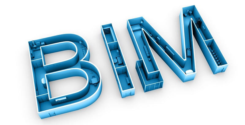
When viewing a BIM model, you could select a duct and see information like model number, installation date, the system it connects to, and so on. The BIM can include any other data that might be important to a stakeholder.
A BIM model will enable you (or your clients) to:
- perform better coordination during the design and planning stages to orchestrate the work of trades
- have a wealth of accurate spatial information about the building project, for instance, for prefabricating elements offsite
- provide the building’s owner-operator with a comprehensive data set of building elements for operations and maintenance
- and more.
Read our definitive guide to scan-to-BIM here →
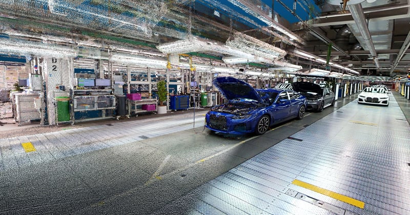
Digital factory
A digital factory is an idea more than a thing. Think of it as a combination of models, methods, and tools — including simulations, 3D visualizations, and industrial IoT sensors — that a factory uses to connect its digital data with the physical world. The digital factory can encompass the factory, the production assets, the supply chain, and even the people and products.
Obviously, this topic is deep, but one thing should be obvious: A digital factory starts with the creation of up-to-date 3D models of the factory itself, as well as physical assets like machines. And a mobile mapping system is the fastest, most cost-effective method.
A digital factory will enable you (or your clients) to:
- present a unified data stream with multiple levels of granularity — from the production network down to a single machine
- access performance insights and identify areas for improvement, complete with spatial context
- significantly improve predictive maintenance to reduce downtime
- and more.
Wait, what is SLAM?
Before we go any further, let’s discuss SLAM. This term is an acronym for (S)imultaneous (L)ocalization (A)nd (M)apping. The technology was originally developed for robots to track their position in environments they have no previous knowledge of.
Most SLAM works this way: It reads data from a camera or other sensor mounted on the device and uses computer vision algorithms to recognize features in the environment. Then it uses these features to build a rough map, which it uses to determine a rough location for the robot. As the robot moves, the SLAM builds a better map, which helps it to better locate the robot. And so on.
Today, you'll find SLAM used in a broad variety of applications like smart vacuums, self-driving cars, and of course, mobile lidar scanners.

Read our definitive guide to SLAM here →
What does that have to do with mobile mapping?
A mobile mapping system couldn’t work without SLAM.
A terrestrial scanner never moves during capture. But a mobile mapping system does, and this adds an extra variable when it’s generating a point cloud. The scanner uses SLAM to solve for this variable, which allows it to place each 3D measurement properly in space.
That means the quality of the SLAM algorithm in a mobile mapping system has a huge effect on its accuracy.
Does SLAM offer any other benefits?
The best SLAM algorithms on the market are capable of some futuristic processing feats. For instance, NavVis' software uses SLAM to remove traces of people and vehicles that move through your scan, remove noise and artifacts from the point cloud, and even improve the accuracy of your point cloud beyond the sensor's accuracy specs.
Mobile mapping vs TLS
OK, let's get down to it: Which one is better?
When mobile mapping is better
Compared to a terrestrial laser scanner, a mobile scanner offers:
- Higher speed (10X or more)
- Reduced client disruption (since you're moving faster)
- Expanded services and offerings
- New business models
- A sharper competitive edge
Find out 5 reasons why it's time to invest in mobile mapping →
When terrestrial scanning is better
Compared to a mobile scanner, a terrestrial scanner offers:
- Higher accuracy (sub-6 mm compared to 6mm or so with a mobile mapper)
- Integration with total stations
- Longer range
Consider the hybrid workflow
For about a decade, people in the know have been asking whether a mobile or terrestrial scanner is the better option. But recently, many leading users have decided that the best option is usually both.
3D scanning pros across industries are starting to use these tools together on a single project, playing each one to its strengths. In short, a mobile mapping system can provide speed and efficiency, and a terrestrial scanner can offer the highest possible accuracy and range in those situations where you really need it. This is called a hybrid workflow, and it offers the best of both worlds — and extra value that you can pass along to your clients.
Read about how seven different service providers use a hybrid workflow for reality capture →
How do I know which mobile mapping system to pick?
Great, you say. Sounds good. But how do I determine which mobile mapper is right for me? But there are a lot of mobile mapping systems on the market, and the marketing for each one is pretty convincing.
The first thing to do is think about your business and your potential applications. What are your needs? What are common client needs? With that in mind, what are the most important specs of a mobile mapping system? Speed? Accuracy? Cost? Software integration? Make a short list of scanners that might work for you.
Once you have that worked out, check each scanner’s datasheet. Look for specifications, like how many points it captures per second, IP classification, and perhaps most important of all, the various kinds of accuracy. Here's a handy guide to walk you through the spec sheets you gather.
Learn about 9 terms you need to know on a lidar scanner datasheet →
You'll also want to evaluate some data from the scanner. Judge the data sets by metrics like the amount of noise in the data, the resolution in fine details, and the accuracy. If that sounds complex, it doesn't have to be: We've put together a guide to five quick steps you can use to quickly judge any mobile mapping data set.
Next, you'll want to dive deeper into each scanner’s accuracy. Since the accuracy numbers on a data sheet represent the scanner's performance in a controlled setting, it can only ever provide a rough guide to accuracy. That's why manufacturers should supply accuracy numbers pulled from rigorous testing across common applications.
See NavVis' white paper here to learn how NavVis VLX performed in various challenging scenarios, complete with benchmarking against TLS data.
Last, get a demo for every scanner on your shortlist. Test it in an environment you're familiar with. Push it to its limits. Grill the salesperson. Be sure that you make the right decision.
Then, you can buy a mobile system with the confidence that it will help take your business to the next level.
Wrapping up
Have more questions? Want to demo NavVis' own mobile mapping system, NavVis VLX? Get in touch with one of our experts here. We'll help you out.

Sean Higgins is an independent technology writer, former trade publication editor, and outdoors enthusiast. He believes that clear, buzzword-free writing about 3D technologies is a public service.